We’ve made it to the weekend! Finally, Hurricane Debby has dissipated and will continue to move out to sea. There is still plenty of weather to talk about including a nice blast of cooler temperatures for the Upper Midwest and Northeast this weekend. The southern U.S. will continue to deal with the heat unfortunately with high pressure overhead. Finally, we’ll touch on the wildfire threat out West and some rain chances for the central CONUS.
Weekend Setup
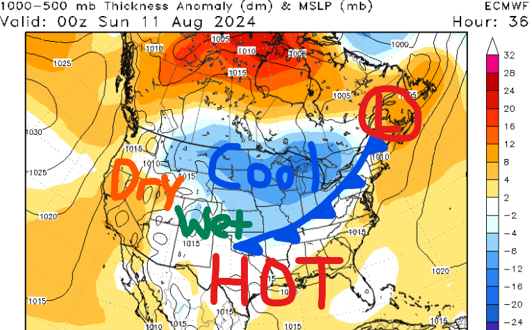
We have many different features to talk about for this weekend. The main one is a slight cooldown in temperatures across the Midwest and Northeast as a strong cold front pushes south. Behind this front will feature lots of sunshine and drier air which is why it may feel like late September for some of us.
Dew points are forecasted to be 60 degrees or below north, especially on Saturday. With low dew points and temperatures forecasted to be in the upper 70s to low 80s, this is the weekend to get outside if you live further north.
Across the southern CONUS, it’ll continue to be HOT. High temperatures will be in the 90s and even triple digits from Texas to Florida. I’ll have more on this below.
Finally, dry weather out West will raise wildfire concerns over the next couple of days while locations further east are forecasted to see some rainfall.
More Heat for the Southern U.S.
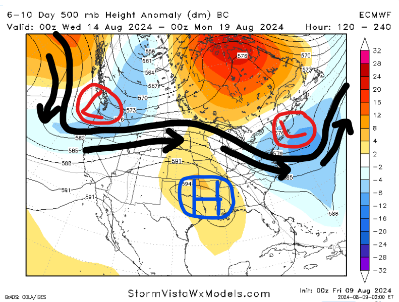
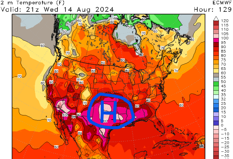
Going into next week, our main focus will be the ridging pattern in the mid-levels of the atmosphere across the central CONUS. Temperatures are forecasted to return to average after this quick “cooldown” up north and high pressure will continue to dominate down south.
High temperatures next week are forecasted to be 90 degrees or higher across the Southern Plains and Southeast where there will be more sunshine and sinking air. Across the northern CONUS, temperatures will rise back into the 80s with increasing dew points as well, so it’ll feel more like summer again.
Throughout the week, the aforementioned high will move eastward which is why we are confident in below-average precipitation for the Southeast. The best chances for rainfall will come later in the week when there will be a slight breakdown in the ridging pattern.
Wildfire Threat Out West
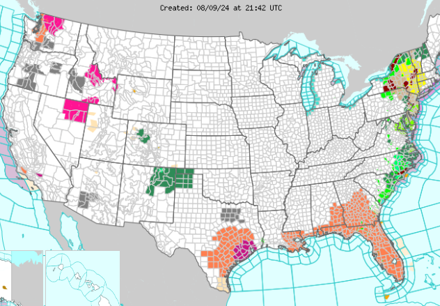
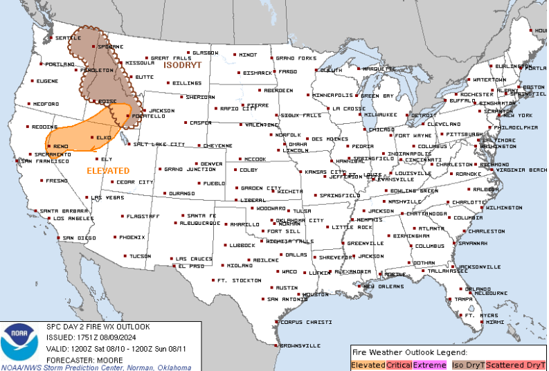
Here is a current look at all of the country’s hazards as of this evening. This map should change by this weekend as Debby exits, so our main focus will turn to the wildfire threat out West.
Red flag warnings (pink color) have been issued for portions of Nevada, Idaho, and Washington due to low relative humidity values and gusty winds. Avoid outdoor burning in these areas and know where to go if you’re in the path of these fires.
For Saturday, the SPC has highlighted northern Nevada, Idaho, and eastern Washington in the risk of wildfires. After that, the Great Basin will have the best chance of seeing these conditions next week due to west-southwesterly flow. Monday could pose a risk of wildfires across Nevada and southern California due to a progressive shortwave passing by.
Rain Chances for Central U.S.
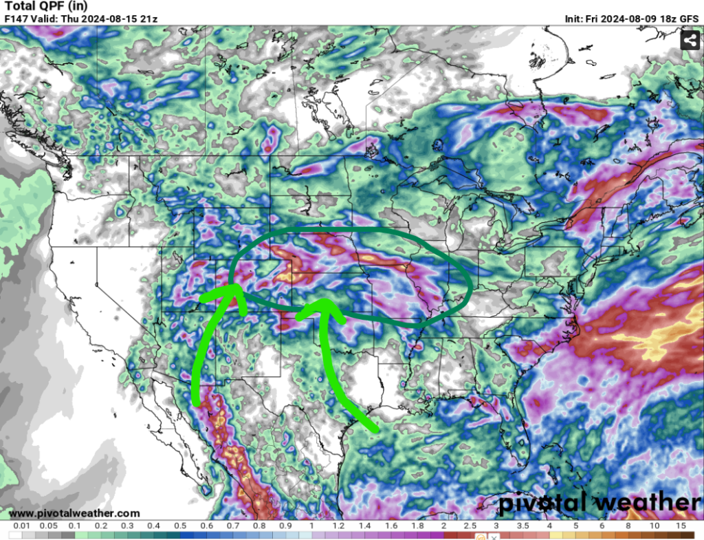
Early next week, rain chances are possible across the central U.S. due to the area of high pressure across the South. Moisture will begin to advect northward as showers and thunderstorms will traverse across the Plains and Midwest starting on Sunday.
Multiple rounds of rain are possible next week, but there will be dry time in between. Also, we are not concerned with any significant flooding issues as most areas will only see 1-2″. You may get to hold off on watering your plants around the house next week if you live in this part of the country.
However, eastern Colorado could see rainfall totals exceeding 2″ as this would cause trouble in the mountainous terrain. Remember to turn around and avoid flooded waters!
Areas like Kansas could use the rain the most as some locations are in a severe drought.


