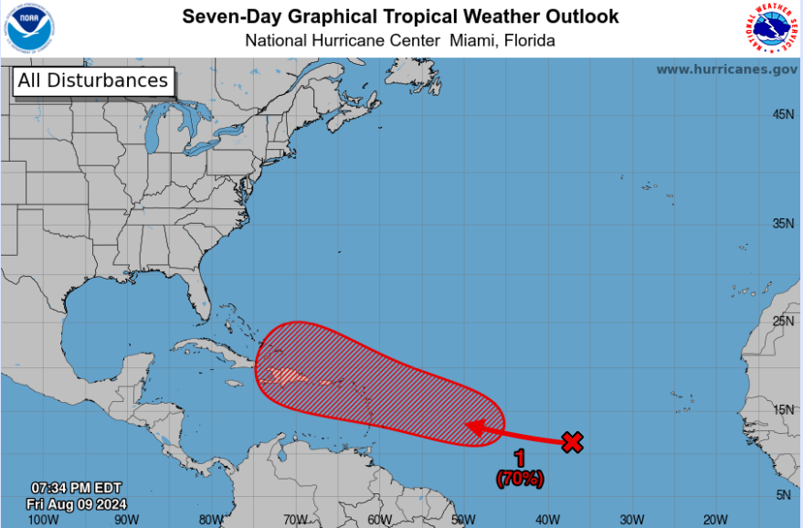
It’s tropics time! Hurricane Debby got August off to a hot start and the rest of the month looks active too. The National Hurricane Center (NHC) has highlighted a new area of interest over the open Atlantic that has a high (70%) chance of formation by next week. We’ll discuss who can see impacts first and if the U.S. is in play with soon-to-be Ernesto.
Current Look At the Tropics
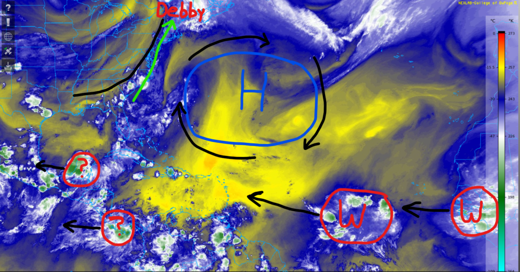
Across the Caribbean and Gulf, we have a disorganized area of showers and thunderstorms over Central America. This was previously monitored by the NHC, but conditions are now unfavorable for development.
Over the U.S., a strong cold front is moving through the Midwest and Northeast which is helping kick Debby out.
Finally, we have two new waves near the coast of Africa which are forecasted to move west over the next few days.
As we get towards next week, models are favoring development with the first wave as it could impact the Leeward Islands and Puerto Rico by the middle of next week.
Our second wave could struggle depending on the strength of the first wave as wind shear could limit development. Regardless, the European model hints at a new wave coming off the coast of Africa late next week that could organize into a tropical depression or storm. The next names on the list are Ernesto and Francine.
Model Guidance
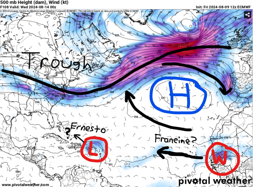
There are several factors to look at with future Tropical Storm Ernesto.
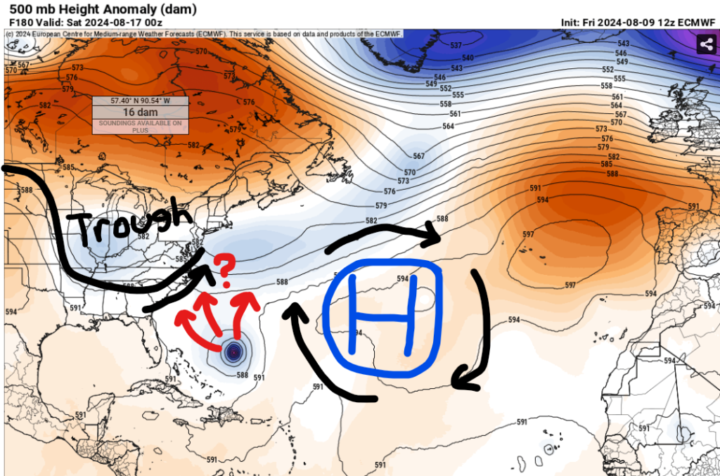
First, how quickly does it organize? A system that develops faster would feel the steering from the high pressure and pull the storm more northward.
Second, how much land interaction does this storm have next week? More time over Puerto Rico and Hispaniola could slow down the intensification process.
Third, how strong is the high pressure over the Atlantic and how deep is the trough over the eastern CONUS? If Ernesto can develop and get back over open water again, models are suggesting it could be in the southern Bahamas by late next week. By then, this storm would be dependent on the steering patterns aloft.
Obviously, there is still A LOT of uncertainty and we’ll have more confidence in this system by early next week once it becomes a named storm. Everyone should continue to check the latest forecast, especially along the east coast of the United States.
In the Pacific
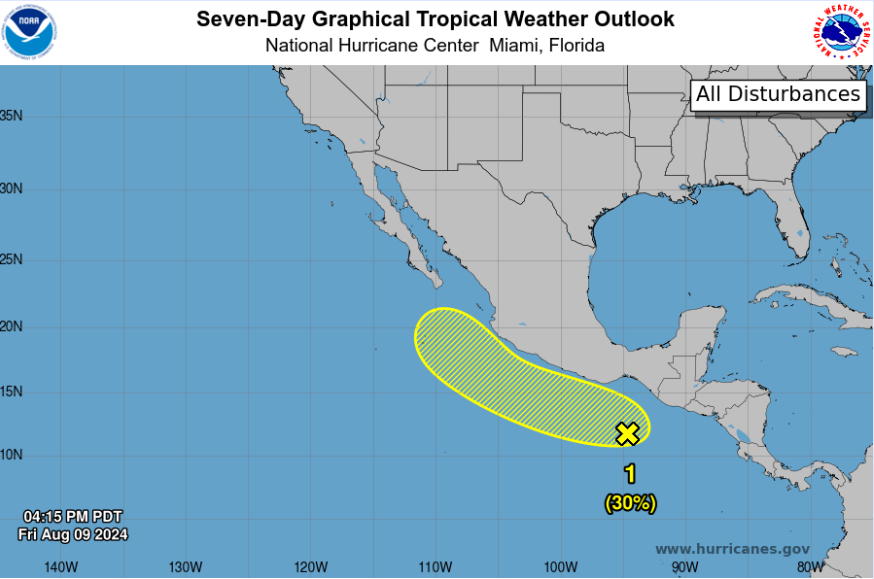
In the eastern Pacific, a couple hundred miles south of the coast of southern Mexico, there is a disorganized area of showers and thunderstorms. As of now, the NHC gives it a 30% of development over the next seven days as it is forecasted to parallel the coastline. The next name on the list is Gilma.
Luckily, models suggest that conditions will become unfavorable near Baja California, so significant impacts seem unlikely at this point. This could increase moisture for western Mexico and the southwest U.S. by late next week, so we’ll continue to monitor this area for potential flooding.


