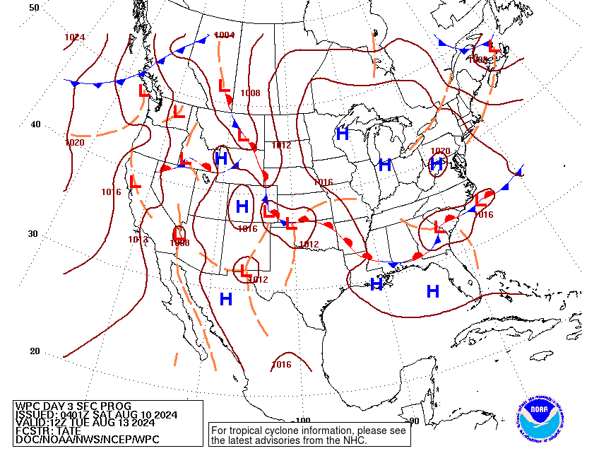
For the past couple of days, we’ve had a slight break from the miserable heat that we’ve had to start off August with a stationary cold front helping to bring in dry air to the Deep South. The good news is, we’ll have a couple more days of dry heat even into the early week. The bad news, we go back into our typical humid heat by mid-week. Let’s take a look.
This Weekend
With an influx of north wind from the surface to the mid-levels, we’ll have another dry and hot day today and tomorrow. Dewpoints will be in the low to mid-60s across most of LA/MS/MS. Areas closer to the coast of Louisiana and Florida will still experience the more humid air, however. Temperatures will stay in the low to mid 90s with the heat index rising into the low 100s during the day. A few clouds are possible, but fairly scarce. Overnight, temperatures will fall into the low to mid 70s.
By Monday, we’ll have temperatures rise into the upper 90s as the north wind begins to weaken across the board. The heat index will rise into the low to mid 100s, however the humidity still won’t be as much of a factor.
Mid-Week
Tuesday is when we’ll get an influx of more southwesterly winds contributing to the rising dewpoints. With an already prominent Atlantic ridge, this will help with the development of a Gulf ridge to the south. A long low pressure system stemming from the Rockies and moving eastward will drive more moisture flow to our neck of the woods. Rain chances for Tuesday and Wednesday look fairly limited, but a few pop-up thunderstorms may be possible. Temperatures will rise into the low 100s during the day with the heat index reaching the mid to upper 100s.
End of the Week to the Weekend
Thursday will see the heat index reaching up to 110 in some areas with the high reaching close to 100. A few stray pop-up thunderstorms are possible during the day, but I wouldn’t count on them to bring much rain.
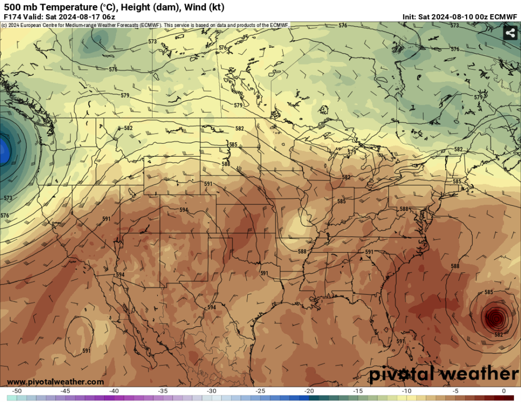
//Courtesy: Pivotal Weather
Friday is when we may see a slight reduction in the heat thanks in part to the cold front I mentioned earlier. In the upper-levels, there is a small shortwave trough digging slightly south which could help in some mid-to-upper level cloud formation. If we get enough cloud cover during the day, we’ll see temperatures come down a few degrees during the day. A few isolated storms are also possible during the day as the cold front moves closer to the southeast.
Saturday is a similar story with the cloud cover and rain chances as the cold front begins to pass us. A few isolated storms are possible during the day, however there won’t be a lot of rain unless a stray storm is able to get enough flow to it. With the passing of the cold front, Sunday looks to be hot, but drier overall, much like this weekend.
I’ll take a look at the tropical forecast tomorrow, so stay tuned!
Select Data Set:

Regional Day-to-Day Forecast
Today – Sunny, with a high in the mid 90s. Heat index values as high as 100. North wind around 5 mph.
Tonight – Mostly clear, with a low around 70. North wind around 5 mph becoming calm.
Sunday – Sunny, with a high in the mid 90s. North wind around 5 mph.
Sunday Night – Clear, with a low in the low 70s. Calm wind.
Monday – Sunny and hot, with a high near 98. Calm wind becoming north northwest around 5 mph.
Monday Night – Mostly clear, with a low around 75. Calm wind.
Tuesday – A 20 percent chance of showers and thunderstorms in the afternoon. Sunny and hot, with a high near 100. Calm wind becoming west around 5 mph.
Tuesday Night – Mostly clear, with a low in the upper 70s. Calm wind.
Wednesday – A 20 percent chance of showers and thunderstorms in the afternoon. Sunny and hot, with a high near 100. Calm wind becoming west northwest around 5 mph.
Wednesday Night – Mostly clear, with a low in the upper 70s.
Thursday – A 20 percent chance of showers and thunderstorms. Sunny and hot, with a high near 100.
Thursday Night – Mostly clear, with a low in the upper 70s.
Friday – A 30 percent chance of showers and thunderstorms. Sunny and hot, with a high in the upper 90s.


