Hello, and thanks for reading today’s tropical weather outlook; this report covers quite a lot. Looking at the Atlantic Ocean, we have a tropical system that is likely to develop in the next few days. Currently, this possible system is expected to form near the Lesser Antilles. This potential tropical system is expected to move in a northwest direction over the next week. Whether this system impacts the United States or not will depend on how mid-level pressure systems are set up next week. Looking at the Pacific, it is a much calmer situation, with only one possible system, which has a much lower chance of development.
Current situation in the Atlantic

Just a few days ago, we were dealing with Hurricane Debby, which caused major flooding to parts of the Southeast; well, we already have another area of disturbance. As of this writing, this area of showers and thunderstorms continues to organize as this area of low pressure continues to strengthen. Currently, this system is about 1,000 miles east of the Lesser Analies and is moving westwards.
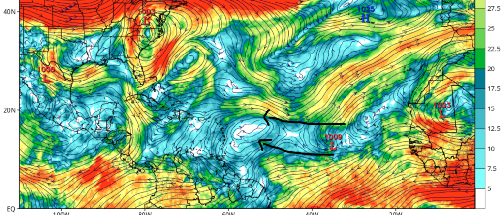
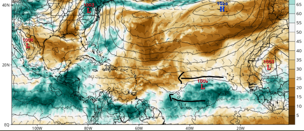
As shown in the images above, environmental conditions are very conducive for tropical development in the next few days. With a combination of low windshear and high relative humidity in the mid-atmosphere, tropical development is likely in the next few days. After development, the system is expected to move to the west-northwest, possibly impacting parts of the Caribbean. Those residing in the Lesser Antilles should be prepared to take action for this storm.
Will the U.S. see impacts?

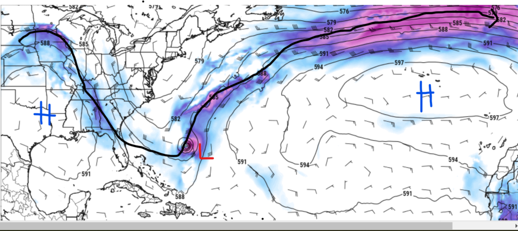
Those living in the Southeastern U.S. may be asking if this system will impact this region since this area is recovering from Debby. Well, I do have some tentative good news; I do not think that this system will have major impacts on the mainland U.S.
The reason why is that a center of high pressure is expected to sit over the Southeastern U.S. when the system is expected to pass by. Also, a trough near the expected system will help steer the hurricane away from the Continental U.S. If this forecasted setup remains in place, I think that this possible hurricane will remain over the Atlantic, with only minor impacts expected to coastal regions of the East Coast. Now this setup I am talking about is still a week away, which means that things could easily change, so please check back daily for the latest tropical information.
A quick look at the Pacific

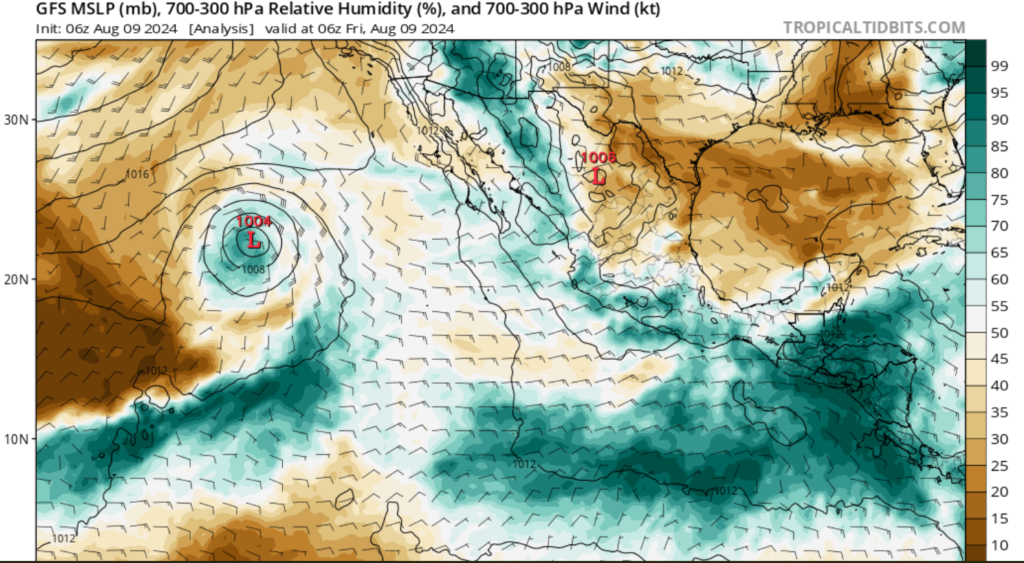
Over the last few days, the low-pressure system seen in the image to the right has slowly weakened over the last few days. This is because of unfavorable environmental conditions (dry air aloft, high windshear, and cooler waters). As this system continues to move northwest, continued weakening is expected. Regardless of what this system does, I don’t expect much impact besides some heavy rainfall for parts of Western Mexico.


