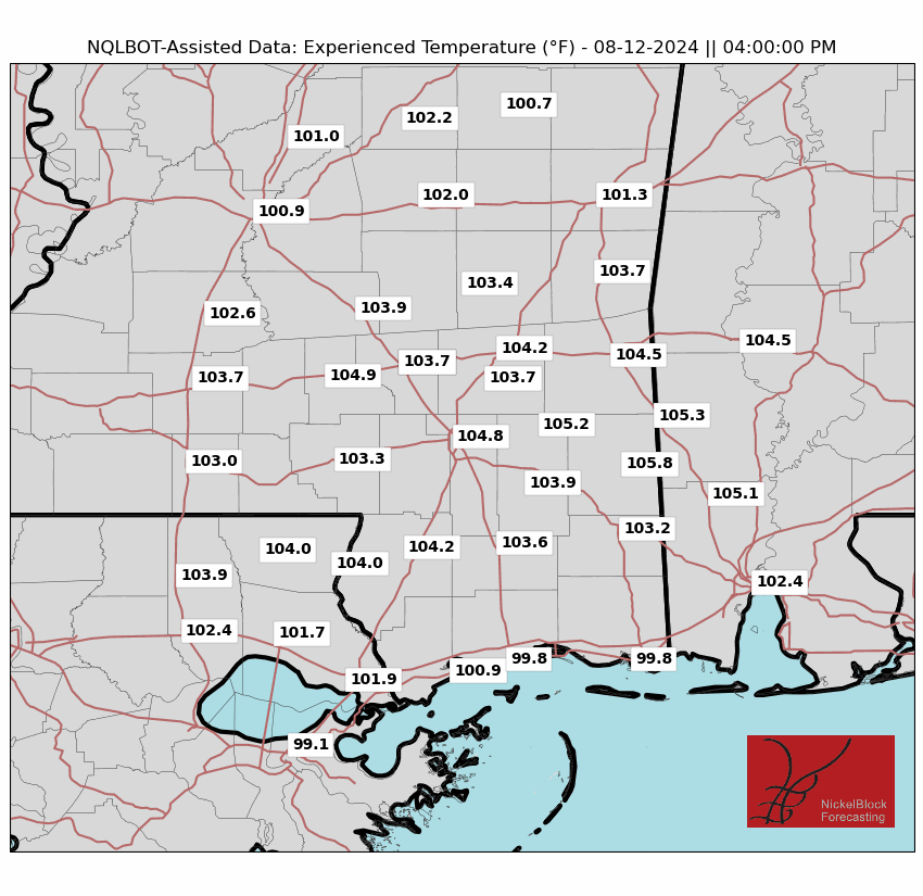
The heat is still on for us and it’s not looking like anything will be different for a while! As we start the week, we’ll start off with more dry heat and eventually move into higher dew points bringing up the heat index each day.
This evening, temperatures will remain in the mid 90s and eventually fall as the sun goes down. No matter how you slice it, it’s still hot outside until it gets dark, so plan accordingly if you’re out tonight.
Starting off tomorrow, we’ll see the temperature reach the upper 90s with the heat index in the low 100s and few clouds in the sky. Winds will still be pulling from the north keeping us dry until the evening. We’ll dip into the low 70s for the evening with winds calming down overnight.
Tuesday is when the dew points start to creep up during the day and cause the heat index to start rising towards the mid-100s all the way to 110 in some areas. I won’t be surprised if a heat advisory shows up for the rest of the week starting Tuesday. We’ll reach up to 100 for the high with winds coming in from the northwest as a Gulf ridge begins to form.
Tropical Outlook
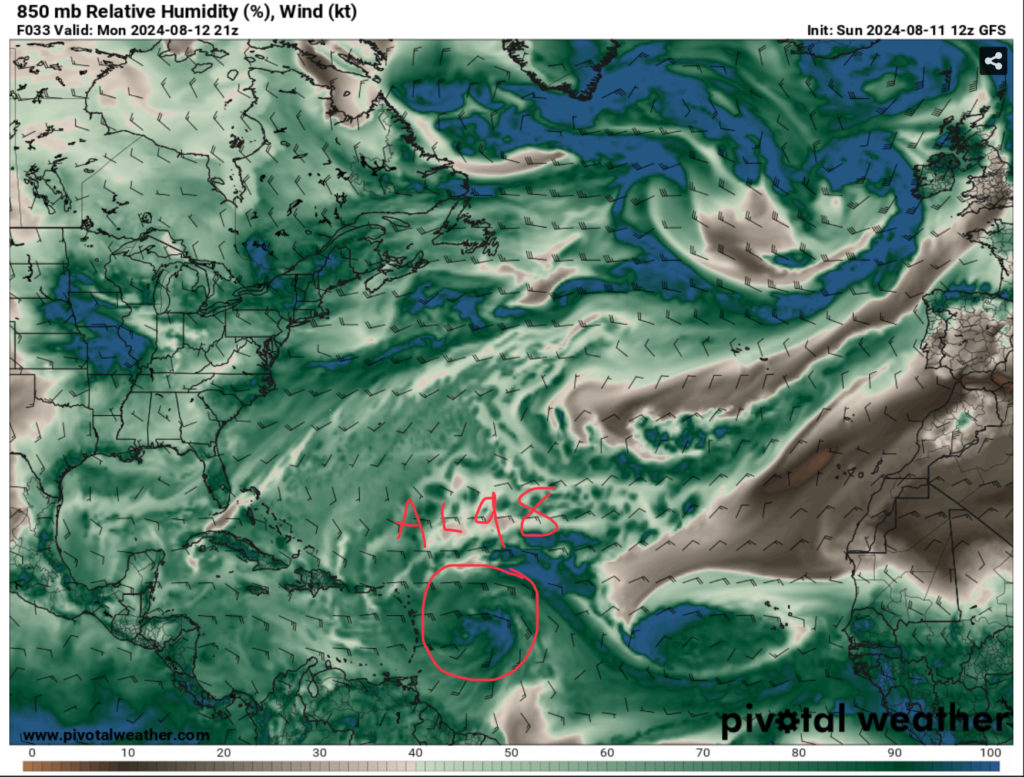
So far, AL98 is gaining traction as it approaches the Lesser Antilles. It already has enough moisture flow to feed it, however this Invest looks to be moving a little fast. Compound this with a strong Atlantic ridge and developing ridge in the Gulf, there’s a possible chance that this will miss the US entirely. Right now, the GFS and Euro models have the Invest hooking north after it develops, but the Lesser Antilles will likely deal with the storm when it’s strengthening.
Regional Day-to-Day Forecast
Tonight – Mostly clear, with a low in the low 70s. North wind around 5 mph becoming calm.
Monday – Sunny and hot, with a high in the upper 90s. Heat index values as high as 105. Calm wind becoming north around 5 mph.
Monday Night – Mostly clear, with a low in the mid 70s. Calm wind.
Tuesday – Sunny and hot, with a high near 100. Heat index values as high as 105. Calm wind.
Tuesday Night – Clear, with a low in the mid 70s. Calm wind.
Wednesday – A 20 percent chance of showers and thunderstorms in the afternoon. Sunny and hot, with a high in the upper 90s. Calm wind becoming west northwest around 5 mph.
Wednesday Night – Mostly clear, with a low in the mid 70s. Calm wind.
Thursday – A 30 percent chance of showers and thunderstorms in the afternoon. Sunny and hot, with a high near 100. Calm wind becoming north around 5 mph.
Thursday Night – Mostly clear, with a low in the upper 70s. Calm wind.
Friday – A 30 percent chance of showers and thunderstorms in the afternoon. Sunny and hot, with a high in the upper 90s.
Friday Night – Mostly clear, with a low in the upper 70s.
Saturday – A 30 percent chance of showers and thunderstorms. Sunny and hot, with a high in the upper 90s.
Saturday Night – Partly cloudy, with a low in the mid 70s.
Sunday – A 20 percent chance of showers and thunderstorms. Sunny and hot, with a high in the upper 90s.


