Happy Monday! I hope everyone had a safe weekend! We have more heat to start our week off, with highs in the upper 90s and heat indices in the 100s as dry conditions rule our region. This trend is expected to continue through the work week. This weekend, we should see a change as a cold front moves through our area, bringing the chance for scattered showers/thunderstorms. While it will not be “cooler,” temperatures will be lower than the usual 100F we have seen in the past few weeks. Let’s get into it!
SYNOPTIC SETUP:
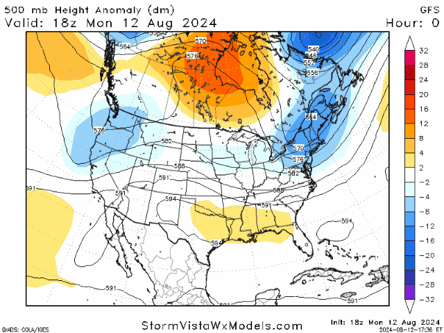
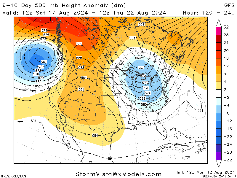
Over the next couple of days, a high-pressure ridge will form and will be over our area for most of the workweek. This ridge will allow for the high temperatures and lack of rain we have seen often this summer. The map on the left depicts upper-level winds that coincide with the ridge developing this week.
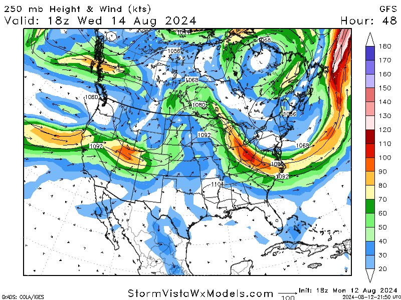
As the ridge begins to clear towards the end of the week, a weak trough develops and could bring the weak cold front into our region. This will allow us for showers/storms as we move into the weekend, along with slightly cooler temperatures, but probably not enough to notice a difference thanks to the “experienced” temperature.
REST OF THE WORK WEEK:
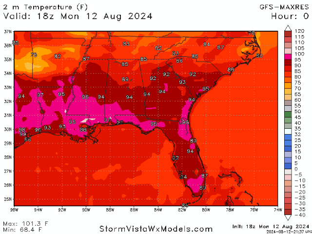
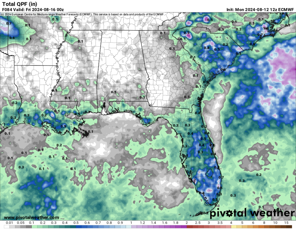
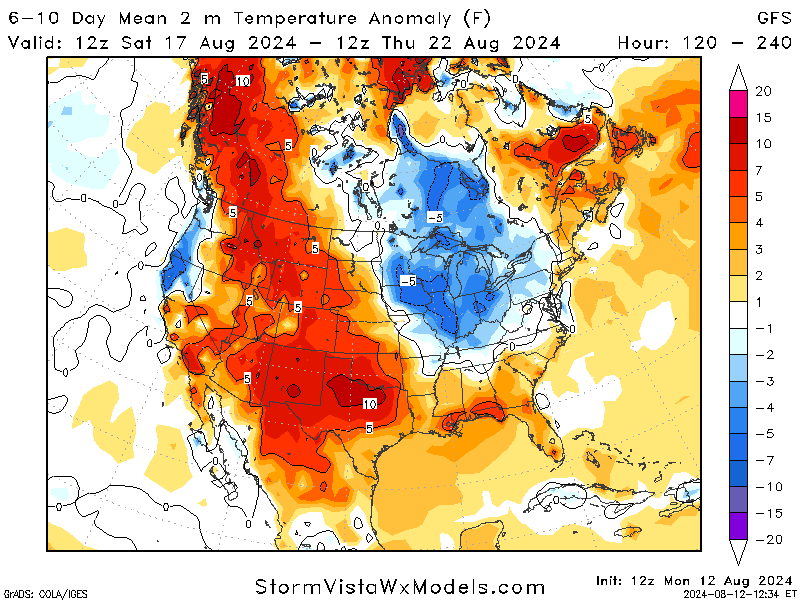
Looking at the rest of the work week, temperatures are expected to sit at the usual upper 90s, with some areas peaking in triple digits. Unfortunately, there’s little relief in sight as the forecast indicates a significant lack of precipitation across the region. Rain chances will be minimal, with no significant systems expected to bring widespread showers. While the models show a chance for the coastal areas of our region to get some rain, the inland areas are expected to be left high and dry.
With the highs in the upper 90s for most of the days, the heat index, which factors in humidity, could push “feels-like” temperatures even higher. These high heat indices will make it crucial for residents to take precautions against heat-related illnesses. With little to no cloud cover expected, the sun will be relentless, further exacerbating the heat. Please exercise caution while working outdoors and be aware of your body.
LOOKING AHEAD:
As we move towards the weekend, models agree that a mid-level trough is forming in the Great Lakes region and reaching down to the deep south as the ridge currently affecting us shifts to the west. This will allow for cold front movement and potentially bring slightly cooler temperatures to our area.
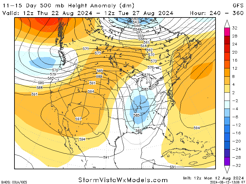
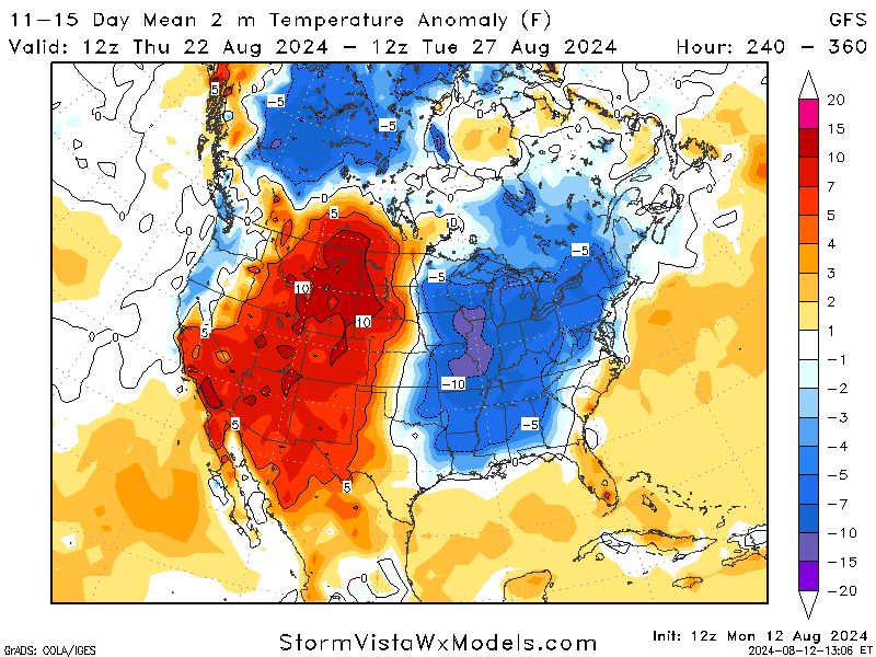
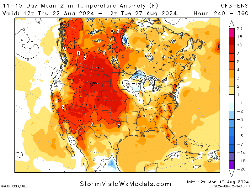
Looking further ahead to two weekends, the models agree on a trough or broad area of low pressure affecting our area but disagree on temperature. On the right, the GFS model shows temperatures below average for 15 days, but the GFS-ENS model shows slightly above-average temperatures. This proves that while knowing what the weather will be further out is helpful, it is only sometimes the most reliable.
BRIEF TROPICAL UPDATE:
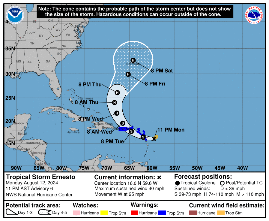
Tropical Storm Ernesto is a large storm that’s still developing, and while it hasn’t fully come together yet, it’s showing signs of becoming more organized. The storm’s center still needs to be defined, and its structure could be stronger, but some features around it are improving. Ernesto’s wind speed is around 40 mph, moving westward, slightly slower than before. It’s expected to pass over the Leeward Islands soon, move across the northeastern Caribbean tomorrow, and then approach Puerto Rico by tomorrow evening or night. Afterward, Ernesto will likely start moving northward as it interacts with weather systems near the U.S. east coast.
As the storm moves, conditions will likely become more favorable for it to strengthen, especially after it passes north of the Greater Antilles. The storm is expected to get stronger over the next few days gradually. The main concerns of this tropical storm area are as follows:
- Tropical Storm Warnings: Ernesto is expected to bring tropical storm conditions to parts of the Leeward Islands early Tuesday and to the Virgin Islands and Puerto Rico by late Tuesday.
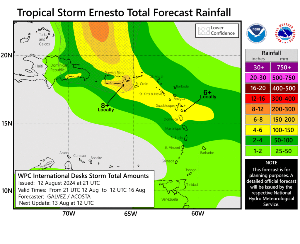
- Heavy Rainfall: Heavy rains could cause flash flooding and mudslides in the Leeward and Virgin Islands through Wednesday and in Puerto Rico from Tuesday to Thursday.
- Bermuda Concerns: It’s still too early to predict the impact on Bermuda later in the week, but residents should stay updated on the storm’s progress.


