Happy Saturday! I hope that you have had a great week. Looking at the general weather setup for the region, I am expecting hot and humid temperatures to continue through the weekend. Air temperatures are expected to hit the upper 90s, with a few triple digits possible this weekend. Luckily, a cold front is expected to dive down to our region by Monday morning, providing some relief to the region.
Looking at our rainfall chances today and tomorrow, most of the region should expect isolated to scattered showers. These showers should develop this afternoon and should continue through this evening. Some of these storms could be severe, as our northern communities are in a marginal risk of severe weather.
Scorching temperatures expected

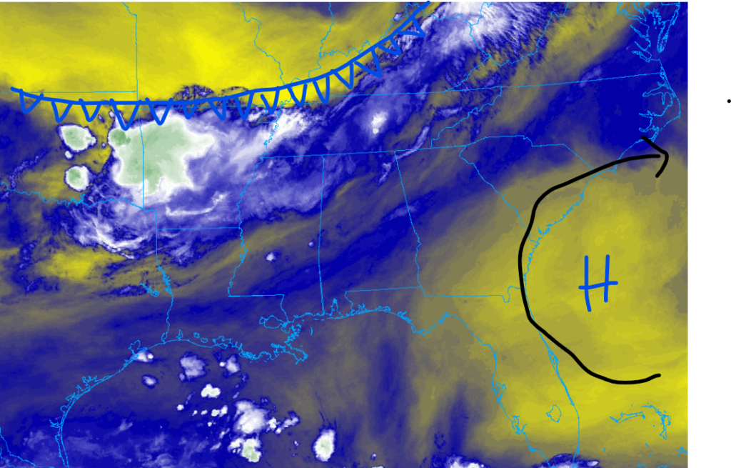
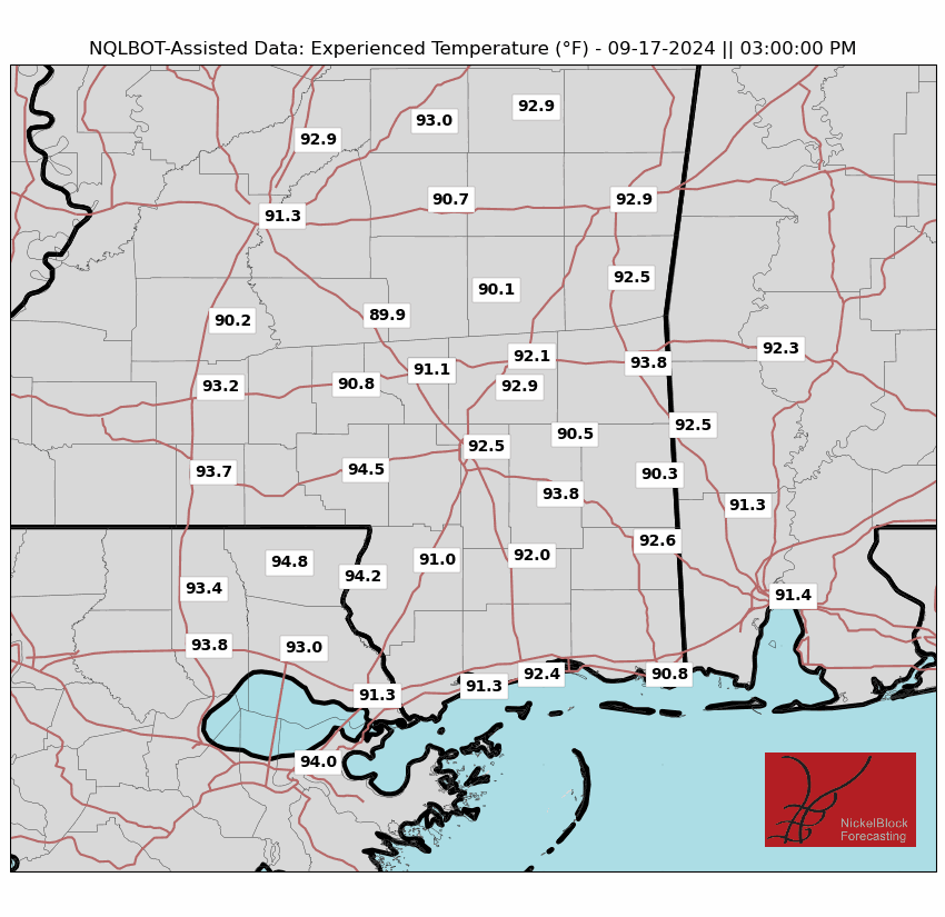
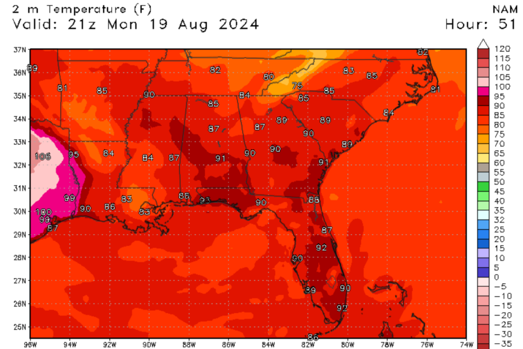
Looking at our temperatures for today, one thing is very obvious, heat and more heat. This is thanks to areas of high-pressure center located off the coast of Florida and to the south of us, as seen in the image to the right. These areas of high pressure are causing our air temperatures to climb to above-normal values. Air temperatures are expected to climb into the upper 90s for areas inland, with cooler temperatures expected along the coast, thanks to the sea and gulf breeze. Tomorrow won’t be any cooler, with temperatures expected to climb to over 100 degrees Fahrenheit for our inland communities. Heat index values are expected to be well over 110 degrees Fahrenheit for inland locations, as seen in the images below.

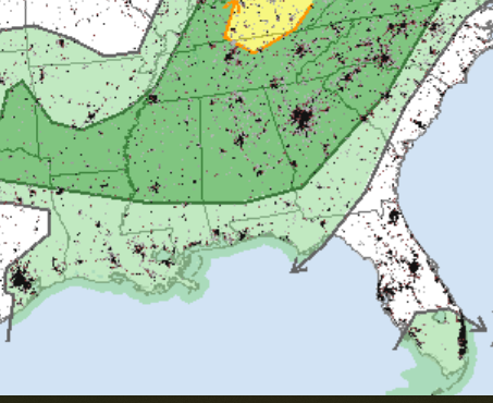
Because of these high forecasted temperatures, both heat advisories and heat warnings have been issued for the region. I am expecting that these heat alerts will continue through Sunday evening before the cold front mentioned moves through. These extreme temperatures and heat index will pose a risk for those who are unprepared. Please be very careful when venturing outside today and tomorrow, and make sure to watch for heat-related illnesses.
Isolated showers are expected, with a couple of severe storms possible
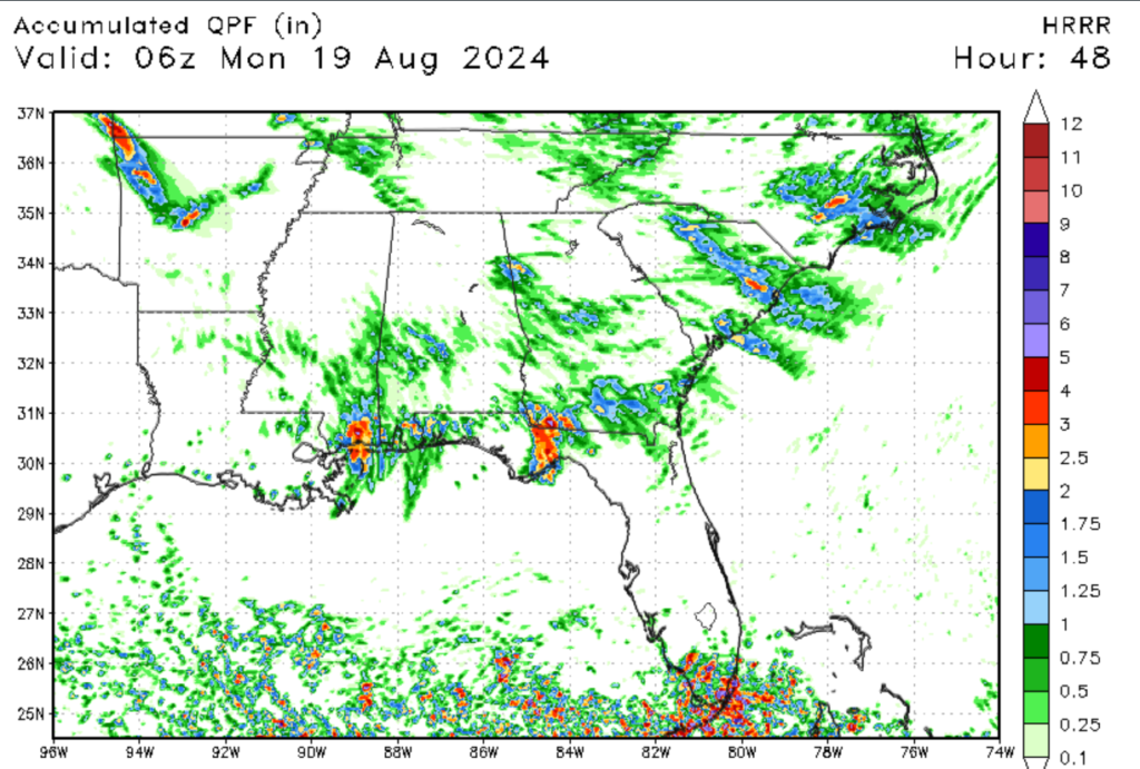
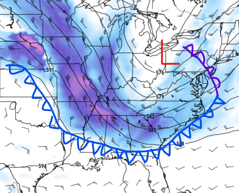
Not only will we be watching for extreme heat, but we will also be watching for isolated to scattered showers this afternoon. Our northern communities, such as Jackson, MS, are under a marginal risk of severe weather today, with high winds from microbursts being the primary threat. These storms are developing thanks to a trough to our north, which will eventually bring cooler air to our region. Further south, convective development is possible thanks to the sea and gulf breezes; however, these storms will be isolated in nature, so don’t expect any rainfall today.
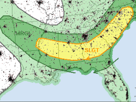
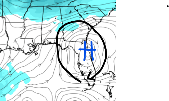
Looking at our storm chances for tomorrow, the far northern reaches of our area are under a slight risk of severe weather, while the rest of our region is under a marginal risk. As temperatures and dew points will be high tomorrow, instability in the atmosphere will come into play. CAPE values could be over 2000 J/kg, with lower-level lapse rates expected to be around 8 degrees Celcius per Kilometer. An isolated supercell is possible, but I am expecting multicell storms to be the primary concern as they ride this cold front, as seen in the image to the right. Strong winds will be the primary threat, with some isolated hail expected from the taller cells. Heavy rainfall and lightning are also possible with some of these storms. Please make sure to keep a very close eye on the radar tomorrow as this cold front approaches.
Slightly cooler weather is expected this week, and no additional tropical development

The cold front expected to move through the region will help bring some relief to the region for next week. I am expecting that high temperatures will drop into the low 90s for most communities. Lows for next week could drop into the mid-60s for areas inland, which will provide a nice relief from the sweltering heat. Not only will temperatures be lower next week, but humidity values are expected to drop to as low as 40% in the afternoon.
Looking at the tropics, the only system in the Atlantic Basin is Ernesto, which just made landfall in Bermuda this morning. I don’t expect tropical development for the next several days, as a lack of moisture and moderate windshear will set up in the intertropical convergence zone, limiting development. Even though no additional tropical development is expected, we are reaching the peak of hurricane season. This means that you need to pay closer attention to tropical weather reports and be prepared to take action if needed.


