Hello there, and happy Sunday. There is quite a lot going on in both the Atlantic and Pacific basins. In the Atlantic, Ernesto has been downgraded to a tropical storm as it continues to move north. Current forecasts state that this system will move northeastward, directly missing the Providences of Nova Scotia and Newfoundland. Even though direct landfall is not expected, heavy rainfall, high surf, and strong winds will cause impacts to coastal regions of these Providences.
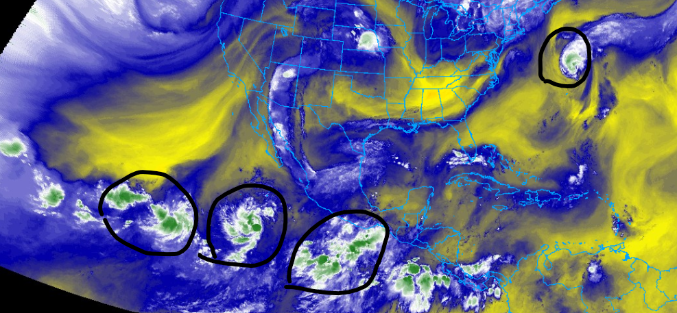
Looking westwards, there is a lot more action. Specifically, there are two areas of disturbances that we are watching in the Centeral Pacific. Both have a 50% chance of forming in the next seven days. These systems could cause impacts to the Hawaiian Islands in the next week or two. The third system has just formed into tropical depression 7e and is located off the coast of Mexico.
The Atlantic

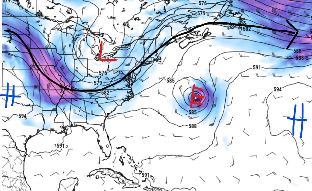
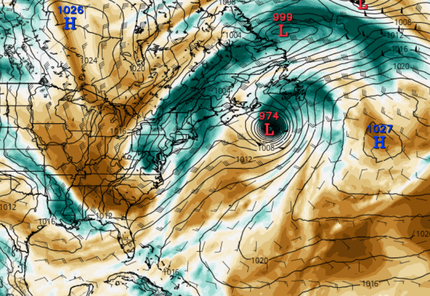
Looking at the Atlantic Basin, the only system that we are keeping an eye on is Tropical Storm Ernesto, which made landfall on the Island of Bermuda on August 17th as a category 1 storm. This system has a history of damaging winds, high surf, and heavy rainfall, which has caused damage to multiple islands in the Caribbean and the Island of Bermuda.
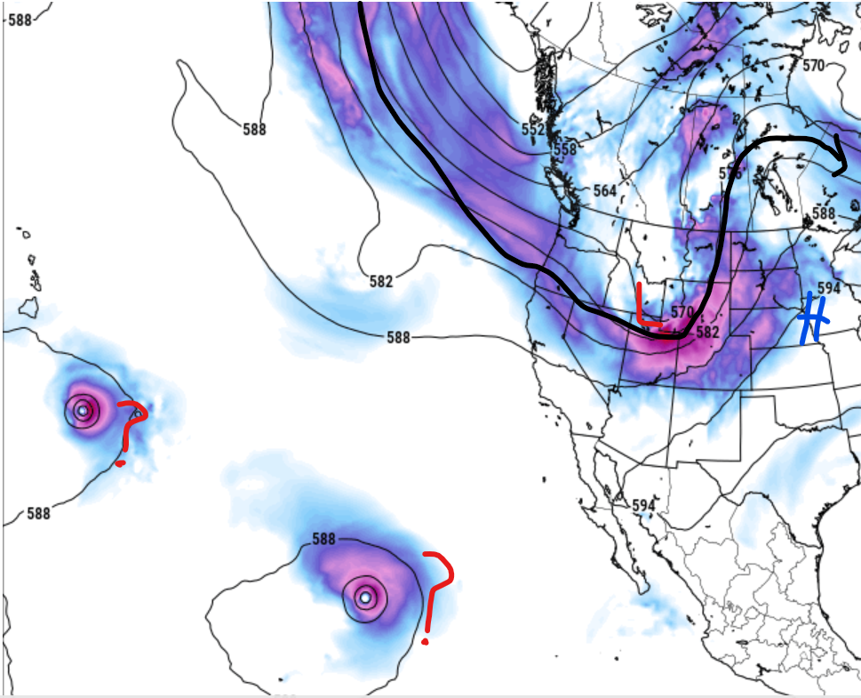
As of this writing, Ernesto is located at latitude 36.1 N and longitude 62.5 W and is moving north-northeast at 16 mph. The minimum central pressure last observed was 978 MB, and the maximum sustained winds were 70 mph. Some restraining is possible over the next couple of days as the system continues to move off the U.S. coast. This is due to a trough to the west of the storm, which is helping to steer the system away from Mainland North America. The dipping of the jetstream and a ridge to the southeast is also helping.
What to expect

Ernesto is expected to continue on a north/northeast track over the next several days. The good news is that no direct landfall is expected in the near future. The only concern is how this system will affect the British Isles, but I do expect that Ernesto will be a post-tropical system by then. Even though no direct landfall is expected, wind, waves, and heavy rain are expected for the coasts of Nova Scotia and Newfoundland. Southwest-facing coasts are at the greatest risk for coastal flooding. Please make sure to take care for the next couple of days as this storm passes by.
The Pacific Basin

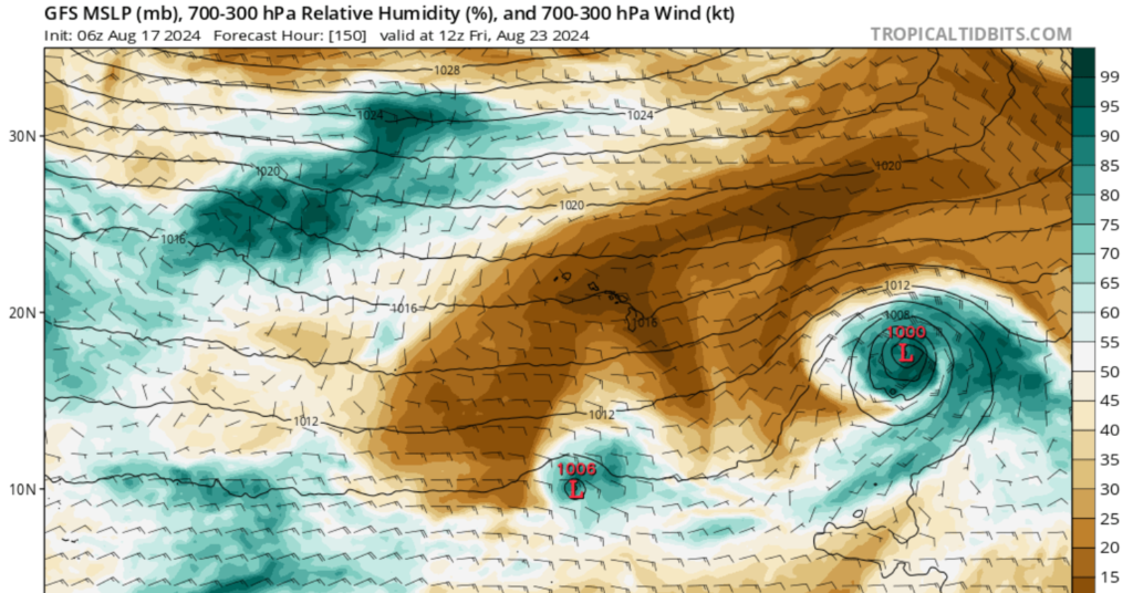
Looking westwards, multiple systems and areas of disturbance are present in the Pacific Basin. One of these systems, Tropical Depression 7E, formed on August 18th and is named Tropical Depression 7E. As of this writing, 7E is located at latitude 14.6 North and longitude 110.7 West and is moving west-northwest at 13 mph. Minimum central pressure was observed at 1007mb, and maximum sustained winds were 35 mph. Some gradual strengthening is expected over the next several days.
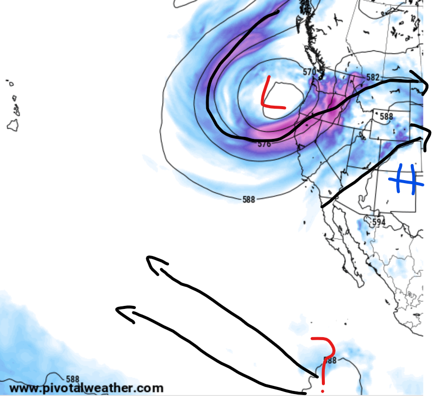
Our areas of disturbance, shown by the yellow x’s, are starting to gain strength and could form into a tropical system by the middle of this week. As of this writing, both of these systems are just areas of disorganized showers and thunderstorms. The question is, which disturbance will be the dominant one, or will they merge into one system? Models agree that these systems will interact with each other, but I can’t give a concrete answer on which system will be the dominant one. Regardless of what happens to these systems, those residing in the Hawaiian Islands need to keep a close eye on these potential tropical systems.
What to expect

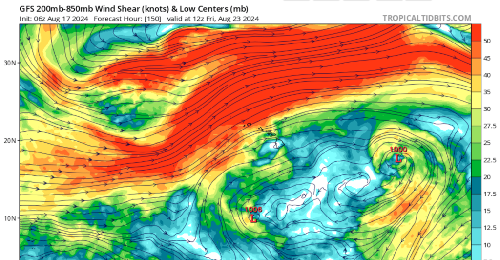
Tropical storm 7E is expected to slowly move westward as it strengthens into a tropical storm, with no landfall expected for the next several days. However, areas of disturbance closer to Hawaii could pose a threat to the islands over the next 7 to 10 days. I do expect weakening as this system moves closer to the islands, as an area of dry air and high windshear are in place north of the islands, as shown in the images below. Regardless of these potential storms’ impacts, those residing in Hawaii should continue to receive the latest tropical information.


It’s strange, and I am NOT expressing disappointment, believe me, having gone through of the 2 worst hurricanes to strike the US (Camille and Katrina), but I thought the pre-season predictions had all the tropical systems in the Atlantic, not the Pacific. Makes you wonder where/how these predictions are coming from. BTW, I hope it continues!