I’m sure for many of us, there’s a noticeable difference in the temperatures across South Mississippi. While it’s not quite the Fall cooldown we want, I’m sure many of us are relieved that we’re out of the miserable summertime temperatures that have been plaguing us for the past 2 months. That said, we’re still in the “False Fall” part of the Mississippi season calendar, so we still have a little ways to go to get the real fall-like weather.
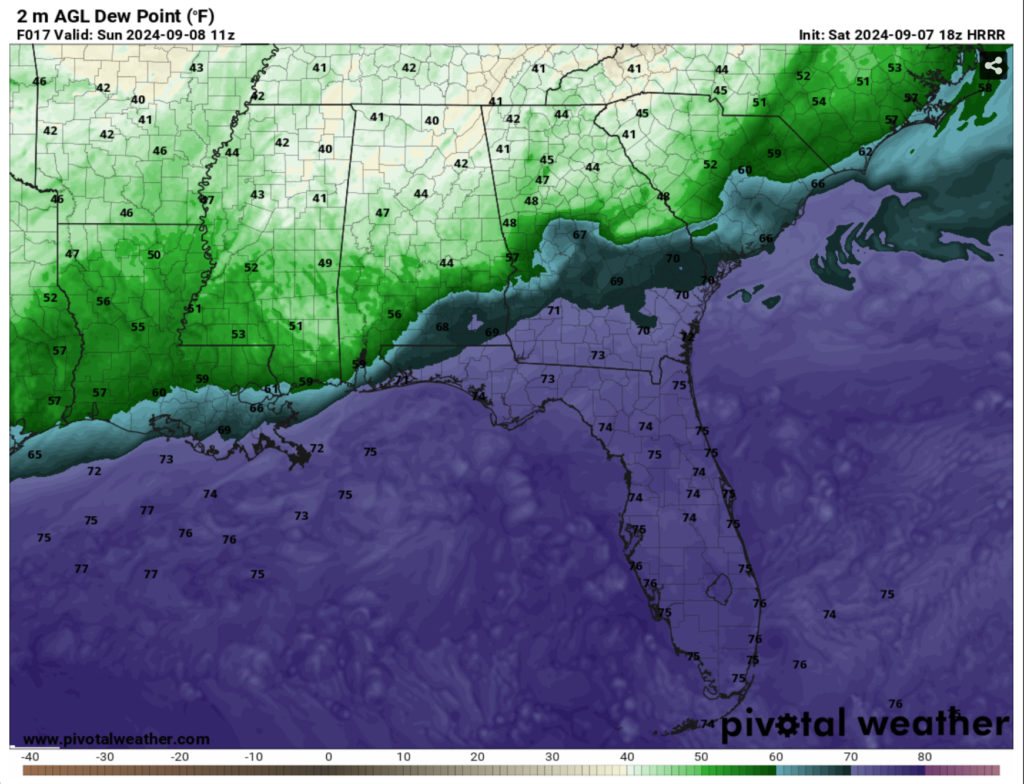
Tonight, we’ll dip into the low 60s with the winds beginning to kick up overnight. The stationary front will move south causing the dew point to drop quite a bit. In the morning, dewpoints will drop into the low 50s which is a good indicator for some pleasant weather on Sunday.
During the day on Sunday, temperatures will reach the mid 80s with some gusty winds during the day. Winds coming from the northeast will be consistent around 5-10mph with 20mph wind gusts. We’ll see few clouds during the day as it’ll be fairly dry in the atmosphere. Overall, it’ll be quite a pleasant Sunday for our early September. Overnight, we’ll reach the mid 60s with the northeast winds beginning to wane.
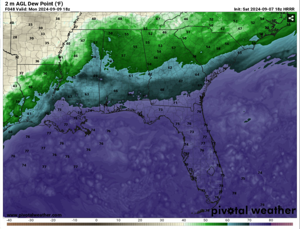
By Monday, there will be a return flow of moisture from the Atlantic bringing some slightly higher dewpoints to the Deep South. This will up the humidity during the day compared to Sunday and slightly up the rain chances during the afternoon. Looking at the HRRR model, this looks to be very limited and close to the coast as the stationary front moves slightly north, however it will still hover around the Gulf. Highs will reach the upper 80s during the day and near 70 at night.
Regional Day-to-Day Forecast
Tonight – Partly cloudy, with a low in the low 60s. North northeast wind 5 to 10 mph, with gusts as high as 20 mph.
Sunday – Sunny, with a high in the mid 80s. Northeast wind around 10 mph, with gusts as high as 20 mph.
Sunday Night – Mostly clear, with a low in the mid 60s. North northeast wind around 5 mph.
Monday – A 20 percent chance of showers and thunderstorms in the afternoon. Mostly sunny, with a high in the upper 80s. East northeast wind 5 to 10 mph.
Monday Night – A 20 percent chance of showers overnight. Mostly cloudy, with a low in the upper 60s. East wind around 5 mph.
Tuesday – Showers likely and possibly a thunderstorm in the afternoon. Mostly cloudy, with a high in the low 80s. East wind 5 to 10 mph. Chance of precipitation is 60%. New rainfall amounts between a tenth and quarter of an inch, except higher amounts possible in thunderstorms.
Tuesday Night – A 50 percent chance of showers and thunderstorms. Mostly cloudy, with a low around 70. East wind around 5 mph.
Wednesday – Showers likely, with thunderstorms also possible in the afternoon. Mostly cloudy, with a high in the upper 70s. East wind 5 to 10 mph, with gusts as high as 20 mph. Chance of precipitation is 60%.
Wednesday Night – Showers likely and possibly a thunderstorm. Mostly cloudy, with a low around 70. East wind around 5 mph. Chance of precipitation is 70%.
Thursday – Showers likely and possibly a thunderstorm. Mostly cloudy, with a high in the upper 70s. Chance of precipitation is 60%.
Thursday Night – Showers likely and possibly a thunderstorm. Mostly cloudy, with a low in the low 70s. Chance of precipitation is 60%.
Friday – A 30 percent chance of showers and thunderstorms. Partly sunny, with a high in the mid 80s.
Friday Night – A 30 percent chance of showers and thunderstorms. Mostly cloudy, with a low in the low 70s.
Saturday – Mostly sunny, with a high in the mid 80s.


