The weather pattern will remain fairly quiet and consistent through the weekend. Expect temperatures to stay around five degrees above average for both highs and lows, with drier air leading to fewer clouds each afternoon. No major weather changes are anticipated.
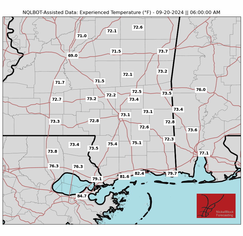
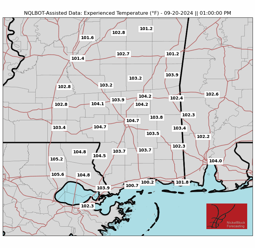
The “Experienced Temperature” may be as high as 105F in some spots. Recall the “Experienced Temperature” is when we factor in things like Sun intensity, wind speed, and humidity. It is truly an attempt to figure out what it would feel like if you were standing outside in your yard.
Pretty hot tomorrow.
The actual air temperatures will top out around 90F.

As we start the workweek, a ridge of high pressure controlling the weather will weaken, allowing a trough to move through the Rockies and into the Mississippi River Valley. This change will bring a gradual increase in moisture due to a shift in winds from the south and southeast. A weak front may approach from the north, but I don’t think it will make a move through the entire area. So no cool down. But, we may see a bump in the shot for rain – around 20-30%, from Tuesday through Thursday.
By the time we start moving through next week, we will be watching for the potential for tropical development in the western Caribbean and southern Gulf of Mexico between Wednesday and Saturday. Most global models and their ensembles show signs of development, but there’s uncertainty regarding the timing and location.
In short “something” will happen. But we can’t know what yet.


A central U.S. trough could steer any system toward the eastern Gulf, while another scenario points to ridging over the central U.S., which could favor a track toward the southwestern or western Gulf. And a third option is somewhere in the middle, where it would shove the system west and the it would U-turn and fly back to the northeast.
As you can tell from the circular spaghetti model above, there isn’t any kind of consensus or “lean” in the model guidance that would indicate where the “Something” may go.
As always, we’ll monitor trends and provide updates as the situation becomes clearer.
REGIONAL DAY TO DAY FORECAST
Tonight: Mostly clear. Lows in the upper 60s. Northwest winds around 5 mph in the evening, becoming light and variable.
Friday: Sunny. Highs in the lower 90s. Northeast winds around 5 mph.
Friday Night: Mostly clear. Lows in the upper 60s. East winds around 5 mph in the evening, becoming light and variable.
Saturday: Sunny. Highs in the lower 90s. East winds around 5 mph.
Saturday Night: Mostly clear. Lows in the upper 60s.
Sunday: Sunny. Highs in the lower 90s.
Sunday Night: Mostly clear. Lows in the upper 60s.
Monday: Sunny. Highs in the lower 90s.
Monday Night: Mostly clear. Lows in the upper 60s.
Tuesday: Mostly sunny. A slight chance of showers and thunderstorms in the afternoon. Highs around 90. Chance of rain 20 percent.
Tuesday Night: Partly cloudy. Lows in the lower 70s.
Wednesday: Partly sunny. A chance of showers and thunderstorms in the afternoon. Highs in the mid 80s. Chance of rain 30 percent.


