I’m not ready to guarantee that Tropical Storm Helene misses our area. But now that it has formed, the models have a good handle on the system, and the forecast is mostly unchanged, I feel pretty confident saying the risk to our area is pretty small.
Instead, light rain showers will dominate Wednesday, though intensity will be lower than today. Rainfall rates will be minimal for most areas, Then a sort-of-unusual weather pattern will develop as a tropical system approaches the Florida panhandle, interacting with the stalled frontal boundary and cutoff low.
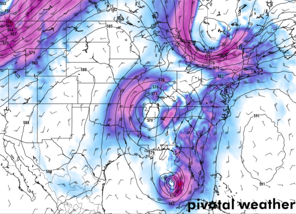
So far, it looks like any rainfall from this setup would be pretty minimal. Instead, it looks like Helene will curly-cue northward and around the area of low pressure, giving our area a bit of a miss. No complaints here. While we could use some rain, we don’t want to earn it with a Major Hurricane.

Yes, Helene is forecast to be a Major Hurricane at landfall, and, frankly, I don’t wish that mess on anyone. Here is the latest from the NHC on Helene. Currently forecast to be a Major Hurricane by Thursday afternoon. Then make landfall sometime Thursday night.
Back here, though, the weather should be reasonably calm on the west side of the storm. And that clam weather should last through most of the week and into the weekend.
REGIONAL DAY TO DAY FORECAST
Tonight: Mostly clear in the evening, then becoming partly cloudy. Lows around 70. South winds around 5 mph in the evening, becoming light and variable.
Wednesday: Partly sunny. A slight chance of showers and thunderstorms in the morning, then showers likely with a chance of thunderstorms in the afternoon. Highs in the upper 80s. Northeast winds around 5 mph. Chance of rain 60 percent.
Wednesday Night: Mostly cloudy with a chance of thunderstorms. Showers likely, mainly in the evening. Lows in the upper 60s. Northeast winds 5 to 10 mph. Gusts up to 20 mph after midnight. Chance of rain 60 percent.
Thursday: Mostly cloudy in the morning, then becoming partly sunny. A chance of showers with a slight chance of thunderstorms. Highs in the lower 80s. North winds 10 to 15 mph with gusts up to 25 mph. Chance of rain 50 percent.
Thursday Night: Partly cloudy in the evening, then clearing. Lows in the lower 60s.
Friday: Sunny. Highs in the mid 80s.
Friday Night: Mostly clear. Lows in the mid 60s.
Saturday: Sunny. Highs in the upper 80s.
Saturday Night: Mostly clear. Lows in the upper 60s.
Sunday: Mostly sunny. Highs in the upper 80s.
Sunday Night: Partly cloudy in the evening, then becoming mostly clear. Lows in the upper 60s.
Monday: Mostly sunny. Highs in the upper 80s.


