The last few days of summer-like weather are hopefully upon us with the tropical wave I mentioned last week moving around in the Gulf contributing to the humid conditions across much of the coastal South. This weekend will be quite warm and humid with temperatures topping out in the upper 80s during the day and the mid to upper 60s overnight. The good news is, it’s almost out of here!
Some bad news is that we won’t get much rain for a while. October is our driest month, and, well, it’s living up to its name. Even tomorrow is a slim chance with a rogue thin line of rain in the afternoon. For today, we’ll see some mid and upper level clouds from the tropical system moving across the skies which will impede much of the sunshine. That won’t really affect the temperatures as it’ll reach the upper 80s during the day. Since the clouds will hang around, it’ll hold some of that heat and keep the low temperature a bit to the upper 60s and even to around 70 closer to the coast.
By Sunday, the humidity will stay around, but the clouds will move out as we get a little more influence from the northeast during the day. Temperatures will hover around the upper 80s and the dewpoint will begin to fall towards the lower 60s which will make it a little more bearable during the day. The winds will also begin to pick up from the incoming cold front with wind gusts up to 20mph possible especially towards the evening. Overnight, the temperature will reach the mid 60s.
Monday will be fairly warm as we go into the afternoon, but the cold front will drop the dew point into the upper 50s by the end of the day making it a much more pleasant evening, if not pretty windy. The winds will gust a bit into the upper teens and low 20s by the end of the day. This cold front is a good indicator that we’re about to exit summer. While we’ll still get some warm days ahead, it’ll be a lot nicer overall.
The Tropics
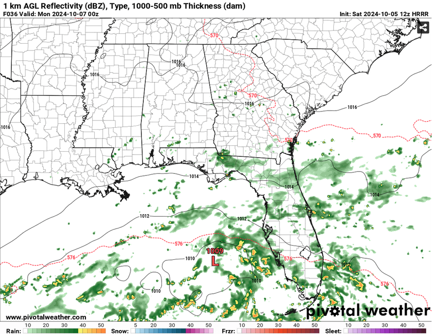
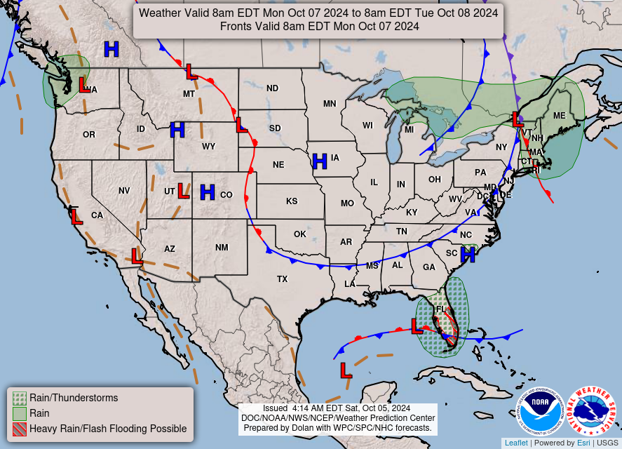
Oh yeah, I’m talking the tropics because it still isn’t over! But the good news is, it’s gonna be a little harder for us to be on the receiving end of a storm. Unfortunately, that might not be the same for Florida. The Euro and GFS models both show Invest 92L moving from the northern Yucatan to the middle of the Gulf and eventually towards Florida before moving east into the Atlantic. The cold front I mentioned will have an impact in where this thing is headed, however there is a significant section of warm water in the east-central part of the Gulf (likely from a stream of Caribbean influence moving north) that will help this thing develop. The GFS and Euro differ on how strong this thing will be, but it does start to tighten and strengthen over time in the Gulf. I’ll provide an update tomorrow if there’s anything new.
Select Data Set:

Regional Day-to-Day Forecast
Today – Mostly cloudy, with a high in the mid to upper 80s. East northeast wind around 10 mph.
Tonight – Mostly cloudy, with a low in the upper 60s. East wind around 5 mph becoming calm.
Sunday – Sunny, with a high in the upper 80s. Northeast wind 5 to 10 mph, with gusts as high as 20 mph.
Sunday Night – Mostly clear, with a low in the mid 60s. Northeast wind around 5 mph becoming calm in the evening.
Monday – Sunny, with a high in the upper 80s. North northeast wind 5 to 10 mph, with gusts as high as 20 mph.
Monday Night – Clear, with a low in the upper 50s. North wind around 5 mph.
Tuesday – Sunny, with a high in the low 80s. North wind 5 to 10 mph, with gusts as high as 20 mph.
Tuesday Night – Clear, with a low in the upper 50s. North wind around 5 mph.
Wednesday – Sunny, with a high in the low to mid 80s. North northeast wind 5 to 10 mph, with gusts as high as 20 mph.
Wednesday Night – Clear, with a low in the mid to upper 50s.
Thursday – Sunny, with a high in the low 80s.
Thursday Night – Clear, with a low in the mid 50s.
Friday – Sunny, with a high near 82.


