If you haven’t noticed by now, we’re officially in the season of autumn with some crisp mornings and warm afternoons. The past few days have been fairly windy with the cold front moving through and temperatures dropping into the low 40s in the mornings and 70s during the afternoon. This weekend will warm up slightly with few clouds in the sky and winds calming down by late Monday. If you ever wanted a weekend to enjoy yourself outside and do your favorite thing, this is the one! If you’re out for the homecoming game tonight, bring a jacket, it’ll be cool tonight!

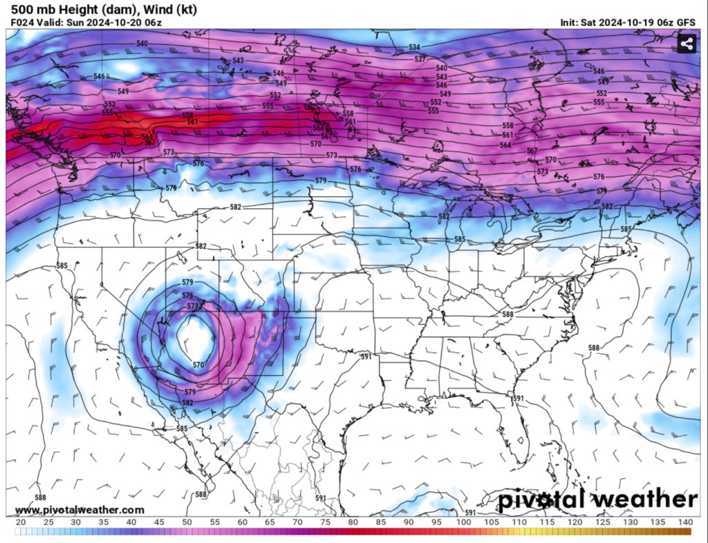
Looking at the upper atmosphere, the upper levels show a broad area of ridging over the eastern US with more linearity as you move up the Great Lakes. Over in the southwest, a large closed low pressure system resides over much of California to Colorado. This will get some traction as a Pacific trough moves it out towards the central Plains and eventually the Great Lakes. This won’t mean much for us severe weather-wise since we’re stuck under a ridge, however it will affect our temperatures later in the week.

For this weekend, however, it’ll be quite pleasant however we look at it. Temperatures will be in the upper 70s today with winds pulling from the east northeast. Overnight, we’ll climb up into the upper 40s around the Pinebelt with the low beginning to creep up each night.
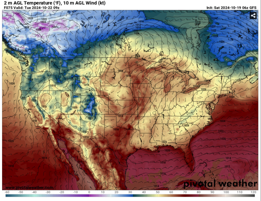
Sunday will be a similar story with the temperature reaching around 80 with only a few clouds in the sky and northeast winds around 5mph. Overnight, the temperature will be in the upper 40s to around 50 closer to the coast. As Monday comes around, we’ll reach the low 80s during the day with the winds pulling from the northeast one more time before they shift overnight. The winds will then shift towards the southeast as that trough I mentioned earlier moves towards the Plains and shifts the gradient towards the south.
Another thing to be concerned about is the fire hazard for the next several days. While the winds aren’t strong, we’re in our dry period which means there won’t be any rain for relief if a fire begins to spread. Please heed any burn bans that are put out and don’t burn anything on windy days.
Regional Day-to-Day Forecast
Today – Sunny, with a high in the upper 70s. East northeast wind around 5 mph.
Tonight – Clear, with a low in the mid to upper 40s. Northeast wind around 5 mph becoming calm in the evening.
Sunday – Sunny, with a high near 80. Northeast wind around 5 mph.
Sunday Night – Clear, with a low in the upper 40s. North northeast wind around 5 mph becoming calm in the evening.
Monday – Sunny, with a high in the low 80s. Calm wind becoming east northeast around 5 mph in the morning.
Monday Night – Clear, with a low around 50. Northeast wind around 5 mph becoming calm.
Tuesday – Sunny, with a high in the low to mid 80s. Calm wind.
Tuesday Night – Clear, with a low in the mid 50s. Calm wind.
Wednesday – Sunny, with a high in the mid 80s. Calm wind becoming west southwest around 5 mph.
Wednesday Night – Mostly clear, with a low in the upper 50s.
Thursday – Sunny, with a high in the low to mid 80s.
Thursday Night – Mostly clear, with a low in the upper 50s.
Friday – Sunny, with a high in the mid 80s.

