I spent the last week and change on the road traveling to see some family and friends as well as take in a Packers game up in Green Bay. For any football fans out there, I would highly recommend it. Im biased, as a Packers fan, but I will say that everyone I talk to says visiting Lambeau is a Top 10 experience.
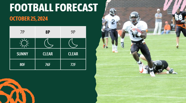
Speaking of football… If you’re headed to a game tonight, enjoy the weather!

All that said, I made it back just in time. The weather is about to get interesting.
n upper-level trough approaching the U.S. West Coast will set up a building ridge over the Rockies and central U.S. Meanwhile, a wave moving across the northern states will push a weak cold front into our area tonight into tomorrow. However, the front is expected to lose steam quickly so we aren’t anticipating much from this first front locally.


The biggest change with this first front will be the warm-up we get ahead of it. Ahead of the front, temperatures will remain around 5 to 8 degrees above normal for late October, but a brief cooldown is anticipated by Sunday, with highs only 3 to 5 degrees above average for most folks, with others closer to normal.
By midweek, a trough in the western U.S. and a ridge in the eastern U.S. will set up southwesterly flow over our area, bringing back warmer temperatures. Regional conditions will also become more humid ahead of a frontal zone to the northwest. The key question is whether the ridge shifts far enough east to allow the cold front to push through.
The latest models are split, with the ECMWF and CMC showing a stronger low-pressure system that could push the front eastward, bringing rain and perhaps some storms to the area. The GFS, however, keeps the front weaker and stalled well north. Regardless, the midweek period into Friday holds the best rain prospects we’ve seen in weeks – of course, just in time for Halloween.

I know a lot of you guys have outdoor plans during the evening (and the kids want to trick or treat) so please keep tabs on the forecast in the coming days.
Speaking of scary things, you’re likely going to see some pretty scary stuff floating around social media calling for another hurricane in the Gulf – for now, feel free to ignore it. We don’t have enough data to support a forecast calling for anything tropical in or near the Gulf. There is some background support for “Something” to happen out in the tropics, but where it goes and what it does is still TBD.
REGIONAL DAY TO DAY FORECAST
Tonight: Clear. Patchy fog after midnight. Lows in the upper 50s. Southwest winds around 5 mph in the evening, becoming light and variable.
Saturday: Patchy fog in the morning. Sunny. Highs in the upper 80s. North winds around 5 mph.
Saturday Night: Clear. Lows in the upper 50s. Southwest winds around 5 mph, becoming northwest around 5 mph after midnight.
Sunday: Sunny. Highs in the upper 80s. North winds around 5 mph.
Sunday Night: Mostly clear. Lows around 60.
Monday: Sunny. Highs in the mid 80s.
Monday Night: Mostly clear. Lows in the lower 60s.
Tuesday: Sunny. Highs in the mid 80s.
Tuesday Night: Mostly clear. Lows in the lower 60s.
Wednesday: Mostly sunny. Highs in the lower 80s.
Wednesday Night: Mostly clear. Lows in the mid 60s.
Thursday: Mostly sunny. Highs in the lower 80s.
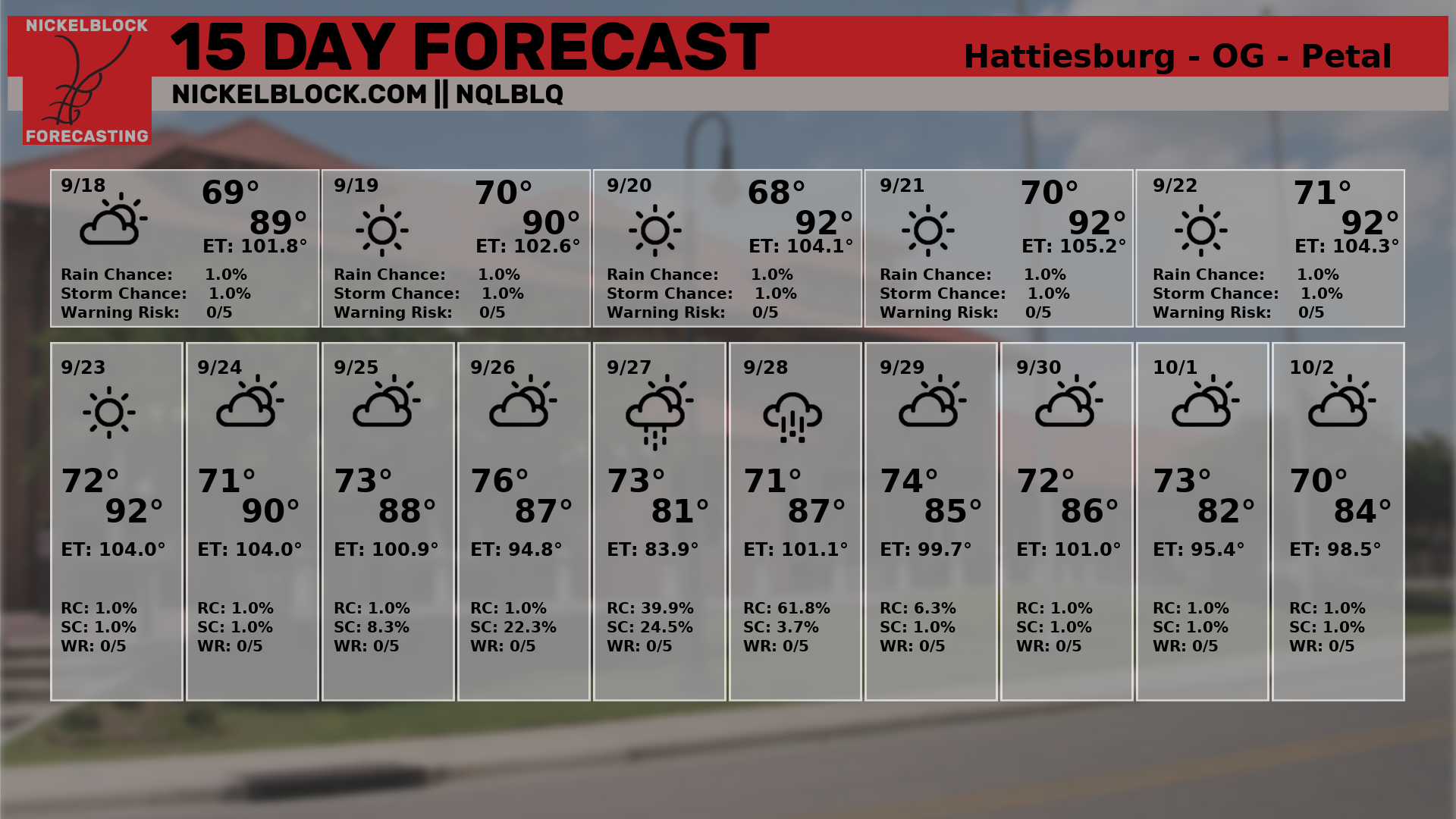
15-DAY FORECAST


