UPDATE: The SPC has increased parts of the area to a SLIGHT RISK as of the 1030am update
ORIGINAL: Hey guys, just a brief update on the forecast for this afternoon and evening. I don’t think things will get too wild weather-wise, but I still think we will have a handful of showers and storms across the area with some folks picking up about an inch of rain.
But the data this morning is showing a brief window of opportunity between about 3p and 7p for a few storms to get rooted and provide an opportunity for a few tornadoes.
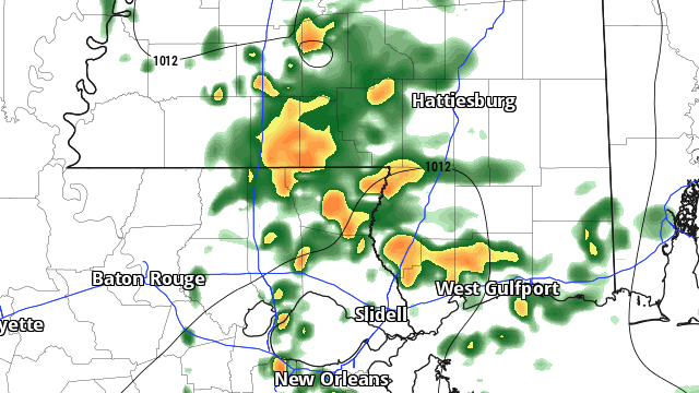
The latest from the HRRR model shows a cluster of storms lifting NE from southern Louisiana through Mississippi and off toward Alabama.

On the southern flank of this cluster I think we may have enough low-level moisture and instability to drive the development of some rotating storms and the development of a tornado or two. Maybe more if one decides to hop-scotch around.
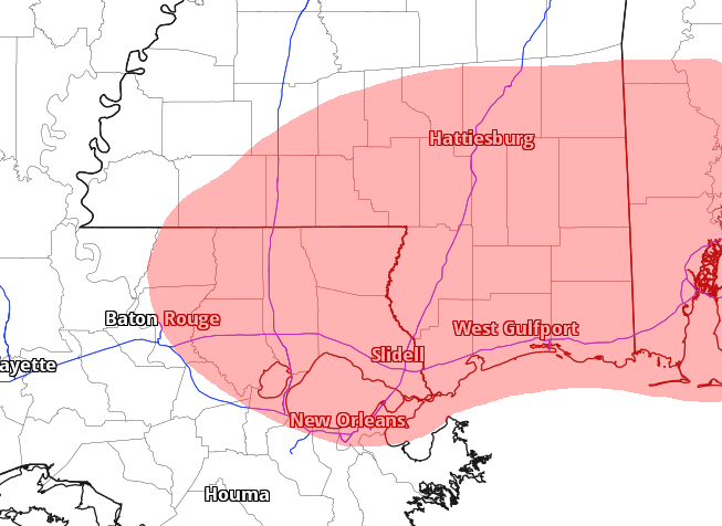
The main area of increased concern is highlighted in red here:

And honestly, that highlighted area probably goes a bit too far north, but I don’t want to undercut the threat too much.
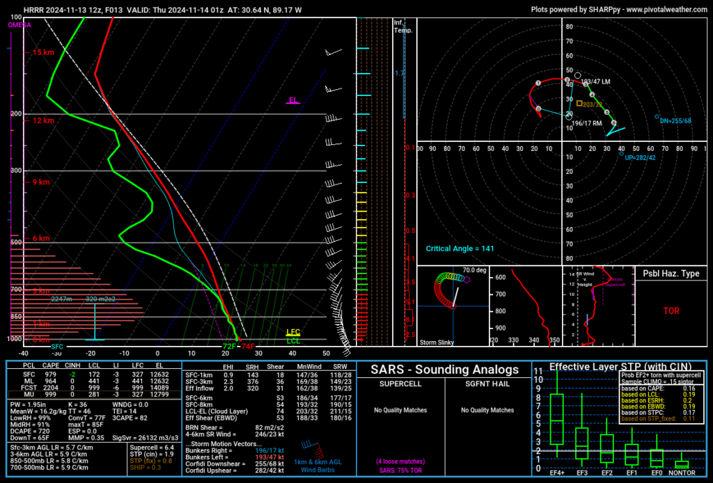
The good news is there isn’t enough ‘umph’ in the atmosphere this afternoon adn evening for a powerfully destructive long-track tornado. But, looking at the Skew-T data, there is enough of the typcial ingredients to lead to a low-end risk for a few tornadoes.

The Storm Prediction Center has the area under a Marginal Risk this morning, but I wouldn’t be surprised if they increased us to a small area of a Slight Risk by late morning or midday.
Does this mean anyone needs to be “concerned” about significant severe weather? No. Probably not.
Instead, it means that you need to simply pay more attention to the weather today, have a radar app handy (like the NickelBlock Forecasting app!), and make certain you can get the alerts from the NWS (hey, the NickelBlock Forecasting app does that, too!)

