I know every attention-seeking social media person covered this about two weeks ago, but I think I’ll take a stab at it this time around since it’s about six days out. Is it going to be cold? Absolutely. Is it going to snow? I’m putting my bets on no, but depending on the placement of the low pressure in the next few days, that could change, but it’s not very likely. Let’s take a look.
Severe Weather Tomorrow
I think the first thing we need to address is another low pressure system heading our way now. A decent looking area of low pressure will move from the southern Rockies in New Mexico east northeast to Oklahoma bringing with it a chance for severe weather across parts of east Texas, west and central Louisiana, Arkansas, and central Mississippi. The upper levels are negatively tilted which means that this thing will be fairly well-formed by the time it reaches east Texas.
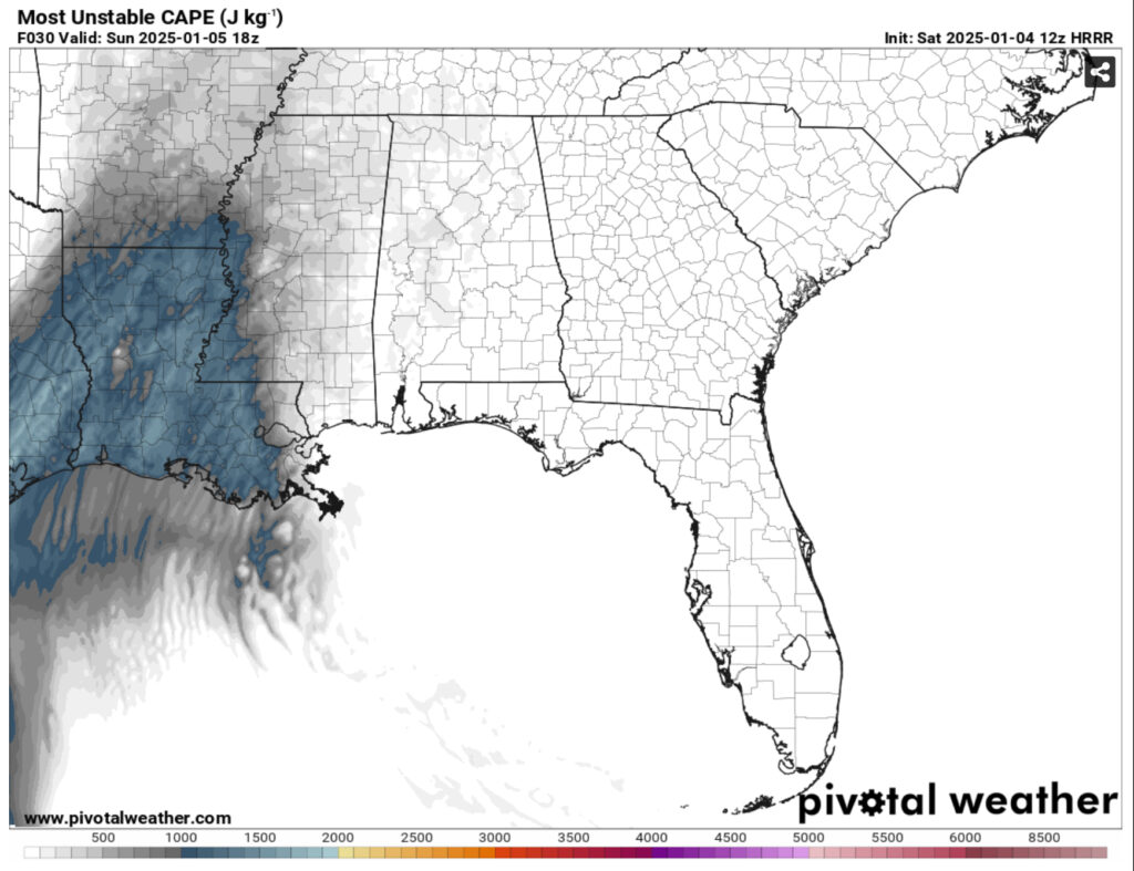
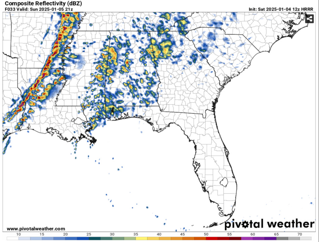
Looking above, you can see that the most unstable CAPE is centered around east Texas and most of Louisiana. On the right is the reflectivity model showing the possible line of storms moving across Arkansas and Louisiana. The main concern for tomorrow is straight line winds, and looking at the wind gusts, they could reach over 60mph in some areas. If any discrete cells form ahead of the main line, tornadoes will be possible if they get enough rotation going, and it’s possible. Central Louisiana and areas of the Delta and west central Mississippi should be aware of the possible severe weather tomorrow.
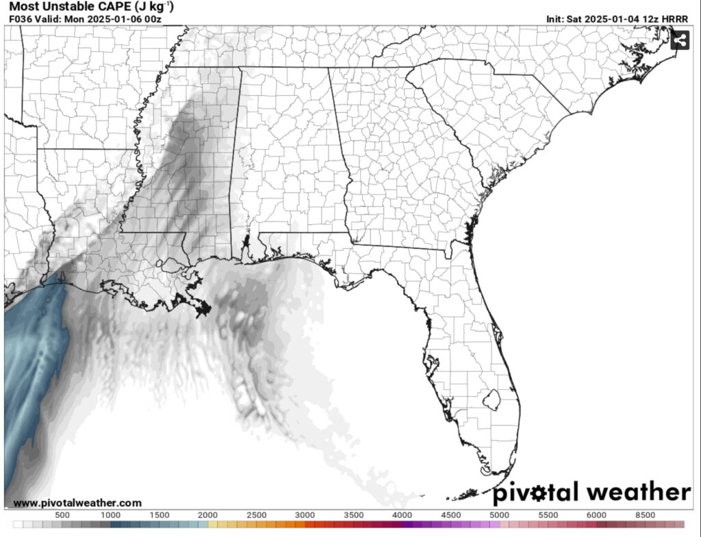
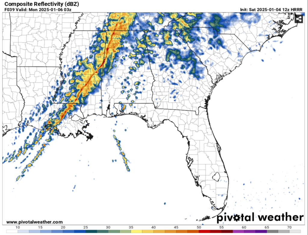
As the evening progresses, that potential energy wanes and the probability for severe weather reduces as the storms move east. I think the main reason for that would be the “blob” aka the moisture inflow that the warm front pulls in and also the warm front’s orientation. There’s more of a tight gradient towards the middle of the low and a bit of a wonkier orientation of the warm front towards our neck of the woods. That doesn’t mean that we’re out of the woods, however. We’ll also see some gusty winds and heavy rain with a possible tornado by the time the main front reaches us.
The Cold and Chance for Snow
After the cold front passes Sunday night, be prepared for a very cold and blustery Monday. Winds from the northwest will move in behind the front gusting up to 25mph. Temperatures will barely make it out of the 40s making for quite a chilly day. Overnight, the temperature will fall well below the freezing mark into the mid to upper 20s across the area. If you have any plants or pets outside, cover them up, bring them in, and keep them warm.
This trend will continue for much of the week as the winds shift towards the north. Highs will remain in the low to mid 40s and lows will fall into the low to mid 20s until Friday.
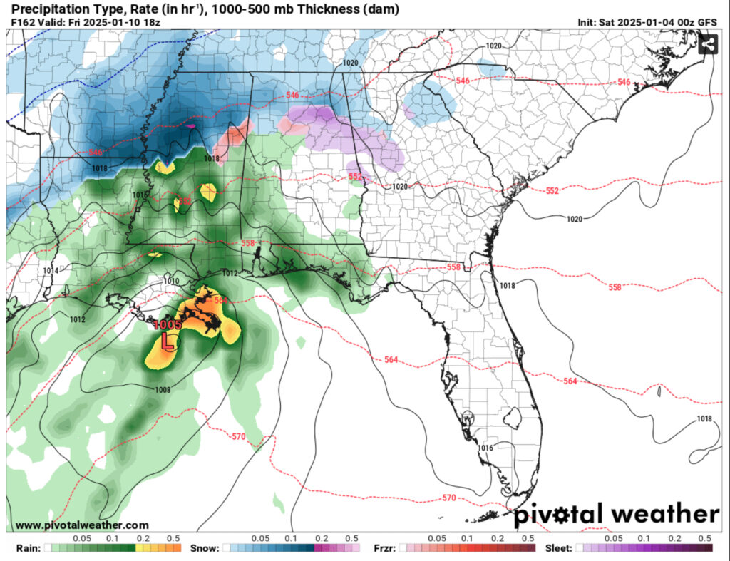
Both the GFS and the Euro models are in more agreement of what the low pressure system is going to do on Friday. The GFS shows the low bringing more winter weather further south towards the ArkLaMiss Delta and towards Memphis and north Alabama while the Euro model keeps most of it towards the Tennessee border.
Part of the reason we likely won’t see any winter weather is because of the ground temperatures and the mid-level atmosphere temperatures. There is a blatant melting point at the mid-levels and while sometimes this will reform the precip into sleet or sometimes freezing rain, the ground temperatures are also well above freezing for this to happen. Part of this is because of the influx of south winds from the low and nothing on the back side of it to warrant any winter weather. While I don’t think that we will get much in terms of winter weather, it doesn’t mean that some areas of central Mississippi wouldn’t get some possible sleet or a wintry mix. We’ll have to wait a little longer for the models to come into full agreement.
After the low leaves, we’ll have another cold couple of days on the weekend with temperatures in the 40s on Saturday and up to 50 on Sunday. Afterwards, we’ll go into our more average winter temperatures to start off the week which will be a nice change compared to this coming week.
Regional Day-to-Day Forecast
Today – Increasing clouds, with a high in the mid 50s. Calm wind becoming east southeast around 5 mph in the morning.
Tonight – A 30 percent chance of showers, mainly before sunrise. Cloudy, with a low in the upper 40s. East southeast wind around 5 mph.
Sunday – Showers likely. Cloudy, with a high in the low 70s. South wind 10 to 15 mph, with gusts as high as 30 mph. Chance of precipitation is 60%. New precipitation amounts between a quarter and half of an inch possible.
Sunday Night – Showers, mainly before midnight. Low in the low 30s. South wind around 15 mph becoming west northwest after midnight. Winds could gust as high as 30 mph. Chance of precipitation is 100%. New precipitation amounts between a half and three quarters of an inch possible.
Monday – Mostly sunny, with a high in the low 40s. Northwest wind 10 to 15 mph, with gusts as high as 25 mph.
Monday Night – Partly cloudy, with a low in the mid 20s. North northwest wind 5 to 10 mph, with gusts as high as 20 mph.
Tuesday – Sunny, with a high in the low to mid 40s. North wind 5 to 10 mph.
Tuesday Night – Mostly clear, with a low in the low 20s. North northwest wind around 5 mph.
Wednesday – Sunny, with a high in the mid 40s. North northwest wind 5 to 10 mph.
Wednesday Night – Partly cloudy, with a low in the low to mid 20s.
Thursday – Mostly sunny, with a high in the mid 40s.
Thursday Night – Partly cloudy, with a low in the mid to upper 20s.
Friday – A 30 percent chance of showers. Partly sunny, with a high in the low to mid 40s.

