Link to Nick’s breakdown here.


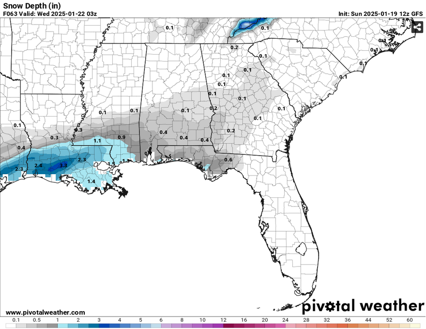
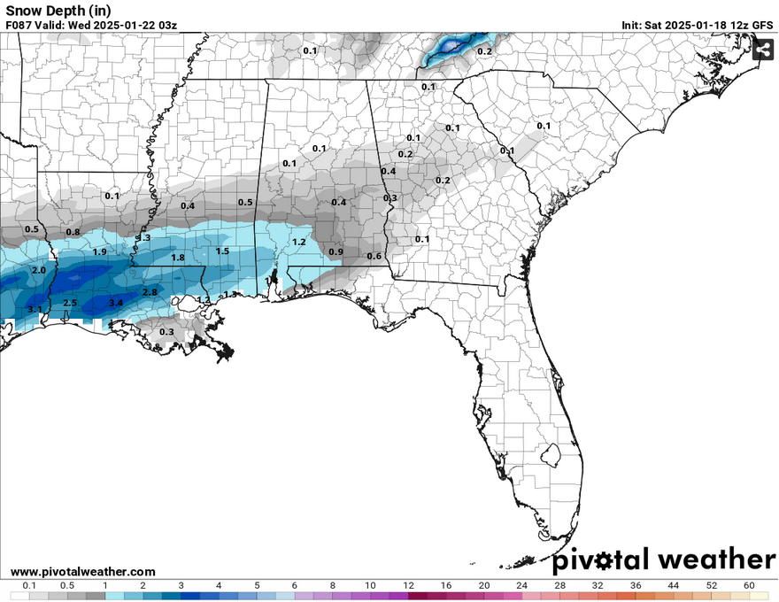
So far, there has been a slight shift in the forecast, but it doesn’t mean that it will lessen the effects. The models have shifted the surface low’s position a bit further south in the Gulf of Mexico which could mean a change in impact for much of us in coastal Mississippi and in the Pinebelt.
This is still subject to change as medium range models can adjust every 6 hours. What this does mean is that it could shift the heavier snowfall further south into much of southeastern Louisiana (like Nick said, this is a moving target). The conservative amount we’re getting is still around 2 inches of snow for much of us in the Pinebelt.

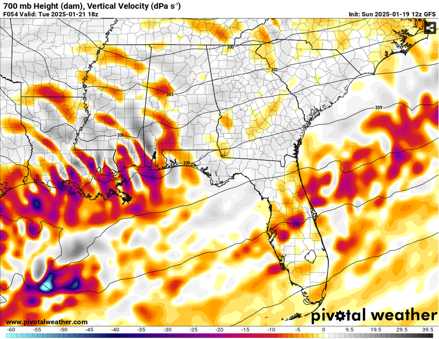
Part of the reason may be the lack of omega forcing in the mid-levels according to the latest model output. However, the vertical velocity model still holds strong for areas that will see snow, so this may be an outlier in the next model output.
Either way, I think the fact remains that we will still get snow, we’re now just waiting on the confirmation of how much we’re really going to get.
The other concern for the winter weather is when. So far, it looks like the cloud cover will move in before midnight and we may see a few flakes and flurries into the early morning hours. When we get the real snow cover is going to be around 5-6am and it will keep going for a while.
Louisiana will see its fair share of snow and sleet by the early morning into the mid-morning and we’ll get the main part of it from 9am until 6pm. The other main deal is that we may have a slight warm-up during the day, just barely above freezing, so there may be a mix of rain and snow for a few hours in the afternoon. Afterwards, we’ll be clearing out just in time for temperatures to drop significantly.
Over the next couple of days it’s going to be bitterly cold. Overnight into Wednesday, the temperature will drop into the mid teens which means that the wind chill is only going to make it worse. Wind chills as low as 5 degrees Fahrenheit are possible. I said this before, and I will say it again, wrap your pipes, take your pets inside, and cover your plants. Check on your neighbors and if they need heat or warm food, bring it to them.
The roads will also be icy, not only because of the freezing temperatures on Wednesday, but because of the melting later on in the day. Afterwards, parts of the road will freeze over again with temperatures reaching the mid to upper teens again. I don’t know what MDOT has planned for the highways and bridges, but I won’t be surprised if bridges and underpasses have frozen sections.
Other roads that aren’t main roads will likely be frozen as well, so those outside the city may be stuck inside until Thursday, so please be prepared and careful.
Select Data Set:

Regional Day-to-Day Forecast
This Afternoon – Sunny, with a high in the mid 40s. North northwest wind 10 to 15 mph, with gusts as high as 25 mph.
Tonight – Clear, with a low in the low 20s. North northwest wind 5 to 10 mph, with gusts as high as 20 mph.
M.L.King Day – Sunny, with a high near 40. North northeast wind 5 to 10 mph.
Monday Night – Increasing clouds, with a low in the low 20s. Northeast wind 5 to 10 mph, with gusts as high as 20 mph.
Tuesday – Snow showers, mainly after noon. High in the low 30s. North northeast wind around 10 mph, with gusts as high as 20 mph. Chance of precipitation is 80%.
Tuesday Night – A 20 percent chance of snow showers before midnight. Partly cloudy, with a low in the mid teens. North wind 5 to 10 mph, with gusts as high as 20 mph.
Wednesday – Sunny, with a high in the upper 30s. Northeast wind around 5 mph becoming calm in the afternoon.
Wednesday Night – Mostly cloudy, with a low in the mid to upper teens. Calm wind.
Thursday – Partly sunny, with a high in the low 40s. Calm wind becoming northwest around 5 mph.
Thursday Night – Partly cloudy, with a low in the low 20s.
Friday – Sunny, with a high in the mid to upper 40s.
Friday Night – Mostly clear, with a low in the low 20s.
Saturday – Sunny, with a high in the mid 50s.


Just cut to the chase and show all the snowfall just along the coast. Shouldn’t show the chance of snow at all until you’re SURE of where it will be and how much.
Is this your first time reading a weather forecast?