Link to Nick’s county-by-county breakdown here.
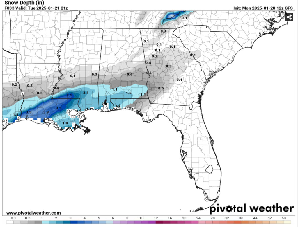
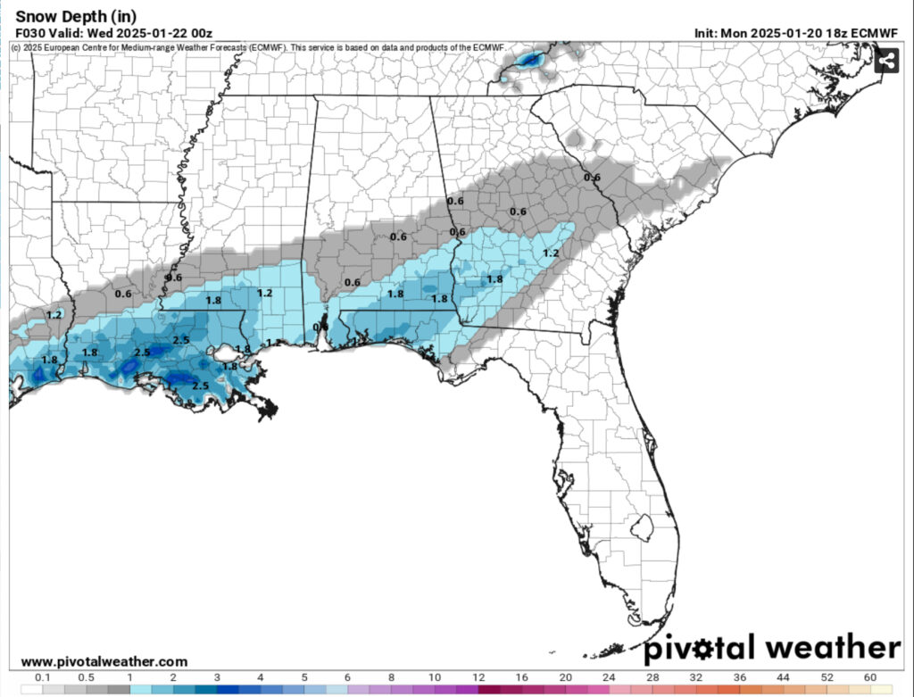
I’ve decided to provide one last update before the winter weather arrives tonight just to give a visual representation of what we’ve been seeing in the past several hours. The snow is still coming and we’ll likely see a decent amount of accumulation especially from the Highway 84 corridor southward to the coast.


So far, the snow depth maps on the Euro model have reduced a bit to around 1.3 inches compared to 1.8 this same run yesterday. The reason for this being that the low-level atmospheric humidity has reduced as the front moves in later in the day. This won’t only affect the amount of snowfall but the duration as well. It may well be that the snow moves out around sunset and we just see some flurries the storm leaves. So overall, a slight reduction in totals, but accumulation is still there.

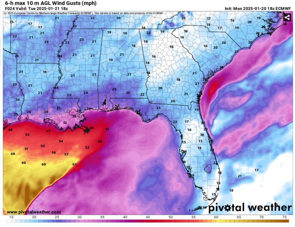
The other big concern for tomorrow is the wind and wind gusts. While these aren’t blizzard conditions, they aren’t conditions we’re used to and 24mph wind gusts and snow are a big hazard. Traveling will be hard to do in blowing snow and power outages are likely with limbs falling on power lines especially with wet snow. Below freezing temperatures are likely all day so expect some icy roads and even roads that are covered in snow.
Overall, a slight reduction in snowfall totals but the location for the snow still looks about the same. We can still expect impacts to much of the Pinebelt and the coast and much of Louisiana. Expect roads to ice overnight and into Wednesday and Thursday, so keep that in mind if you have to commute or travel anywhere.


Noah so proud of you, I knew that weather was one of your main focuses.
Great job!