This is a pretty warm start to February, I tell you what! Not only that, we’re going to be foggy for another night or so since the conditions are very calm in the lower atmosphere. Temperatures will remain in the low 80s for the next several days and only fall into the 60s. This will be a decent setup for some thunderstorms as we approach next Tuesday.
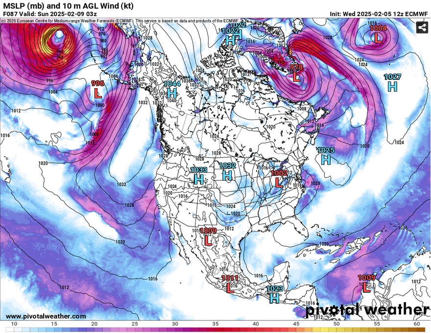
Looking above at the MSLP, there’s a massive high pressure system in the Atlantic that spans all the way from the North Atlantic to the Gulf of Mexico. This is pretty significant since it will help dictate the next few low pressure systems’ direction for the next several days. As we approach the weekend, a small low pressure system will eject out of the plains towards Tennessee. While north Mississippi may see some of the rain, it’s quite doubtful since it’s stuck between a rock and a hard place. By Saturday, another system will eject out of the Rockies, this time a little more impressive. Areas of the Midwest may see some wintry precipitation and parts of Tennessee will see rain. By the time it reaches Mississippi, we’ll get a thin line of rain and thunderstorms that will weaken as it reaches our neck of the woods.
Since this Atlantic high will hang around for the next week or so, we’ll be much warmer and more humid than normal. Southerly winds from the surface and the upper levels will provide plenty of moisture from the Gulf keeping it much warmer overall. While these low pressure systems squeeze through between the high in the Atlantic and the northern Plains, it won’t make a huge effect until a stronger system moves in on Tuesday.
With the temperatures staying steadily in the low 80s, we’re due in for some storms to, well, not actually cool us off much. The dynamics of this system on Tuesday is a little off. The upper atmosphere does have some decent shear to it, however there is little rotation to accompany it. The MCS itself looks pretty decent especially as it moves in from East Texas. It’s a little too early to call, but it does have some cells ahead of it which could be conducive to some supercell development. The two main risks I see with this system would be heavy rain and straightline wind damage, maybe even some hail.
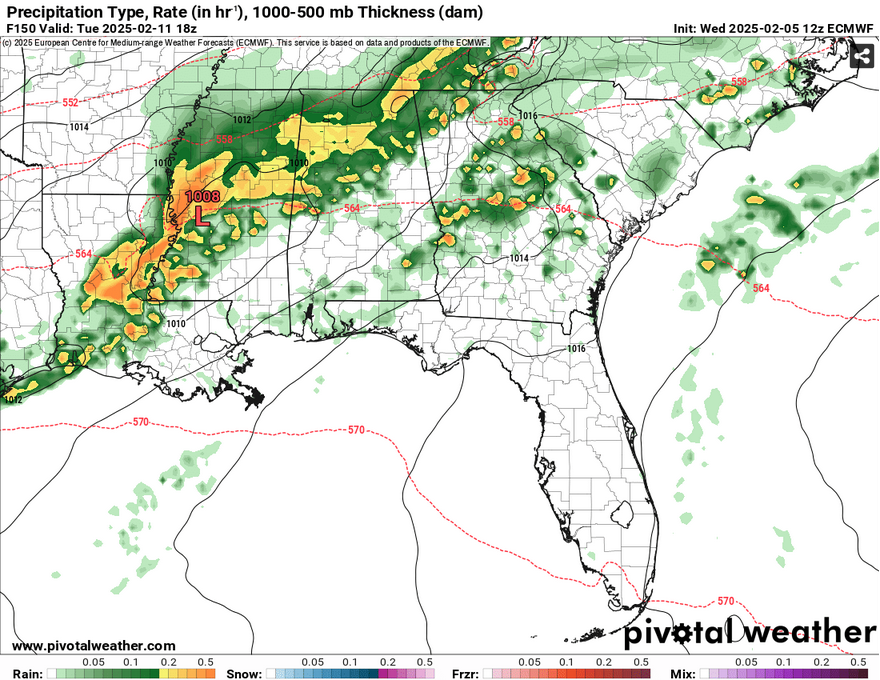
With this system moving out, there is another front that will squeeze out another round of showers and thunderstorms on Wednesday. This looks like a linear MCS that will hug the coast as it moves out. The numbers so far look to be around 1-1.5″ as it moves in. The combination of the Atlantic high along with the Canadian high will move it slowly out, but not before some stray showers for the next few days afterwards.
To summarize: We’ll have warm temperatures and partly cloudy skies for the rest of the week and the weekend with temperatures reaching the upper 70s and low 80s across the Deep South. The overnight temperatures won’t fluctuate much and only reach the upper 50s to low 60s. As we approach Tuesday, rain and thunderstorms will be on the horizon. Wednesday will be a similar story and stray showers for the rest of the week.
I’ll keep you updated on my page and on the blog as I get more model data in on Tuesday’s storms. Have a good rest of the week!
Select Data Set:

Regional Day-to-Day Forecast
This Afternoon – Mostly cloudy, with a high in the low 80s. South southeast wind around 5 mph.
Tonight – Widespread dense fog, mainly between 11pm and 4am. Otherwise, mostly cloudy, with a low around 60. South wind around 5 mph.
Thursday – Patchy dense fog before 10am. Otherwise, cloudy, then gradually becoming mostly sunny, with a high in the upper 70s. Southwest wind 5 to 10 mph.
Thursday Night – Partly cloudy, with a low in the low 60s. South southwest wind around 5 mph becoming calm in the evening.
Friday – Mostly sunny, with a high in the low 80s. Calm wind becoming south southwest around 5 mph in the morning.
Friday Night – Partly cloudy, with a low in the low 60s. South wind around 5 mph.
Saturday – Mostly sunny, with a high in the low 80s. South southwest wind 5 to 10 mph, with gusts as high as 20 mph.
Saturday Night – Partly cloudy, with a low in the low 60s. South wind around 5 mph becoming calm after midnight.
Sunday – Mostly sunny, with a high in the low 80s. Calm wind becoming southwest around 5 mph.
Sunday Night – Partly cloudy, with a low in the upper 50s.
Monday – A 30 percent chance of showers. Partly sunny, with a high in the upper 70s.
Monday Night – A 30 percent chance of showers. Mostly cloudy, with a low around 60.
Tuesday – Showers and thunderstorms likely. Mostly cloudy, with a high in the mid 70s. Chance of precipitation is 60%.


