We’re hitting a pretty warm mid-Spring already with temperatures climbing into the 80s for the next few days. This’ll keep up after the rain is gone on Saturday with Sunday’s temperatures rising into the mid-80s. It sounds like we’re getting a hint of Summer, but we’re still a little ways away.
Tonight, we’ll fall into the mid-50s as the clouds move in from the west. As we go into Thursday, we’ll have another warm one with temperatures reaching the mid 80s during the day and some south winds. the clouds will finally take over during the nighttime and will hold some of the heat giving us a warmer night. We’ll bottom out around 60.
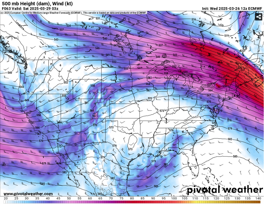
Friday will be a tad bit cooler with the clouds keeping some of the heat away, but not a lot. We’ll hit the low 80s during the day with the south winds ramping up and gusting up to 25mph. This is thanks to a surface high moving into the Atlantic creating a pressure gradient thus squeezing out some high winds along with it. As this is going on, an upper level low originating out of Texas will move towards our area. The surface low will move into the Gulf giving it some modest moisture flow. Some of that rain will reach the LA/MS area overnight while the rest will happen on Saturday.
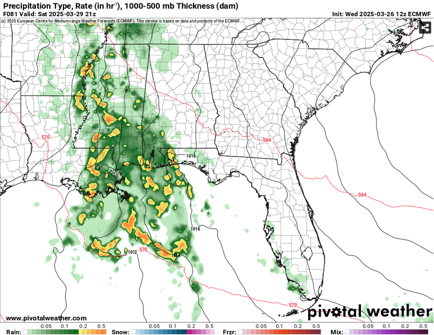
These storms are not expected to be severe on Saturday, however we’ll get a steady flow of rain and some possible thunderstorms. Most of the thunderstorms look to happen in the afternoon hours and persist until the early evening. Since we’ll have rain during the day, we’ll reach the mid 70s during the day and the low 60s at night.
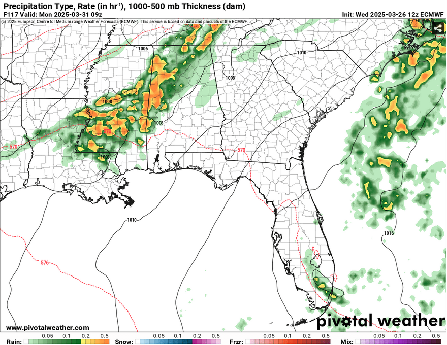
Sunday will be a very warm day with temperatures reaching the mid 80s during the day and south winds blowing in. This will be the setup for the possible severe weather going into early Monday morning, but there are a few shortcomings with this so far. Right now, the models are still out of agreement as to how strong these storms will be. The European model has the jet much further north of us while the GFS is showing a lack of a jet. This doesn’t mean we don’t have the probability for severe weather, but it’s looking to be a little further north to our neighbors around I-20 and northwards. We’ll likely see a few strong and severe thunderstorms. So far, the main threats look to be hail and heavy rain with a limited tornado threat.
Afterwards, we’ll have a small period of calm for Tuesday and Wednesday. We’ll climb from the low 80s on Tuesday and low 60s overnight to a high in the mid 80s again. While this is over a week away, I’ll keep an eye on another possible severe weather day on Wednesday night into Thursday as an organized system may just cut through the upper levels towards our area.
Select Data Set:

Regional Day-to-Day Forecast
Tonight – Mostly cloudy, with a low in the mid 50s. Calm wind.
Thursday – Partly sunny, with a high in the low to mid 80s. Light and variable wind becoming south 5 to 10 mph in the morning.
Thursday Night – Cloudy, with a low around 60. South wind around 5 mph becoming calm in the evening.
Friday– Mostly cloudy, with a high in the low 80s. South southeast wind 5 to 15 mph, with gusts as high as 25 mph.
Friday Night – A 30 percent chance of showers, mainly after 4am. Cloudy, with a low in the low 60s. South southeast wind 5 to 10 mph, with gusts as high as 20 mph.
Saturday – Showers and thunderstorms likely. High in the mid 70s. South wind 5 to 15 mph, with gusts as high as 25 mph. Chance of precipitation is 80%. New rainfall amounts between a half and three quarters of an inch possible.
Saturday Night – A 30 percent chance of showers and thunderstorms, mainly before 7pm. Mostly cloudy, with a low in the low to mid 60s. South southeast wind 5 to 10 mph, with gusts as high as 20 mph.
Sunday – Partly sunny, with a high in the mid 80s. South southwest wind 5 to 15 mph, with gusts as high as 20 mph.
Sunday Night – A 30 percent chance of showers and thunderstorms, mainly after 1am. Mostly cloudy, with a low in the mid 60s. South wind 5 to 10 mph, with gusts as high as 20 mph.
Monday – A 50 percent chance of showers and thunderstorms. Some of the storms could be severe. Partly sunny, with a high in the low 80s.
Monday Night – A 20 percent chance of showers and thunderstorms. Some of the storms could be severe. Partly cloudy, with a low in the mid 50s.
Tuesday – A 20 percent chance of showers. Mostly sunny, with a high in the low 80s.
Tuesday Night – Partly cloudy, with a low in the low 60s.
Wednesday – A 20 percent chance of showers and thunderstorms. Partly sunny, with a high in the mid 80s.


