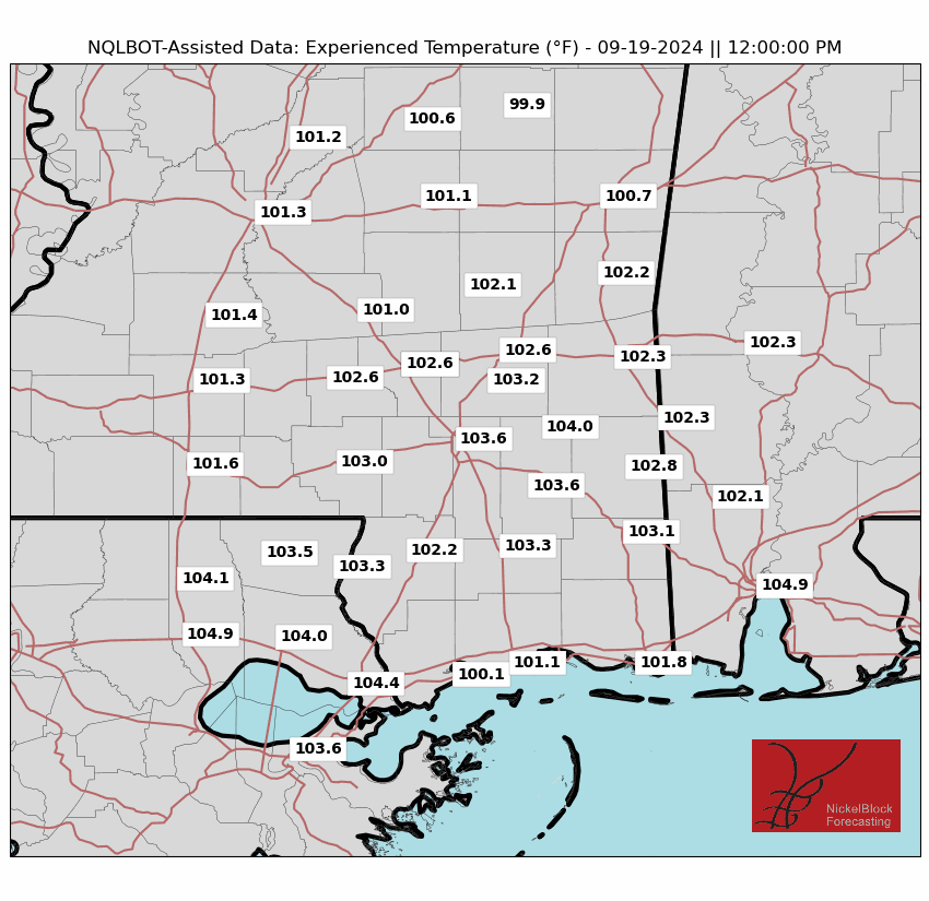
That weak front that has been helping to bring a lot of us some helpful rain, is going to be lifting back northward today. This will result in fewer storms for us than the last few days. And it will also allow some folks to warm up an extra few degrees today.
I also think that when storms do finally fire off, they’ll be a bit later int eh day – closer to 4p and 5p.
Our attention now turns to impacts from Beryl. Locally: Not many. By late Monday into Tuesday, the remnants of Beryl will be close enough to offer some increased low-level shear and a marginal risk of severe storms – but that would be mainly near I-20 and northward. As it makes landfall in Texas late tonight and into tomorrow morning, we will see our biggest push of tropical moisture locally.
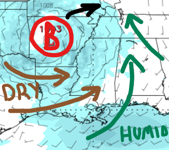
Due to drier air wrapping around the system, the forecast for rainfall has been reduced. As you can see from the illustration above, the dry air is likely to undercut a lot of the rich humid air as we move through Tuesday. I still think we see storms, but the total number of storms – and the amount of rain that will fall out of those storms – won’t be as robust.
Later in the week, an upper-level trough will center over the region, maintaining moist and unstable air for continued showers and storms. The heat is expected to intensify by the start of the next weekend.
REGIONAL DAY TO DAY FORECAST
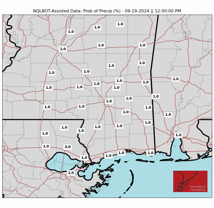
Today: Mostly sunny. A slight chance of showers and thunderstorms this morning, then a chance of showers and thunderstorms this afternoon. Highs in the mid 90s. South winds around 5 mph. Chance of rain 40 percent. Heat index values up to 108.
Tonight: Partly cloudy. A slight chance of showers and thunderstorms in the evening. Humid with lows in the mid 70s. South winds around 5 mph in the evening, becoming light and variable. Chance of rain 20 percent.
Monday: Mostly sunny. Showers likely with a chance of thunderstorms in the afternoon. Humid with highs in the mid 90s. Southeast winds 5 to 10 mph. Chance of rain 30 percent.
Monday Night: Partly cloudy with a slight chance of showers and thunderstorms. Humid with lows in the mid 70s. Southeast winds 5 to 10 mph. Chance of rain 20 percent.
Tuesday: Showers likely with a chance of thunderstorms in the morning, then showers and thunderstorms in the afternoon. Humid with highs in the lower 90s. South winds 5 to 10 mph. Chance of rain 30 percent. Heat index values up to 110.
Tuesday Night: Mostly cloudy. A chance of showers and thunderstorms, mainly in the evening. Lows in the mid 70s. Chance of rain 30 percent.
Wednesday: Partly sunny with a chance of showers and thunderstorms. Highs in the lower 90s. Chance of rain 40 percent. Heat index values up to 105.
Wednesday Night: Partly cloudy with a slight chance of showers and thunderstorms. Lows in the mid 70s. Chance of rain 20 percent.
Thursday: Mostly sunny. A slight chance of showers and thunderstorms in the morning, then a chance of showers and thunderstorms in the afternoon. Highs in the lower 90s. Chance of rain 40 percent.
Thursday Night: Partly cloudy. Lows in the mid 70s.
Friday: Mostly sunny. A slight chance of showers and thunderstorms in the morning, then a chance of showers and thunderstorms in the afternoon. Highs in the mid 90s. Chance of rain 40 percent. Heat index values up to 105.
Friday Night: Partly cloudy. Lows in the mid 70s.
Saturday: Mostly sunny. A slight chance of showers and thunderstorms in the morning, then a chance of showers and thunderstorms in the afternoon. Highs in the mid 90s. Chance of rain 40 percent. Heat index values up to 105.


Hope you are doing OK. I know your present place of work it there in Houston. I looked at a web cam located on a tower in Houston and it was rocking!