Behold! THE ELBOW!

The “Elbow” is the right-angle in the 500mb map over west Texas that often times produces a shot for wintry precip across the region. It is the setup we get down here once every few years that – recently – has been tied to more snow than ice events, but historically tends to produce more ice.
This time, though, it looks like if we get any precip (which is still not quite set in stone) it will likely fall as snow or sleet.
A cold front is set to swing through the area Saturday and into Sunday. There will be the risk for some rain and storms with the front but the main story is likely the colder air that will push in behind it. And it is something that showed up in my charts a few weeks ago. This one below is back on Jan 8th.

It was part of a post that I mentioned that after we got through Valentine’s, the model suggested tha Winter was over. And in fact, int he post I said, aside from the control run (the blue line) that the ensembles were pretty sure we would slowly climb out of the cold and wouldn’t see another week stretch of cold.
I think that forecast still holds. It’ll be cold behind this shot of air this weekend, but I don’t think it lasts all week. A good few days, sure. But I think by Thursday or Friday we will likely warm back up.
The cold air should press into the area on Sunday, leaving us pretty chilly by Monday morning. Here is a look at Sunday morning lows. Already with many spots – regionally – hanging in the 30s and 40s.

And once the cold settles in, the “Elbow” will allow the next low pressure system to swing through much farther south than the typical storm track. That means nearly the entire area will end up on the north side of the warm font and in an area where wintry precip is possible.
The next system arrives Monday night and through Tuesday.
And when you look at the forecast sounding for the atmosphere ahead of the next system, it shows plenty of cold air.

In fact, it shows cold air, a saturated Dendritic Growth Zone, and a below-freezing atmosphere all the way tot he surface. So, if we check the “What kind of precip am I getting” chart for the south….

…. If we follow the guide, we basically get to ride down the left side of the chart and end up with “Snow”
Now, before you get too excited – we are still a few days out. It is Thursday still. And this is for next Tuesday. A lot can change. In particular the amount of available moisture. That means while it can snow, it doesn’t mean it will snow.
Let me type that again: while it can snow, it doesn’t mean it will snow.
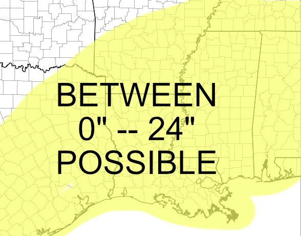
That is why I don’t think you want to see my snowfall forecast totals map. Because it would be empty. Because I don’t think we (meteorologists) have enough data at this point to support any number for a snow total. Because everything between 0.00″ and 24.00″ could happen. I suppose, if you’re desperate for a specific snow forecast for your house, I will say this: You could get up to 2 feet of snow… or nothing.

Not much of a forecast, I know. But it is an honest forecast. Anyone else giving you numbers at this point isn’t be real.
Another honest assessment: Make backup plans for traveling or any activities on Tuesday and Wednesday. Because if any snow falls (we are still in IF territory, here), anywhere, it isn’t likely going to melt for at least 24 to 48 hours.


Zero to 24 inches. That’s what I like … an exact forecast! LOL!!