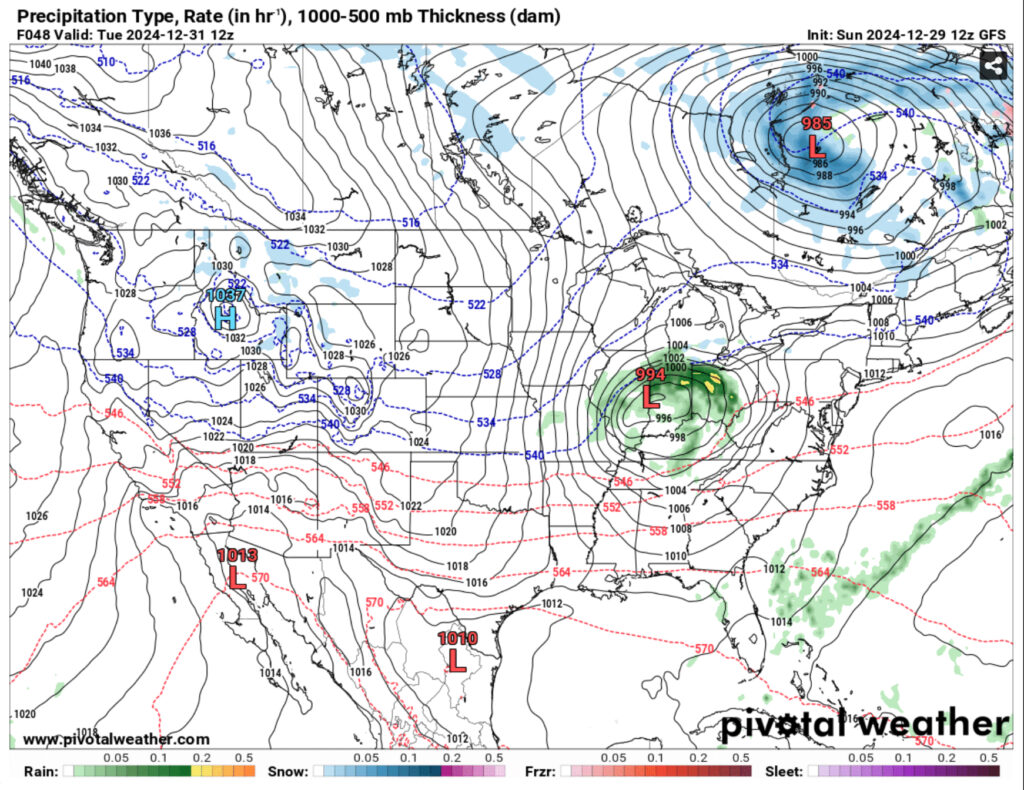
We’re in for a lot better weather over the next several days as the severe weather passed us over last night. We’re in for a bit of a dry spell for the week as another surface low passes over the mid-South and brings some Arctic air to the Deep South for the rest of the week. No, this won’t be a freeze out, but the overall temperature will be much cooler.
Tonight, the west northwest winds will pull through behind the cold front bringing in slightly cooler air today. Overall, it’ll be a pleasant day with temperatures in the mid 60s and a low in the mid 40s. Tonight, the winds will calm down which means that areas of dense fog are likely across the area.
Monday will be a warmup with a surface low moving in in the eastern Plains. Temperatures will warm up to the upper 60s and winds will begin blowing and gusting up to 20mph during the day. The fog will clear up in the morning and give way to sunny skies later in the day. For New Year’s Eve, the clouds will clear up after the overnight hours and make for another gusty day, but pleasant overall. Temperatures will top out in the upper 60s during the day and the winds will shift as the cold front moves in. Overnight, the temperature will dip into the upper 30s to around 40, so if you’re out for a New Year celebration, be sure to bring a coat and dress warmly.

New Year’s Day will be cooler with the north northwest winds blowing, but it’ll be clear skies day and night with temperatures in the mid to upper 50s. Thursday will be a similar story as the northwest winds still blow due to the upper levels. While the NWS shows a 20% chance of rain, it looks fairly limited to parts of Louisiana on Friday. Afterwards, we’ll return to our more seasonal type weather with temperatures in the upper 50s and lows in the 30s. Saturday will be a similar story.

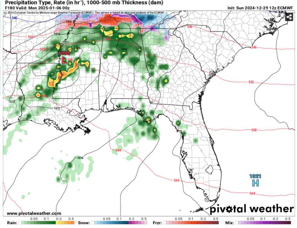
One big thing about Sunday is that the GFS model and Euro models differ quite a bit on what’s supposed to happen. The GFS is much less potent and keeps things further north while the Euro model shows a stronger cold front moving in across the area. With some decent rain and possible storms, however the winter weather will likely stay north into the mid-South. We’ll keep an eye on it as the week progresses.
Regional Day-to-Day Forecast
This Afternoon – Mostly sunny, with a high in the upper 60s. Calm wind becoming west northwest around 5 mph.
Tonight – Widespread dense fog, mainly after 4am. Otherwise, partly cloudy, with a low in the mid 40s. Calm wind.
Monday – Widespread dense fog, mainly before 7am. Otherwise, mostly cloudy, then gradually becoming sunny, with a high near 70. Light and variable wind becoming south 5 to 10 mph in the afternoon. Winds could gust as high as 20 mph.
Monday Night – Partly cloudy, with a low in the mid 50s. South wind 5 to 10 mph becoming west southwest after midnight. Winds could gust as high as 20 mph.
Tuesday – Sunny, with a high in the mid 60s. West southwest wind 5 to 10 mph becoming northwest in the afternoon. Winds could gust as high as 20 mph.
Tuesday Night – Clear, with a low around 40. North northwest wind around 5 mph.
New Year’s Day – Sunny, with a high in the upper 50s. North northwest wind 5 to 10 mph.
Wednesday Night – Clear, with a low in the low 30s. North northwest wind around 5 mph becoming calm in the evening.
Thursday – Sunny, with a high in the upper 50s. Calm wind becoming east northeast around 5 mph.
Thursday Night – Mostly clear, with a low in the mid 30s
Friday – A 20 percent chance of showers. Mostly sunny, with a high in the upper 50s.
Friday Night – Mostly clear, with a low in the low to mid 30s
Saturday – Sunny, with a high in the mid 50s.


Thanks, Noah. I really enjoy reading your forecast!
Good job.,
Thanks! I’ll be back for another one this weekend