We’re starting off the week overcast, but the clouds will soon clear out as the surface low moves out. It’ll be a beautiful but blustery day out today with a high just around 70 and winds out of the northwest at 10 to 15 mph. Tonight, we’ll reach the low 40s with the winds calming down in the evening.
As we cruise into Tuesday, a surface high from the western Gulf of Mexico will roll in keeping the skies clear and temperatures very Spring-like. Tuesday and Wednesday will have highs in the 70s and the low will be in the mid-40s. Wednesday will have some different conditions as the surface high moves eastward towards the Atlantic and brings more southerly winds along with it. Due to the gradient, we’ll see winds pick up a bit and gust up to 20mph. Overnight, the temperatures will fall only into the 50s.
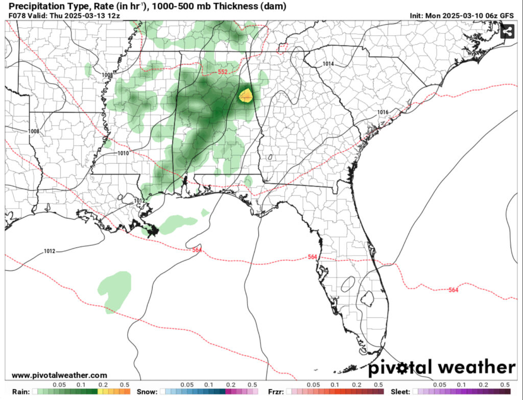
Overnight, an upper level disturbance will move in bringing a modest amount of moisture to much of the Deep South. The European and GFS models are still a bit out of line with each other, but we have a slight chance for rain and even a thunderstorm as the rain moves in late on Wednesday towards Louisiana and west central Mississippi. As the early morning progresses, an arm of rain will move towards the Pinebelt and the coastline and move out by mid-morning. Highs will be around 80 by mid afternoon with west southwest winds moving in. Lows will reach the upper 50s with the winds shifting towards the South.
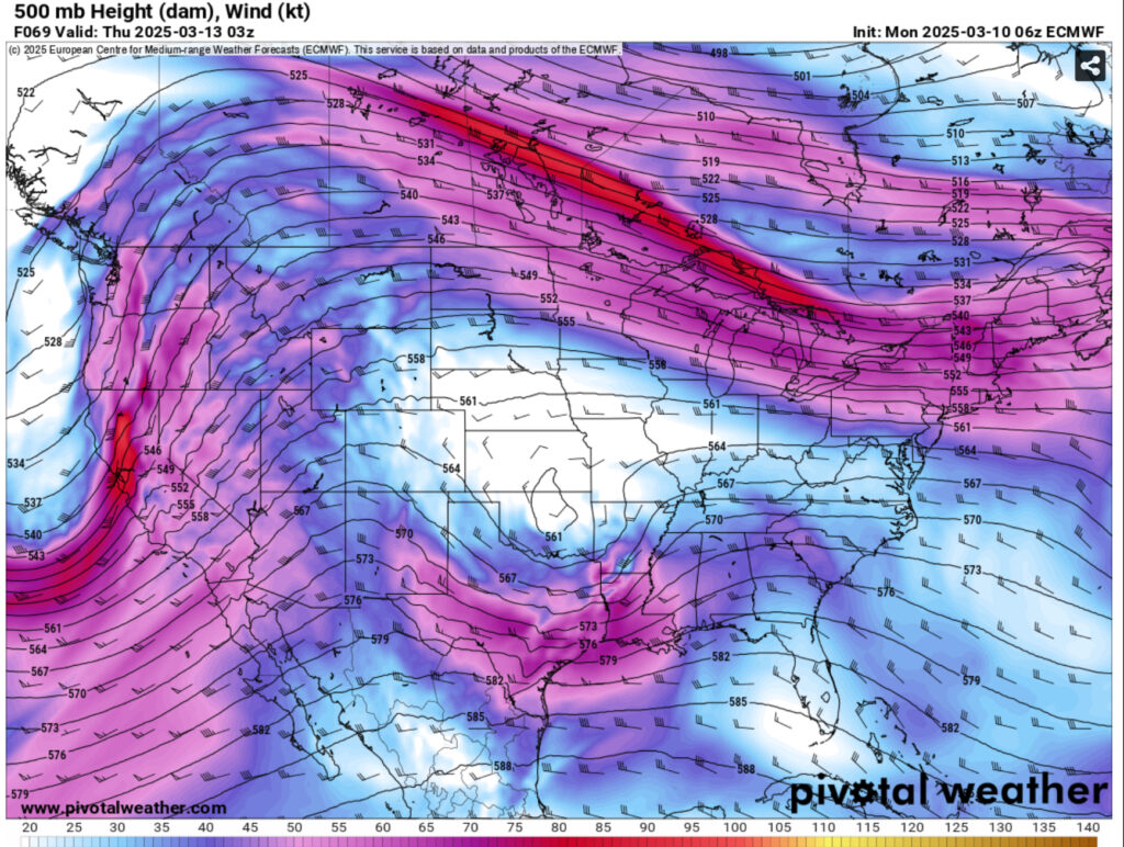
The high will move into the Atlantic and along with it, another upper level low will move from the mid-Rockies across the plains to Missouri. At the surface, we’ll begin to experience some gradient winds due to the clashing of these two systems. South winds will blow in around 10-15mph on Friday and gust near 30mph during the day. The dewpoint will also increase at this time due to the Gulf moisture inflow which means we’ll have a more humid day and a premonition for Saturday. Highs will reach the low 80s and the low will fall into the mid 60s with upper level clouds building in.
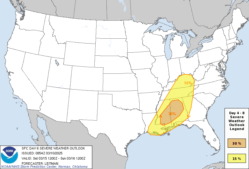
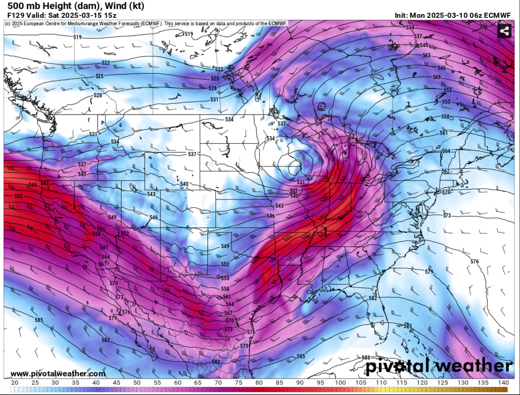
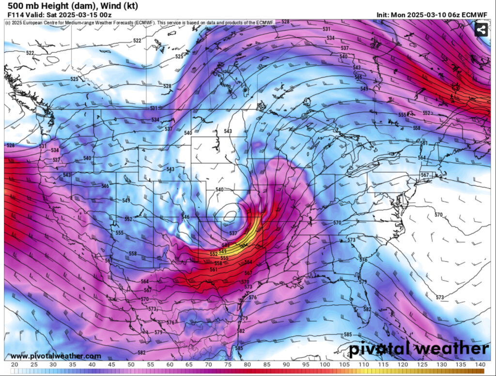
The Storm Prediction Center has already put a 30% chance for severe weather on Saturday due to the nature of the atmosphere. The negatively tilted trough will make its way towards Missouri and head north northeast to the Great Lakes and evolve into a large comma cloud. Coupling with it is a front developing from northern Mexico. The main obstacles with this system is the warm front’s location. Since this system will already be far north, the warm sector will also be there which may weaken its influx in our area. Despite this, there are plenty of other factors that will contribute to the incoming severe weather.
First is our moisture inflow and dewpoints. With a strong gradient at the surface, southerly winds and precipitable water amounts around 1.5-1.7 inches, we’ll have plenty to work with. Dewpoints will reach the mid and upper 60s especially closer to the coastline. The strong gradient winds also will help with a possible wind threat and wind advisory. The southerly inflow along with the negatively tilted trough could allow for some tornadoes to form during with some leading supercell development ahead of the main line. I also noticed a dry slot in the Skew-T’s which would also lead to some possible hail. As the main line moves in, we may not see as high of threats from hail, tornadoes, and wind, but heavy rain is the main concern as we may see 1-3 inches in some areas.
This severe weather threat is still fairly far out, but since the SPC already has their eyes on it, it’s likely that we’ll see a mix of risks coming on Saturday. I’ll have another forecast out by Wednesday covering it as models come into agreement more.
Regional Day-to-Day Forecast
Today – Mostly cloudy through mid morning, then gradual clearing, with a high near 70. North northwest wind 10 to 15 mph, with gusts as high as 25 mph.
Tonight – Clear, with a low in the low 40s. Northwest wind around 5 mph becoming calm in the evening.
Tuesday – Sunny, with a high in the mid 70s. Calm wind becoming west southwest around 5 mph in the afternoon.
Tuesday Night – Clear, with a low in the mid 40s. South southwest wind around 5 mph becoming calm.
Wednesday – Sunny, with a high in the upper 70s. Light south southwest wind increasing to 5 to 10 mph in the morning. Winds could gust as high as 20 mph.
Wednesday Night – A 30 percent chance of showers after midnight. Partly cloudy, with a low in the mid 50s. South wind 5 to 10 mph.
Thursday – A 20 percent chance of showers before 1pm. Mostly sunny, with a high in the low 80s. West southwest wind 5 to 10 mph.
Thursday Night – Partly cloudy, with a low in the upper 50s. Calm wind becoming south around 5 mph.
Friday – Mostly cloudy, with a high in the low 80s. South wind 5 to 10 mph increasing to 10 to 15 mph in the afternoon. Winds could gust as high as 30 mph.
Friday Night – A 40 percent chance of showers and thunderstorms, mainly after 1am. Mostly cloudy, with a low in the mid 60s.
Saturday – Showers and possibly a thunderstorm. High in the mid 70s. Chance of precipitation is 80%.
Saturday Night – A 30 percent chance of showers and thunderstorms. Mostly clear, with a low in the upper 40s.
Sunday – Sunny, with a high in the low 70s.


