Looking ahead, I think we have two shots for rain across the area in the coming week. The first chance shows up tomorrow night as a weak front passes through. This will help to kick up the wind tomorrow and tomorrow night, as well as offer a few light showers.
The next shot for rain arrives on Sunday with an outside shot for some more severe weather. And, I know, we are all sitting here thinking, “When is this going to stop?!”
The good news is that once we get to late April, all of this severe weather stuff should start to slow down a bit. The bad news is late April is still about six weeks away.
First things first: The rain tomorrow? Not much to it. It looks like a handful of showers may glide through after dinner. Instead, it’ll be the wind tomorrow that’ll be pretty breezy.

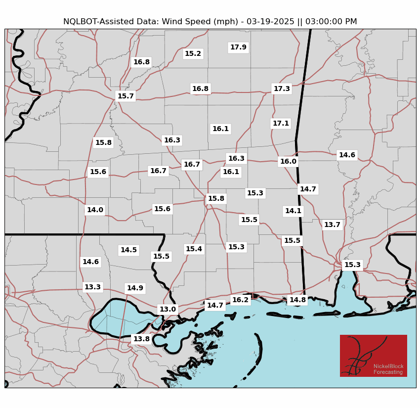
I can attest to the wind speeds, as the wind today at my house in Houston was making the house creek a few times. And all of that will be visiting you guys tomorrow.
Beyond that, the next shot for rain arrives Sunday. Currently the Storm Prediction Center has a Slight Risk for severe weather across parts of Texas, Arkansas, Louisiana and Mississippi.
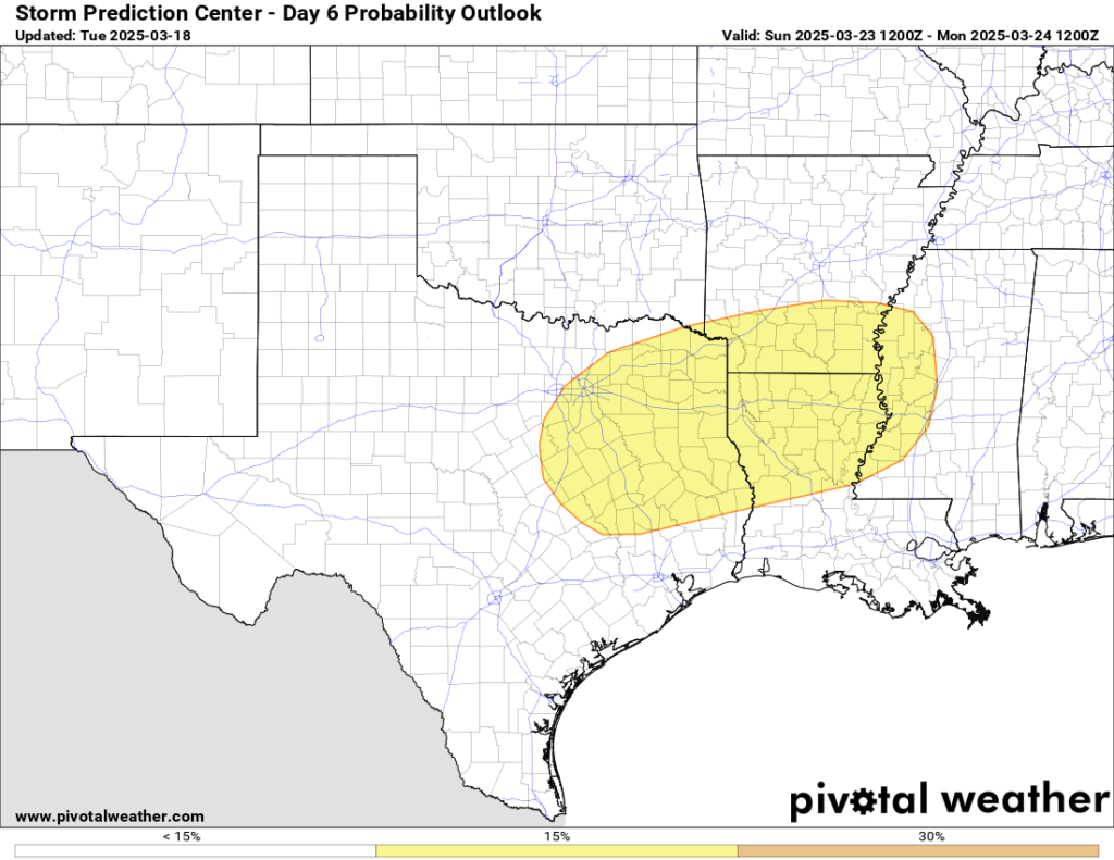
Given the trajectory of the next system, the limited low-level moisture, and the orientation of the front as it moves through, I expect this one to be more of a hail and wind event than a tornado event for us. But it is worth watching all the same. Hail can still ruin your day for certain.
But there is still plenty of time before that gets here. Just keep tabs on the forecast and if you have any outdoor plans on Sunday, now is the time to start thinking about a Plan B, just in case there are storms in the area.
DAY-TO-DAY REGIONAL FORECAST
Wednesday: Mostly sunny. Highs in the lower 80s. South winds 10 to 15 mph with gusts up to 30 mph.
Wednesday Night: Mostly cloudy with a chance of showers with a slight chance of thunderstorms in the evening, then partly cloudy with a slight chance of showers after midnight. Lows in the upper 40s. South winds 10 to 15 mph, becoming west after midnight. Gusts up to 30 mph. Chance of rain 50 percent.
Thursday: Sunny. Much cooler with highs in the mid 60s. Northwest winds 10 to 15 mph with gusts up to 30 mph.
Thursday Night: Clear, cooler with lows in the upper 30s.
Friday: Areas of frost in the morning. Sunny. Highs in the upper 60s.
Friday Night: Mostly clear. Not as cool with lows in the upper 40s.
Saturday: Sunny. Not as cool with highs in the upper 70s.
Saturday Night: Mostly clear in the evening, then becoming partly cloudy. Lows in the lower 50s.
Sunday: Partly sunny. A slight chance of showers in the afternoon. Highs in the upper 70s. Chance of rain 20 percent.
Sunday Night: Mostly cloudy. A chance of showers with a slight chance of thunderstorms in the evening, then showers likely with a chance of thunderstorms after midnight. Lows in the upper 50s. Chance of rain 70 percent.
Monday: Mostly cloudy with a chance of showers and thunderstorms in the morning, then partly sunny in the afternoon. Highs in the mid 70s. Chance of rain 40 percent.


