After a rainy and cold weekend, we’ll get back to some warmer temperatures as another big zone of high pressure rolls in to the Deep South. This will lead us to foggy nights and mornings with slightly above average highs during the day. As we reach the middle of the week, another surface low will move in towards the Great Lakes region bringing a little bit of rain for us before leaving us with more seasonal temperatures on Friday. Let’s take a look.
We had a bout of rain this morning keeping things damp, however the clouds will move out giving us a sunnier day with temperatures in the mid 60s. Winds will be fairly calm as the high pressure keeps them down with us near the center. Due to that, we’ll be dealing with some areas of patchy and dense fog overnight with temperatures in the mid 40s. Since the surface is cooler than the atmosphere overhead, we’ll be dealing with this going into Wednesday morning as well. If you’re driving past sunset tonight, have your low-beams and fog lights ready and drive carefully.
Tuesday will be even warmer with temperatures reaching the low 70s and hardly any clouds. The wind will be fairly calm and even with a slight northwest breeze come in. Overnight, we’ll dip into the upper 40s with patchy fog possible into the morning hours. Wednesday will be slightly more humid with temperatures reaching the mid 70s and the upper level clouds rolling in. The wind will pull from the south indicating the front moving towards our neck of the woods. The temperature will reach the mid 50s in early morning hours with no fog, however the rain will move in with the front.
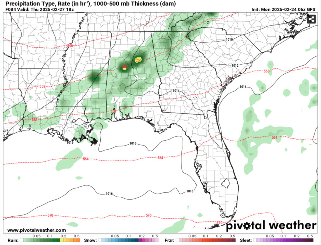
Models are mixed on this system so far. It’s not much to write home about, but depending on the setup, we may get a thunderstorm or two out of it, but it’s looking pretty slim. With another airmass of high pressure right behind this system and an Atlantic high, it looks to limit the moisture flow at least to our area which will inhibit a lot of the convective potential. The winds will pick up a bit with some wind gusts during the day from the South. Overall, a decent chance for rain during the morning and afternoon hours. Afterwards, the cold front moves in cooling us off slightly just in time for Friday. Temperatures will reach the mid to upper 60s during the day with few clouds in the sky and drop into the low 40s overnight.
Regional Day-to-Day Forecast
Today – Mostly sunny, with a high in the mid 60s. North northeast wind around 5 mph becoming calm in the afternoon.
Tonight – Patchy fog after 8pm. Otherwise, mostly cloudy, with a low in the mid 40s. Calm wind.
Tuesday – Patchy fog before 9am. Otherwise, partly sunny, then gradually becoming sunny, with a high in the low 70s. Calm wind becoming northwest around 5 mph.
Tuesday Night – Patchy fog after 1am. Otherwise, mostly clear, with a low in the mid 40s. Calm wind.
Wednesday – Patchy fog before 7am. Otherwise, sunny, with a high in the mid 70s. Calm wind becoming south around 5 mph in the afternoon.
Wednesday Night – Mostly cloudy, with a low in the low 50s. South wind around 5 mph becoming calm in the evening.
Thursday – A 40 percent chance of showers. Partly sunny, with a high near in the upper 60s. Light and variable wind becoming north northwest 5 to 10 mph in the morning. Winds could gust as high as 20 mph.
Thursday Night – Mostly clear, with a low in the low 40s. North northwest wind 5 to 10 mph becoming light after midnight.
Friday – Sunny, with a high in the upper 60s. Calm wind becoming north northwest around 5 mph.
Friday Night – Mostly clear, with a low in the low 40s.
Saturday – Sunny, with a high in the mid 70s.
Saturday Night – Mostly clear, with a low in the mid 40s.
Sunday – Mostly sunny, with a high in the mid 70s.


