Slightly below-average temperatures and lower dew points are likely for the rest of the work week. Areas closer to the coast may see a brief shower or thunderstorm during the afternoon, but confidence is high that our area won’t see much rain until this weekend. Not only will rain chances increase as we head towards Saturday and Sunday, but warmer temperatures are likely as well due to strong mid-level riding. High temperatures are forecasted to be in the mid to upper 90s for most of us!
Limited Rain Chances This Week
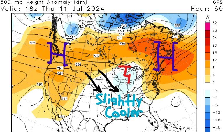
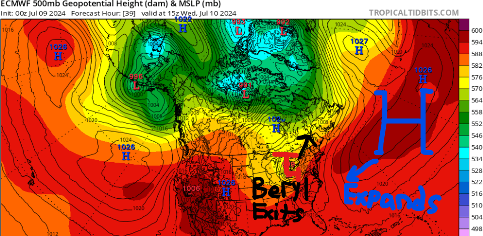
After today, rain chances will be limited for the rest of the work week as the remains of Hurricane Beryl will be far northeast of our area. A drier air mass and slightly cooler temperatures will cover most of our region, except for the southeast where a stalled front will keep high moisture levels, potentially causing isolated showers and thunderstorms in the afternoon.
Temperatures will reach the lower 90s, which is typical for this time of year, but dew points should only be in the upper 60s to low 70s for most of the forecast area. With the drier air and closer to average temperatures, heat index values should stay below 105F, offering some relief from recent heat waves.
For Thursday and Friday, an upper-level trough will move eastward over our region, accompanied by a surface high shifting eastward to our north. This setup will limit moisture return and confine any afternoon storms mainly to our southern areas.
Weekend Heat
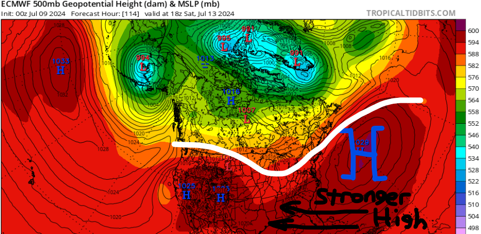
This weekend, a strong ridge in the mid-levels of the atmosphere will move eastward towards our region, with a surface high pressure strengthening across the southeast CONUS. This pattern will bring a warming trend with increasing humidity, leading to better chances for afternoon showers and thunderstorms due to daytime heating.
Areas along the coast have better odds of seeing rain this weekend, especially on Sunday due to the higher dew point values. There is not a lot of agreement with the models this far out for exact totals, but I’m not expecting this weekend to be a complete washout.
Heat index values are expected to rise, potentially prompting a Heat Advisory, especially for our western areas, by Sunday. This advisory may need to be expanded by Monday as conditions persist. Heat indices may exceed 110F, especially on Saturday and Sunday. I would recommend getting your outdoor activities done the next couple of days before the heat and humidity return this weekend.
Quick Tropical Update
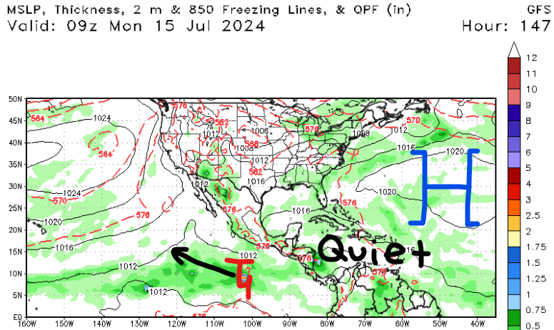
Luckily, we have no new areas to talk about in the Atlantic Basin. Models are picking up on a broad area of low pressure forming in the eastern Pacific early next week. This system should move off to the west-northwest and be no threat to land for the next week.
The eastern Pacific is off to a quiet start as they typically have around 2-3 named storms by this time of the year. The next name on the list is “Bud”.
Remember, it’s only early July and we still have a lot of the hurricane season left, so continue to educate yourself and those around you about tropical meteorology!


