And a happy St. Patrick’s Day! It’s been a pretty pleasant and cool start to the week after our severe weather event on Saturday. If you have the time and means, please find a way to support those affected by the tornadoes in the Pinebelt and central Mississippi.
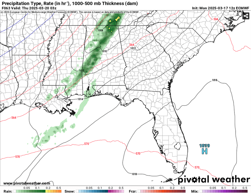
For the next few days, we’ll get a bit warmer as a high pressure system resides over us keeping the clouds away and temperatures in the mid 70s to about 80 by Wednesday. As the high moves out towards the Atlantic, it will form a gradient of winds that we’ll feel during the day on Wednesday making things slightly more humid and gusty. Winds will pull out of the south southwest around 10-15mph with wind gusts up to 30mph. Into the evening hours, we’ll have a small chance of rain as a slim band of rain showers moves in and remains until about midnight. The GFS models are showing the rain picking up more steam by the time it reaches the MS/AL border, but it’s likely we’ll still see a decent chance. A few isolated thunderstorms may be possible before it moves out.
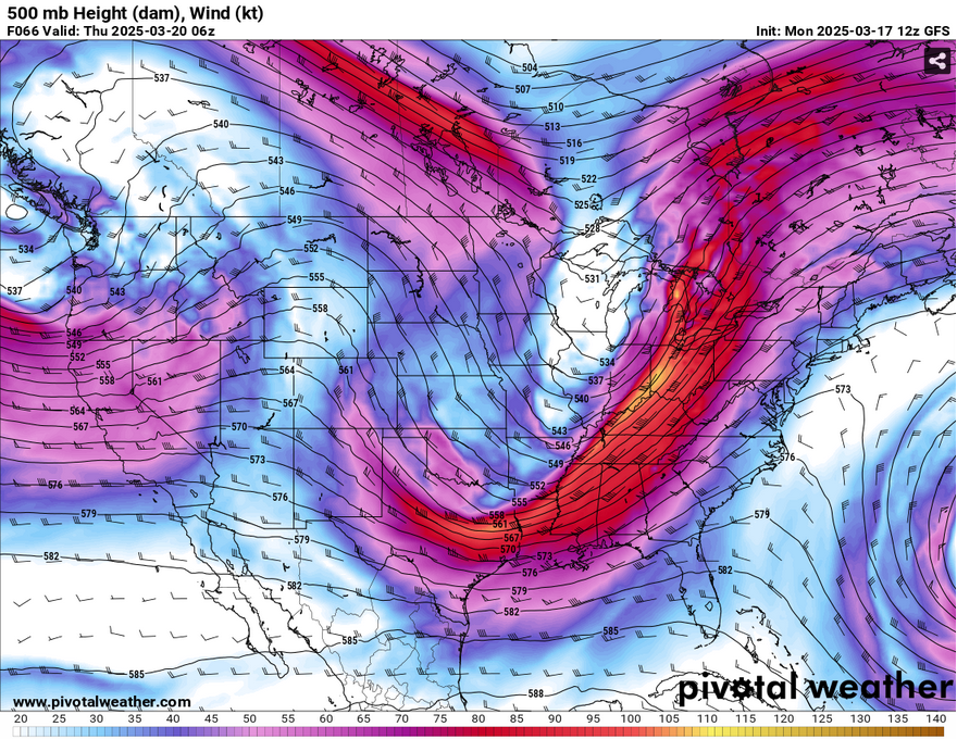
Behind it is not exactly an Arctic blast, a pretty significant mass of cooler air moving through the Plains reaching our neck of the woods. The 500mb analysis shows a strong jet of 100mph winds moving in the upper levels directly above us indicating that we’ll get some cooler air for a couple of days. Overnight, we’ll dive into the mid 40s with clouds clearing out. Due to the mixing, we’ll get some more gusty winds from the north northwest on Thursday and temperatures just reaching the low 60s during the day.
Overnight into Friday, many areas may see some frost this late in the year. Temperatures will reach the low to mid 30s in the morning. It’ll warm up a bit more on Friday with temperatures in the upper 60s to low 70s and winds shifting to the south. It’ll be another cool night Friday night with temperatures in the upper 40s.
Sunday’s Weather
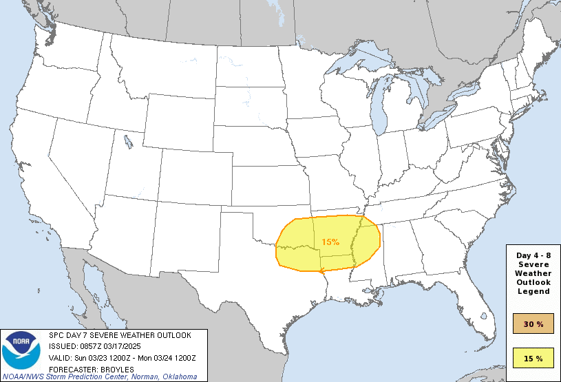
This is just a little brief on the SPC’s outlook for Sunday. So far, they have a 15% chance for severe weather for the Ouachita mountain area as well as the northern Delta, northern Louisiana, and Memphis. Right now, model output is divided on the severity, but it’s within the general area. For those of us further South, thunderstorms are definitely possible from Sunday into Monday, so as the model data aligns, I’ll have another update out later this week.
Select Data Set:

Regional Day-to-Day Forecast
Tonight – Mostly clear, with a low in the low 40s. Calm wind.
Tuesday – Sunny, with a high in the upper 70s. Light south wind increasing to 5 to 10 mph in the afternoon. Winds could gust as high as 20 mph.
Tuesday Night – Mostly clear, with a low in the low to mid 50s. South wind 5 to 10 mph, with gusts as high as 20 mph.
Wednesday – Partly sunny, with a high around 80. South southwest wind 10 to 15 mph, with gusts as high as 30 mph.
Wednesday Night – A 30 percent chance of showers before midnight. Partly cloudy, with a low in the mid 40s. South southwest wind 10 to 15 mph becoming west northwest after midnight. Winds could gust as high as 25 mph.
Thursday – Sunny, with a high in the low 60s. Northwest wind 10 to 15 mph, with gusts as high as 25 mph.
Thursday Night – Clear, with a low in the low to mid 30s. North northwest wind around 5 mph becoming calm in the evening.
Friday – Areas of frost before 8am. Otherwise, sunny, with a high around 70. Light and variable wind becoming south 5 to 10 mph in the afternoon.
Friday Night – Mostly clear, with a low in the upper 40s. South southwest wind around 5 mph.
Saturday – Sunny, with a high near 80.
Saturday Night – Partly cloudy, with a low in the low 50s.
Sunday – A 20 percent chance of showers and thunderstorms. Partly sunny, with a high near 80.
Sunday Night – Showers and thunderstorms likely. Mostly cloudy, with a low in the upper 50s. Chance of precipitation is 70%.
Monday – A 40 percent chance of showers and thunderstorms. Partly sunny, with a high in the mid 70s.


