I didn’t really check to see what ol Punxatawney Phil said yesterday, but if we had an alligator to tell us the weather down here, I think he’d say an early Spring. I don’t know how much I’d put my money on it, but we’re definitely a good bit warmer than normal!
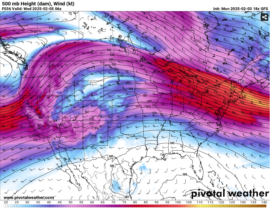
Looking at the upper levels, we’re in a much more linear pattern with an Atlantic low at the surface and a subtropical high in the Caribbean. Both will provide southerly winds to the Deep South for the next several days and we will keep things warm and dry. By Wednesday, a weak cold front will make its way towards north Mississippi, but won’t have enough strength to carry the moisture towards our neck of the woods.
As we warm up, we’ll see our days start off cloudy and eventually clear out. Tomorrow will be quite foggy, so be on alert if you’re commuting to work in the morning as visibility will be low. As the day progresses, we’ll see low level clouds develop and remain throughout. Wednesday will be our cloudiest day with the cold front moving in, but while the clouds come overhead, we’ll still be quite warm into the upper 70s. Lows won’t be much further from the highs due to the incoming clouds at night and will climb from the upper 50s tomorrow to the mid 60s by Friday. Thursday and Friday also promise to be cloudy and slightly clear by the afternoon with temperatures in the low 80s, and yes, I mean low 80s in February. What a change from last month!
Select Data Set:

Regional Day-to-Day Forecast
Tonight – Patchy dense fog after 2am. Otherwise, increasing clouds, with a low in the mid 50s. South wind around 5 mph becoming calm in the evening.
Tuesday – Areas of dense fog before 8am. Otherwise, mostly cloudy, with a high in the upper 70s. Calm wind.
Tuesday Night – Mostly cloudy, with a low in the upper 50s. Calm wind.
Wednesday – Mostly cloudy, with a high in the upper 70s. Light south wind increasing to 5 to 10 mph in the afternoon.
Wednesday Night – Mostly cloudy, with a low in the low 60s. South wind around 5 mph.
Thursday – Partly sunny, with a high in the low 80s. South southwest wind 5 to 10 mph, with gusts as high as 20 mph.
Thursday Night – Partly cloudy, with a low in the low 60s. South wind around 5 mph becoming calm in the evening.
Friday – Mostly sunny, with a high in the low 80s. Calm wind becoming south southwest around 5 mph in the morning.
Friday Night – Partly cloudy, with a low in the low 60s. South wind around 5 mph.
Saturday – Mostly sunny, with a high in the low 80s.
Saturday Night – Partly cloudy, with a low in the low 60s.
Sunday – Mostly sunny, with a high in the upper 70s.
Sunday Night – A 20 percent chance of showers. Mostly cloudy, with a low around 50.
Monday – A 20 percent chance of showers. Partly sunny, with a high near 70.


