I bet that got your attention.
That is the message from the SPC. Looking at the maps, typically we have a 0.20% risk for a tornado on December 28th. And tomorrow the forecast calls for a 10.00% risk in many spots across the area.
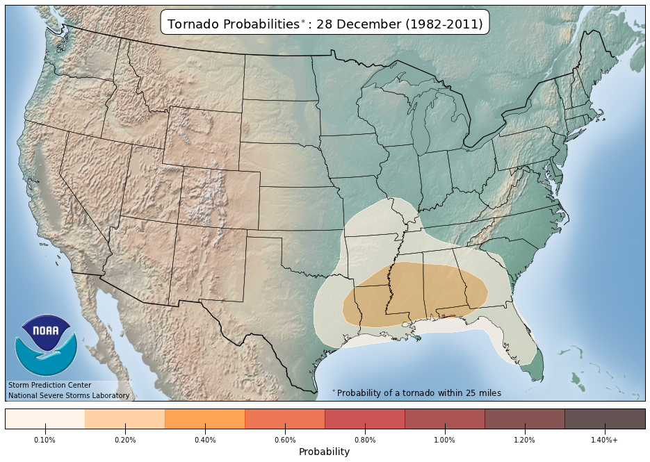
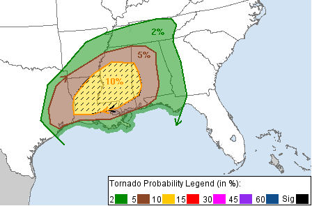
That is a 50x increase in risk.
Now, does that mean there will be dozens of tornadoes and damage all over the place? No. Probably not.
But it does mean the risk for a single tornado to occur is much higher than normal? Yes.
And currently, the model guidance is supportive of a risk for a few tornadoes and tornadoes up to EF3 in strength across the area tomorrow. So it is a day that you may want to keep tabs on the forecast throughout the day.
TIMELINE & THREATS
Short range model guidance is showing two rounds of storms. The first round will arrive in the afternoon and early evening. This will be clusters of storms. The biggest concern will be for the cells on the southern edge of these clusters or the isolated supercells embedded within the eastern edge.
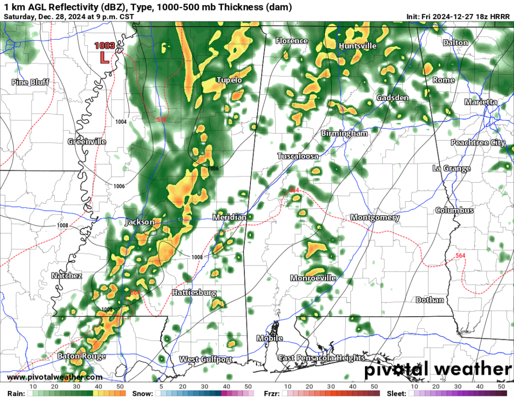
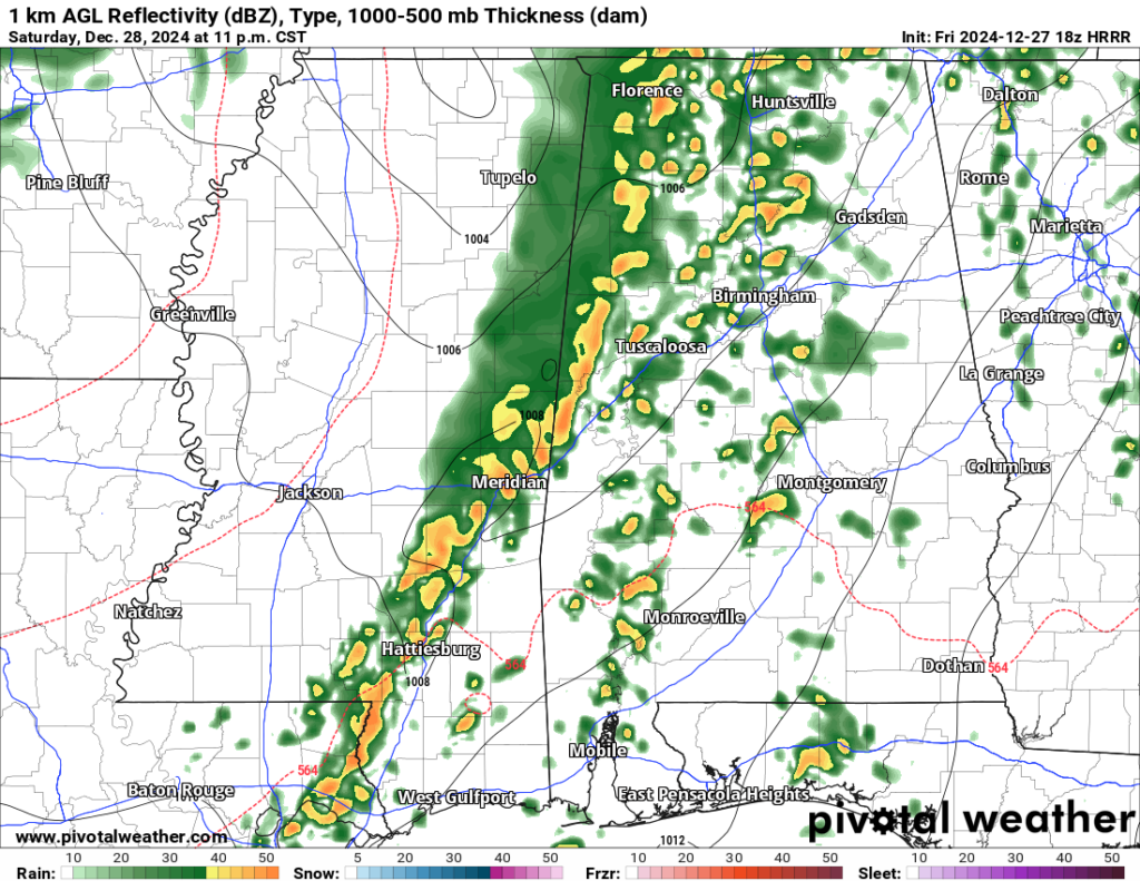
The afternoon and early evening estimated radar images from the HRRR computer weather model show these clusters of storms moving from SW to NE across the area.
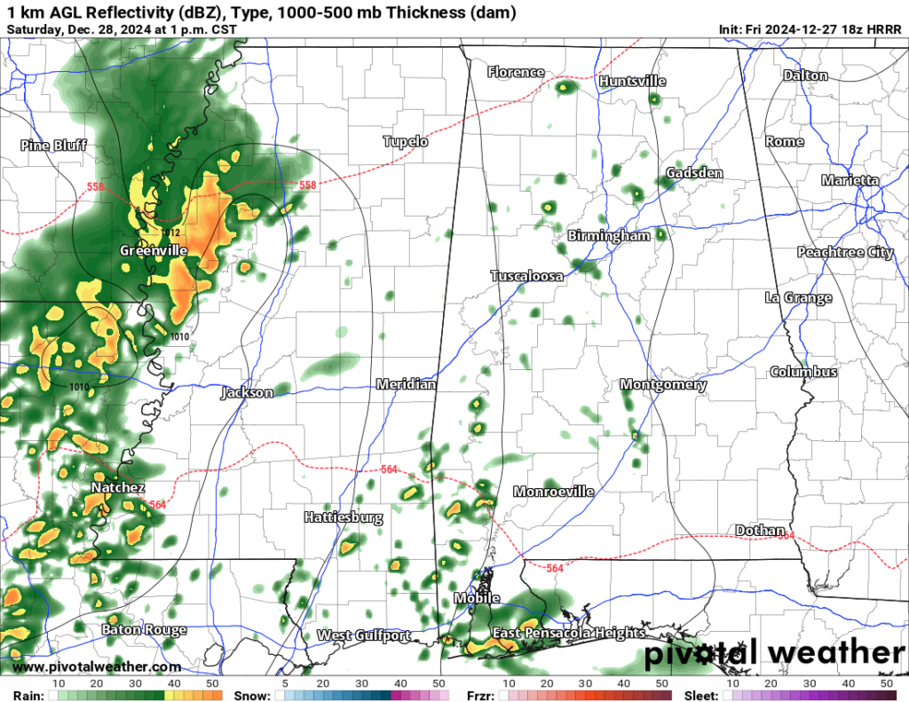

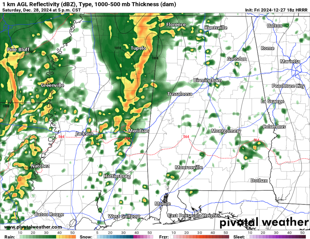
This would be the time when we would be most likely to see the stronger tornadoes, up to EF3 in strength. I also think these storms will have the potential to produce wind gusts up to 70mph, and hail up to the size of half dollars.
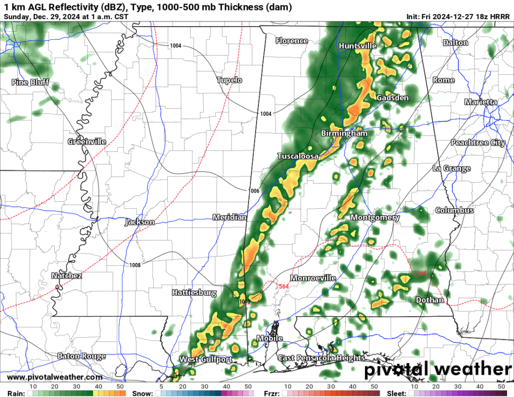
Then, later in the evening, the line of storms will press through the area. At this time, we will have to watch for embedded supercells within the line of storms, but the risk for the stronger tornadoes within the line is going to be a bit lower than earlier in the afternoon.
That said! I think we can’t rule out the chance for ‘up to EF2’ tornadoes within the line.
Looking at the Updraft Helicity Streaks, it is a bit of a mess. But I think we can’t pull something from this. In this kind of environment, any grey streak is an indication of a potentially rotating storm with the potential to produce a tornado.
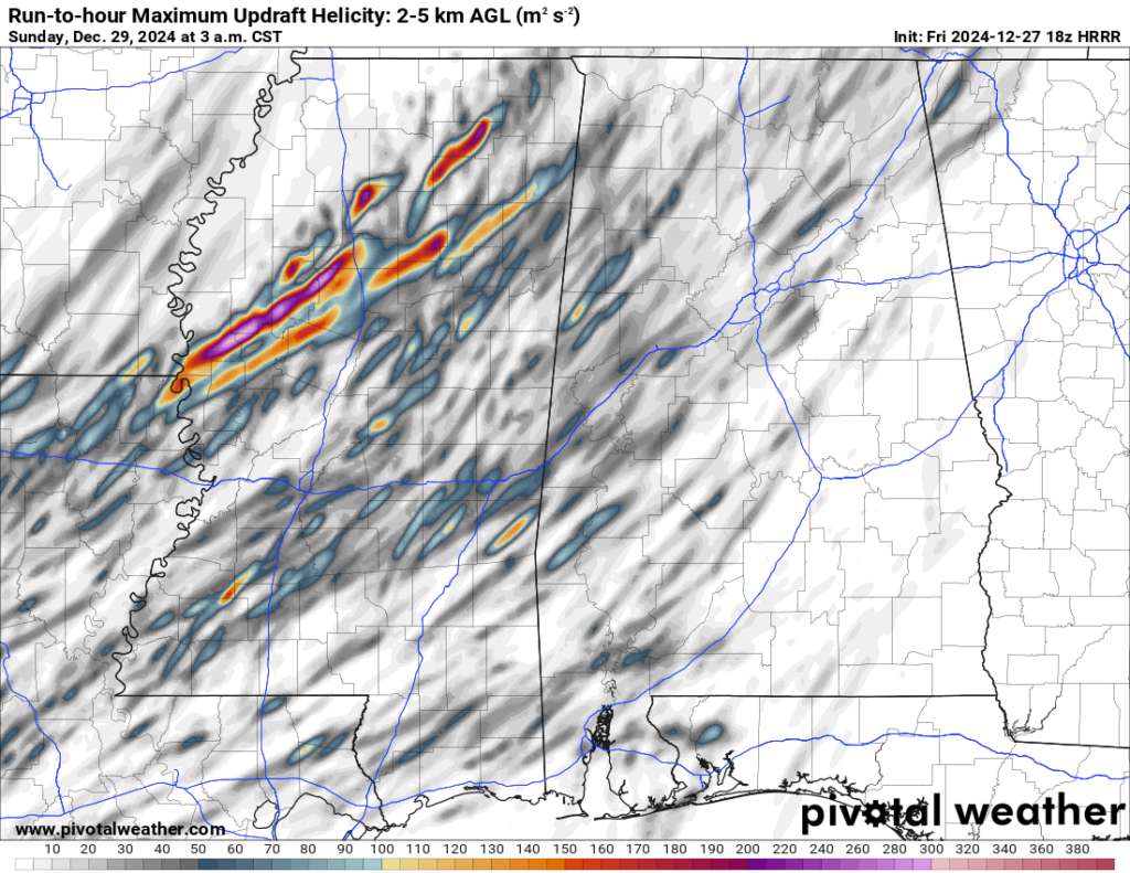
Notice there are two general paths of the action. One north and one south. To me, I’m less interested in the specific placement of these paths because the models are not great at accurately placing the paths to begin with… Instead, I’m more interested in seeing that there are two general paths.
Basically, this tells me that it won’t be mayhem all over the place. It will be mainly a few specific storms that will have the potential to produce tornadoes. While we can’t know where those storms will be specifically yet, at least we know that it won’t be a melee.
Here is a breakdown of the timeline:
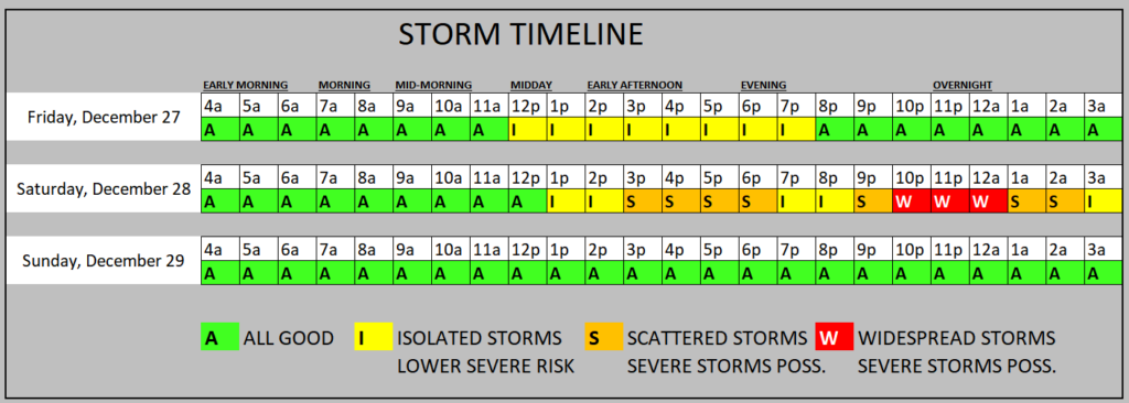
Today’s storms should remain isolated. Then tomorrow we move to scattered and widespread storms. Sunday, things calm down.
KARRIE METER
The Karrie Meter is a bit higher today with the addition of the shorter-range model data.
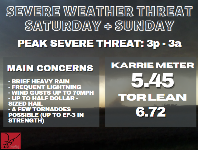
And the “TOR LEAN” still suggests the risk for tornadoes is “higher than normal” which lines up with what the SPC is suggesting.
EXTRAS
No county-by-county forecast at this time.


Thanks for watching out for us, Nick. Hope you had a great Christmas!