We’ll have a slight reprieve from the warm temperatures and even severe weather we received this morning, but that won’t last long! It’ll be warm and pretty humid with temperatures reaching the upper 80s and falling only to around 70. Talk about summer-like! Let’s take a look to why this is.
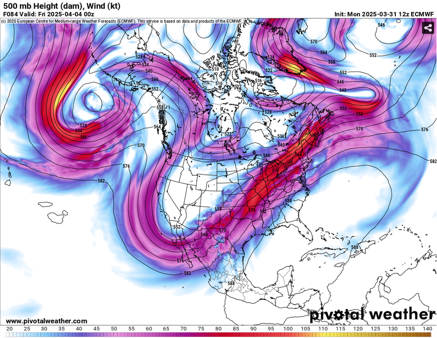
The first big thing I noticed when looking at the forecast for the next several days is the location of a large ridge in the Atlantic as well as the Gulf. This will have a big influence on the forecast as it affects the moisture inflow for much of the coastal South and moves the flow further north towards the middle and northern Mississippi and Ohio River valley. The upper level jet will also be further north driving more of the severe weather and heavy rain further north of us.
At the surface, we’ll see a similar story thanks to a setup in the northern Atlantic that will eventually move south after the current cold front moves east. Afterwards, we’ll see the surface high strengthen and influence stronger southerly flow to much of the Southeast. At the same time, a surface low from the Rockies will move east northeast towards the middle of the Great Plains and eventually strengthening by mid-week as it reaches the Great Lakes region.
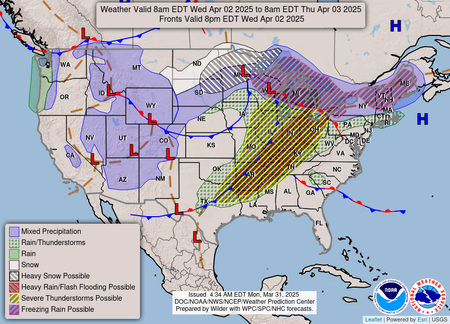
Due to the surface high in the Atlantic, the front will stall out over the middle eastern half of the US which will increase the severe weather threat on Wednesday and Thursday for parts of northern Mississippi and up. Not only this, there will be an increase flooding threat due to the stalling. For us, however, we likely won’t see much until Friday. Another part that we will have to deal with is the increasing gradient at the surface allowing consistent winds of 10-15mph and wind gusts up to 30mph for several days.
Tonight, there will be a brief cooldown with temperatures in the mid 50s and partly cloudy skies. Winds will shift towards the northeast overnight. During the day on Tuesday, we’ll have slightly drier conditions with temperatures reaching the low 80s and fewer clouds in the sky. Overnight, the winds will begin to shift towards the south and we’ll feel a difference in the temperatures with them reaching the mid 60s overnight.
Wednesday will be noticeably warmer and windier with a cloudy day for the start and eventually clearing. Winds will be out of the south southeast around 10-15mph and wind gusts up to 30mph. Temperatures will reach the mid 80s and only fall to around 70 overnight.
By Thursday, we’ll have a very warm day with temperatures in the upper 80s and more humid conditions. It’ll be a partly cloudy day before clouds roll in overnight and a low in the low 70s. Friday will have our slight chance of rain and thunderstorms with temperatures in the mid to upper 80s and south southeast winds around 10-15mph and wind gusts around 25mph.
Select Data Set:

Regional Day-to-Day Forecast
Tonight – Partly cloudy, with a low in the mid 50s. North northwest wind around 5 mph becoming calm in the evening.
Tuesday – Mostly sunny, with a high in the low 80s. Northeast wind 5 to 10 mph becoming south southeast in the afternoon.
Tuesday Night – Increasing clouds, with a low in the mid 60s. South southeast wind around 10 mph, with gusts as high as 25 mph.
Wednesday – Cloudy, then gradually becoming mostly sunny, with a high in the mid 80s. South wind 15 to 20 mph, with gusts as high as 35 mph.
Wednesday Night – Mostly cloudy, with a low around 70. South southeast wind 10 to 15 mph, with gusts as high as 30 mph.
Thursday – Partly sunny, with a high in the upper 80s. South southeast wind 10 to 15 mph, with gusts as high as 30 mph.
Thursday Night – Mostly cloudy, with a low in the low 70s. South southeast wind 10 to 15 mph, with gusts as high as 25 mph.
Friday – A 20 percent chance of showers and thunderstorms in the afternoon. Partly sunny, with a high in the mid to upper 80s. South southeast wind 10 to 15 mph, with gusts as high as 25 mph.
Friday Night – Mostly cloudy, with a low around 70. South southeast wind 10 to 15 mph, with gusts as high as 25 mph.
Saturday – A 40 percent chance of showers and thunderstorms in the afternoon. Mostly cloudy, with a high in the mid 80s.
Saturday Night – A 50 percent chance of showers and thunderstorms. Mostly cloudy, with a low in the mid 60s.
Sunday – Showers likely and possibly a thunderstorm. Mostly cloudy, with a high in the low 70s. Chance of precipitation is 70%.
Sunday Night – A 50 percent chance of showers. Mostly cloudy, with a low in the upper 40s.
Monday – A 20 percent chance of showers. Partly sunny, with a high in the mid 60s.


