We had an absolutely gorgeous day today with plenty of sunshine and warm temperatures! I can’t complain, I got outside every chance I could when I was at work today to be out in it and I hope y’all did too. This doesn’t look to change much during the week. A dry cold front is expected to move in tomorrow and then we’ll have some cooler temperatures followed by a gradual warm-up during the week.
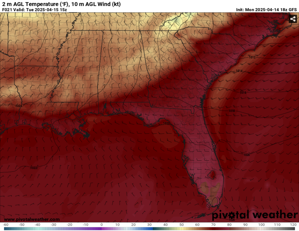
I’m sure you can spot the cold front from the picture above. We’ll have a nice, cooler, and windier type of day tomorrow with temperatures reaching only the mid 70s, so a windbreaker may be recommended tomorrow. Wind gusts will be up to 20mph from the west northwest. We’ll have one more cold night ahead with temps hitting the mid 40s.
The high pressure system will move in to the southeast bringing calmer winds overall and slightly warmer temperatures for Wednesday. We’ll reach the mid to upper 70s during the day with winds out of the east northeast. Overnight, we’ll fall to around 50 with clear skies. Thursday will indicate even warmer temperatures with winds shifting towards the south. We may see some gusty winds from a growing gradient due to the collision of the high and a low developing in the central Great Plains. The humidity will also begin to ramp up a bit due to the moisture inflow. Temperatures will reach the low 80s with some clouds rolling in. Overnight, we’ll fall into the mid 50s.
Friday will be a much warmer day for us as the high pressure system will move further east. More clouds will roll in, but they won’t keep the heat away. With increased humidity, we may reach the upper 80s in some areas, so be careful outside if you’re doing any work outside, going out on the town, or have some sort of Good Friday service outside. It’ll be quite warm for this time of year. Friday night will be much milder too with temperatures in the low 60s.
Rain is looking scarce for the next several days and we likely won’t see anything until next Monday. While we’re not in drought conditions according to the Climate Prediction Center, we are now in fire weather territory. With the lack of rain in the past couple of weeks, vegetation, brush and beds will be very dry. Throwing away cigarettes, trash burning, and other hazards may cause brush and possibly even forest fires. Please heed any burn bans that may pop up soon.
Select Data Set:

Regional Day-to-Day Forecast
Tonight – Increasing clouds, with a low around 60. South southwest wind 5 to 10 mph.
Tuesday – Cloudy through mid morning, then gradual clearing, with a high in the mid 70s. West northwest wind 5 to 10 mph becoming north in the morning. Winds could gust as high as 20 mph.
Tuesday Night – Clear, with a low in the mid 40s. North northwest wind around 5 mph becoming calm in the evening.
Wednesday – Sunny, with a high in the mid 70s. Calm wind becoming east northeast around 5 mph.
Wednesday Night – Clear, with a low in the low 50s. Calm wind.
Thursday – Sunny, with a high in the low 80s. Light east southeast wind becoming south 5 to 10 mph in the afternoon. Winds could gust as high as 20 mph.
Thursday Night – Mostly clear, with a low in the mid 50s. South wind 5 to 10 mph.
Friday – Mostly sunny, with a high in the upper 80s. South wind 5 to 15 mph, with gusts as high as 25 mph.
Friday Night – Partly cloudy, with a low in the low to mid 60s. South wind 5 to 10 mph, with gusts as high as 20 mph.
Saturday – Partly sunny, with a high in the upper 80s.
Saturday Night – Mostly cloudy, with a low in the mid 60s.
Sunday – Mostly cloudy, with a high in the low to mid 80s.
Sunday Night – A 20 percent chance of showers. Mostly cloudy, with a low in the mid 60s.
Monday – A 40 percent chance of showers and thunderstorms. Partly sunny, with a high in the low to mid 80s.


