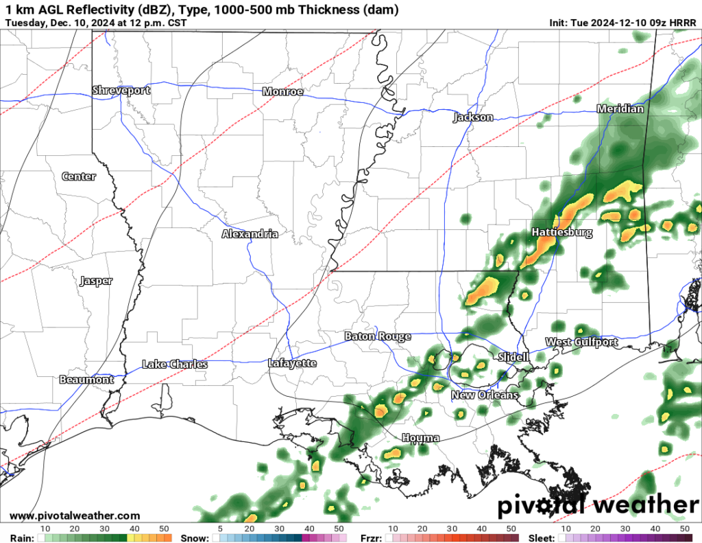
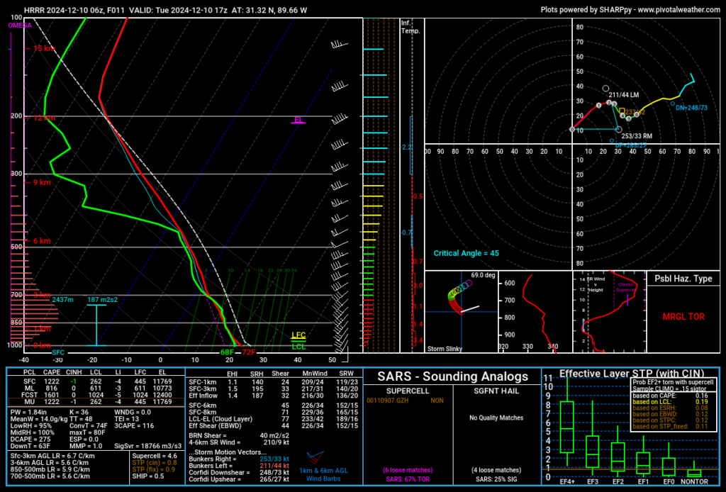
A deep upper-level trough continues to influence the central and eastern U.S., driving widespread rain and thunderstorms across the region. A surface cold front will advance through the area, with rainfall likely ahead of the front this morning into the afternoon. There is a potential for isolated severe storms, with damaging wind gusts and a few tornadoes possible, though the overall severe weather threat remains low.
I will say that there may be a sneaky window for severe weather around lunchtime and into the early afternoon for parts of southeastern Louisiana and into southern Mississippi. These storms won’t be “big” necessarily, but we may have just enough low-level torque to squeeze out a brief tornado and a few wind gusts up to 60mph.
Looking at the model guidance from the HRRR model this morning, it looks pretty similar to a lot of low-end events we have had here over the last decade that managed to produce at least one tornado.


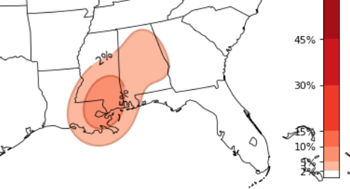
Even the CIPS Analogs (now that it is up and working again after a fire at the University a while back) shows a potential for a tornado or two.

Aside from that, heavy rainfall may lead to localized flooding, especially in areas already saturated from recent rains.
Rain will gradually clear eastward overnight as the front moves out, with temperatures dropping into the mid-30s to 40s for some folks behind the front. While not everyone will see a “Big shot” of cold tonight, I think most folks will get below 50 – at least.
Cooler and drier conditions will prevail as strong northwesterly winds usher in colder air. Highs will remain in the 50s, and lows Wednesday night may dip into the 30s, with a light freeze possible for some folks. Clearing skies are expected as the upper trough moves eastward.


A progressive weather pattern will develop, bringing a warming trend into the weekend as winds shift from northerly to southerly. Highs will gradually climb into the 60s and 70s by the weekend. Another cold front is expected to approach the region by Friday night or Saturday, bringing the next chance of rain. Additional rain is possible early next week, around Tuesday or Wednesday, with details still uncertain.
REGIONAL DAY TO DAY FORECAST
Today: A chance of thunderstorms. Showers. Highs in the lower 70s. Southwest winds 5 to 10 mph with gusts up to 20 mph. Chance of rain 90 percent.
Tonight: Mostly cloudy. Showers likely with a chance of thunderstorms in the evening, then a chance of showers with a slight chance of thunderstorms after midnight. Much cooler. Less humid with lows in the lower 40s. West winds 5 to 10 mph with gusts up to 20 mph, increasing to northwest 15 to 20 mph with gusts up to 30 mph after midnight. Chance of rain 70 percent.
Wednesday: Sunny. Much cooler with highs in the mid 50s. Northwest winds 15 to 20 mph with gusts up to 30 mph.
Wednesday Night: Clear. Patchy frost after midnight. Lows in the mid 30s. Northwest winds around 5 mph.
Thursday: Patchy frost in the morning. Sunny. Highs in the mid 50s. Northeast winds around 5 mph.
Thursday Night: Partly cloudy in the evening, then becoming mostly cloudy. Lows in the upper 30s.
Friday: Partly sunny. Highs in the lower 60s.
Friday Night: Mostly cloudy. A slight chance of showers after midnight. Not as cool. Near steady temperature in the lower 50s. Chance of rain 20 percent.
Saturday: Partly sunny. A slight chance of showers in the morning, then a chance of showers in the afternoon. Highs in the upper 60s. Chance of rain 30 percent.
Saturday Night: Mostly cloudy with a 40 percent chance of showers. Lows around 50.
Sunday: Mostly sunny. A slight chance of showers in the morning. Highs in the upper 60s. Chance of rain 20 percent.
Sunday Night: Partly cloudy. Lows in the upper 40s.
Monday: Mostly sunny. Highs in the upper 60s.
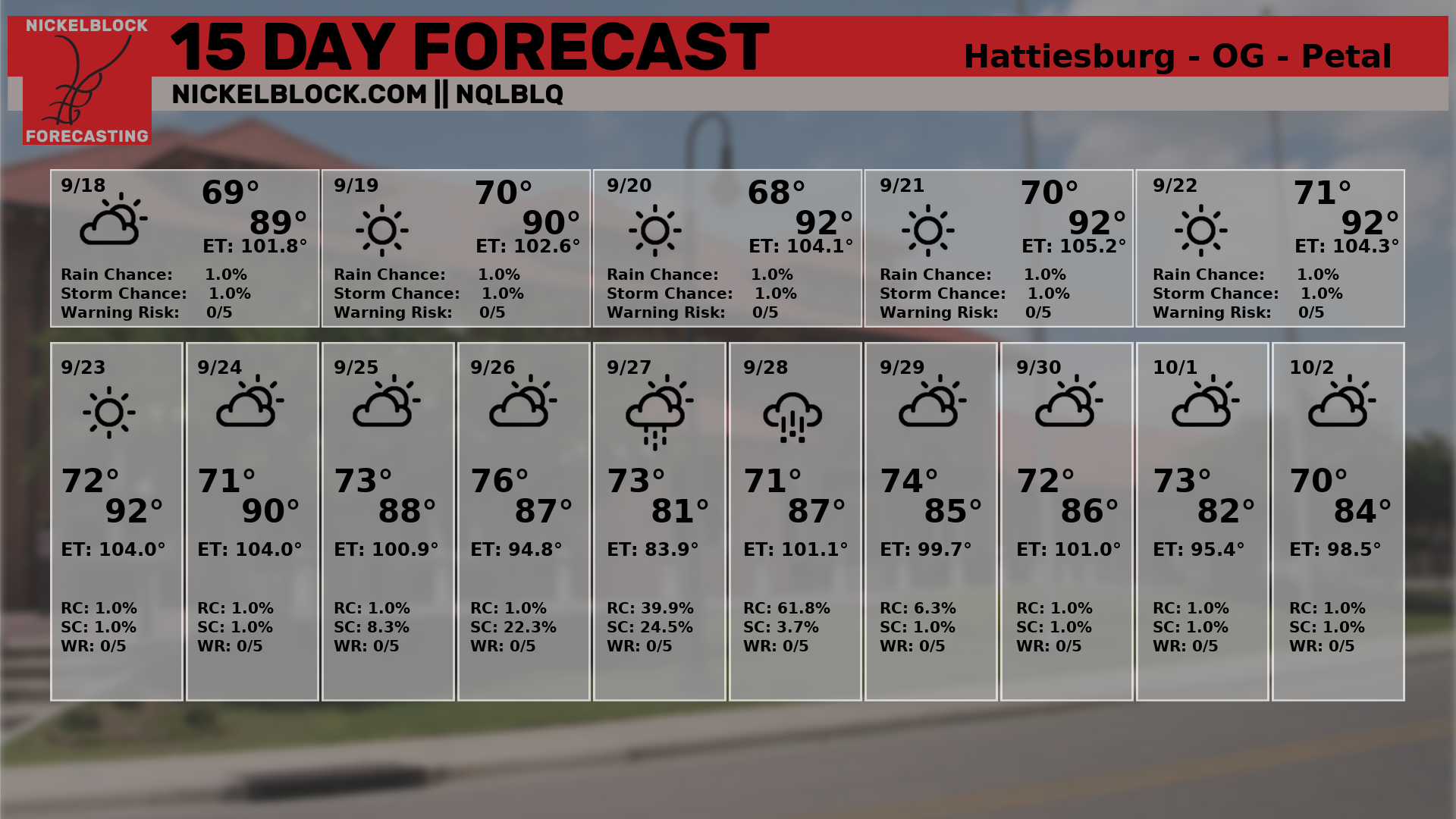
15-DAY OUTLOOK


