Another hot week is in store! Luckily, there will be some rain chances, mainly on Wednesday and Thursday due to a stalled cold front to our north. Regardless, the main story this week will be the above average temperatures with Heat Advisories out for much of the area.
More Heat This Week
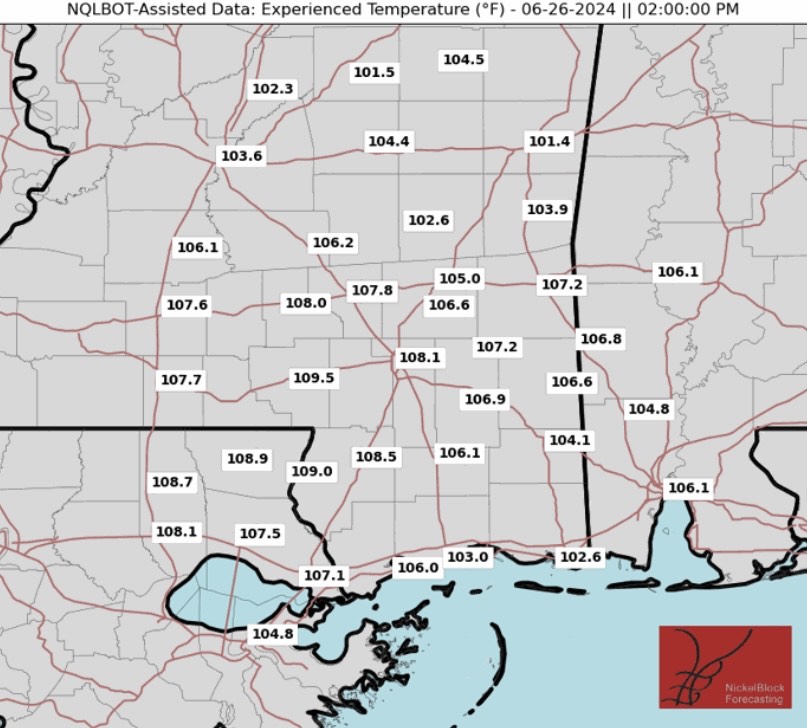
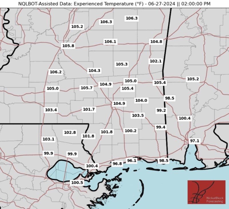
Heat and humidity will continue to remain a concern heading into Tuesday. A surface high over the Tennessee valley will shift east, allowing for a weak return flow by the afternoon. This simply means that weak winds out of the southwest will allow temperatures to be a few degrees warmer than Monday.
An Excessive Heat Warning could be issued as heat index values could exceed 110 degrees in cities like McComb, MS and Hattiesburg, MS. A Heat Advisory is out for most of the area, so please drink plenty of water and limit your time outdoors during the afternoon.
There could be isolated to scattered showers and thunderstorms closer to the coast on Tuesday, but this will provide little relief from the heat. The best chances for rain across the area will be Wednesday and Thursday afternoon as an upper shortwave is forecasted to move through the region. Rainfall totals will likely stay under 1″, but some areas in northern Mississippi could get close to that.
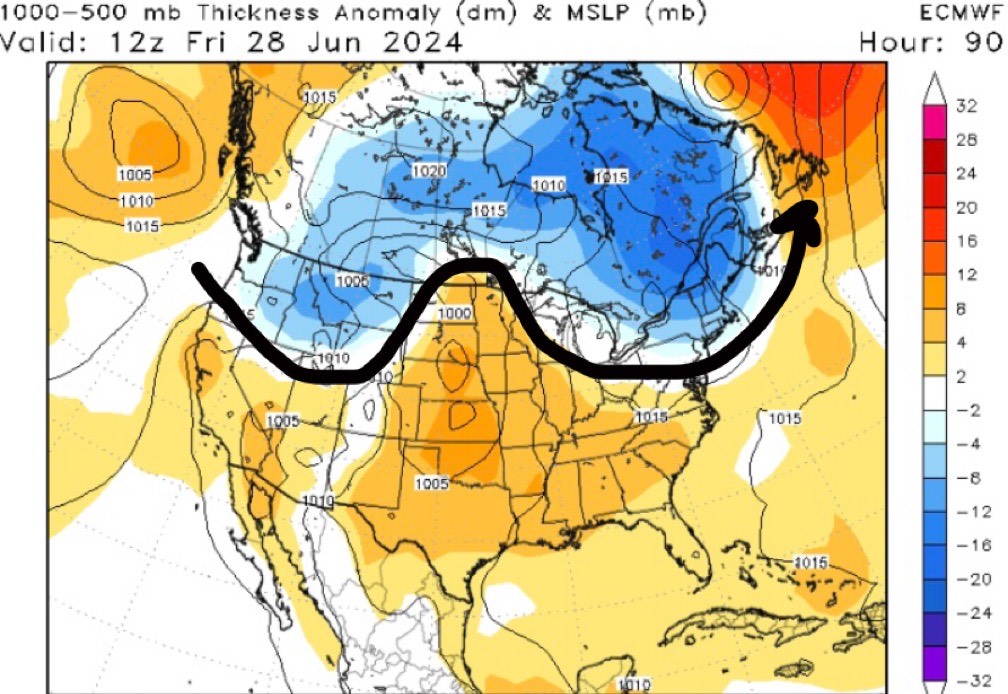
Later this week, deep ridging will take place across the southern CONUS, enabling west-northwest flow into the region. High pressure will be dominating in the mid-levels across the Lower Mississippi River Valley, increasing heights and allowing hot air to take over once again. Northwest flow will also allow for drier air to filter in, so rain chances will be low throughout the weekend.
High temperatures are forecasted to be in the mid to upper 90s with heat indices into the 105-110+ range. An Excessive Heat warning may need to be issued, but either way it’s going to get even hotter, so continue to take precautions as heat related illness will be likely.
Quick Tropical Update
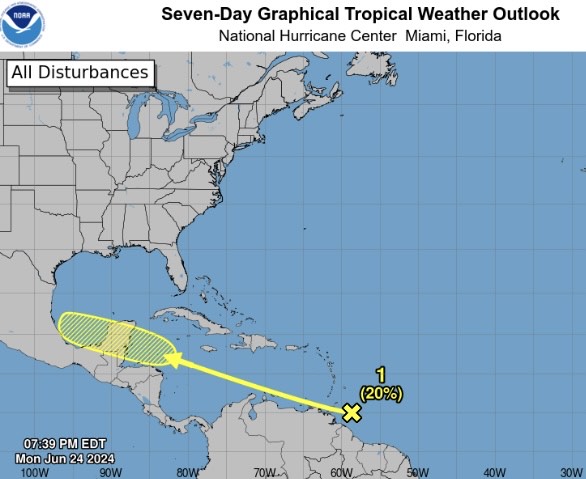
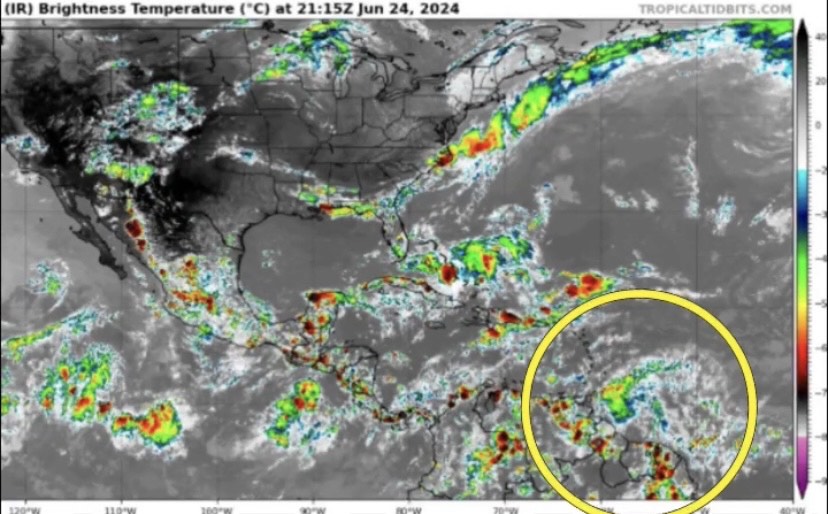
A new area of showers and thunderstorms has been looked at by the National Hurricane Center (NHC) located near the Lesser Antilles. At the moment, this disturbance is not in a zone favorable for development as lots of Saharan dust is being blown west across Africa into the Atlantic basin. If it can survive over the next couple of days, conditions look more favorable for organization as we head into the weekend and early next week.

