We’re at the tail end of the daily rain here in the Deep South. The cold front is almost out of here, and behind it is going to be a growing ridge-dome that will be here to stay for a while. Not only that, it’s going to be hot. The humidity along with the temperatures will cause the heat index to jump into the upper 100s and even up to 110 later in the week.
Early Week
Ending off the weekend, we’ll still have a few scattered rain chances in the afternoon and evening around the Mississippi/Alabama coast. As the cold front moves in, it’ll spark a few scattered thunderstorms across portions of central and south Mississippi before sunset.
Starting tomorrow, rain chances will be more limited with the ridge setting in. We’ll have some isolated thunderstorms possible across portions of Alabama and Mississippi. Temperatures will reach the low 90s across the board and will reach the low 100s in the heat index.
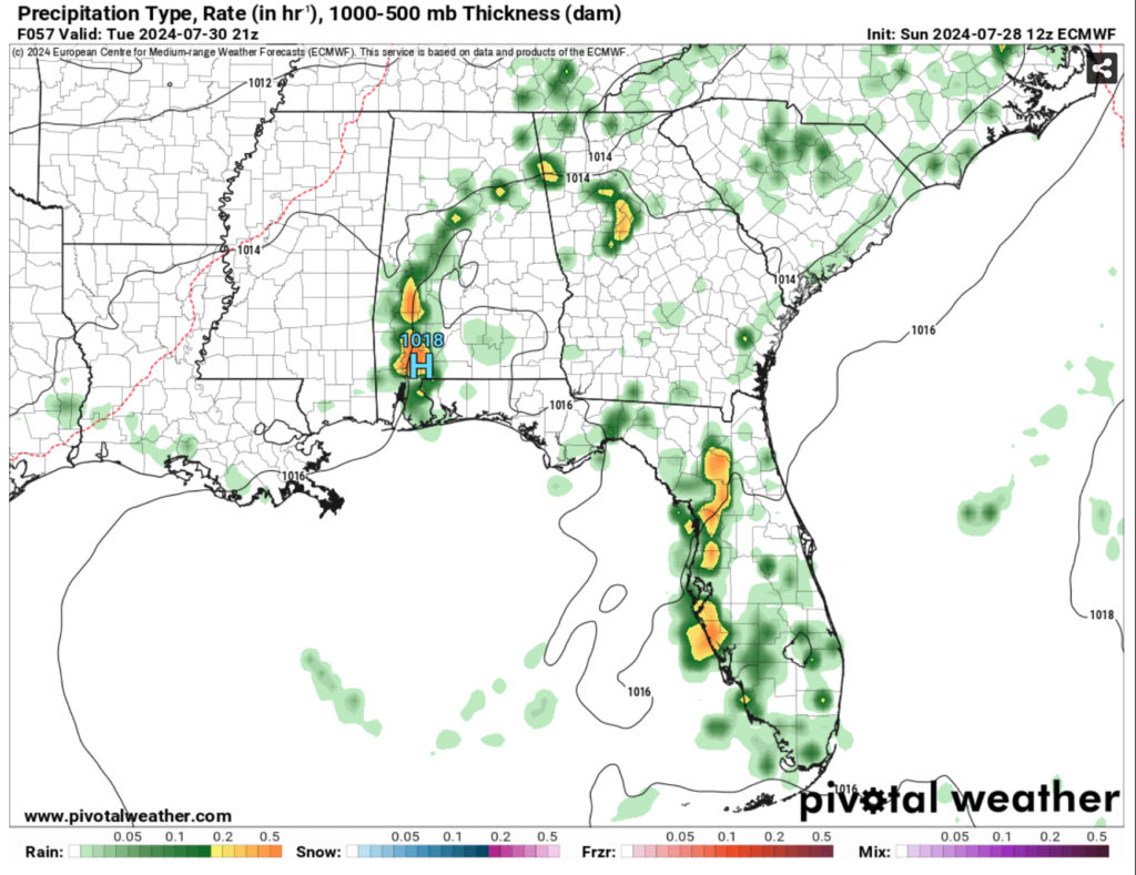
Tuesday will have a small MCS push through parts of Georgia and south-central Alabama before dissipating around Mississippi. Temperatures will reach the low to middle 90s with the experienced temperature around the low to mid 100s.
Mid-Week to Weekend
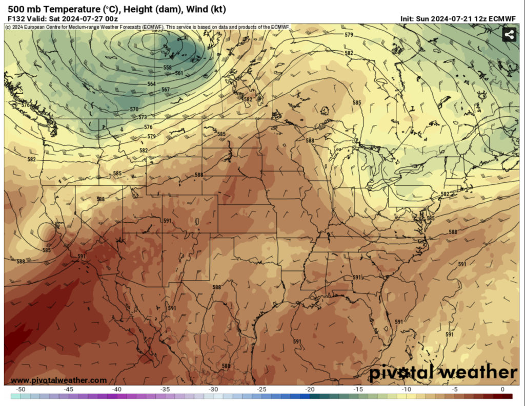
Wednesday is when things really start to heat up and feel more like the dog days of summer. The high pressure system will be in full effect fairly soon and take precedence over the weekend. What this means for us is that rain chances will reduce quite a bit for the next several days and the heat will be on the increase.
The high each day will reach the middle to upper 90s and the heat index will reach the upper 100s up to 110. We’ll have our typical cumulus clouds which a few may spark some afternoon thunderstorms, but most of these look to be isolated and closer to the coast.
Tropical Forecast
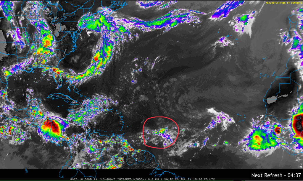
So far, we have one area of interest in the Atlantic. While this disturbance doesn’t look like much right now, it’s set to move towards the Leeward Islands and has a possible chance of developing over the next 7 days. The models so far look like this could turn into an organized system and possibly hook to the east after it develops, however it’s still too early to say how strong this will be or whether or not it will head towards the US. For now, we’ll keep an eye on the Satellite imagery and the models.
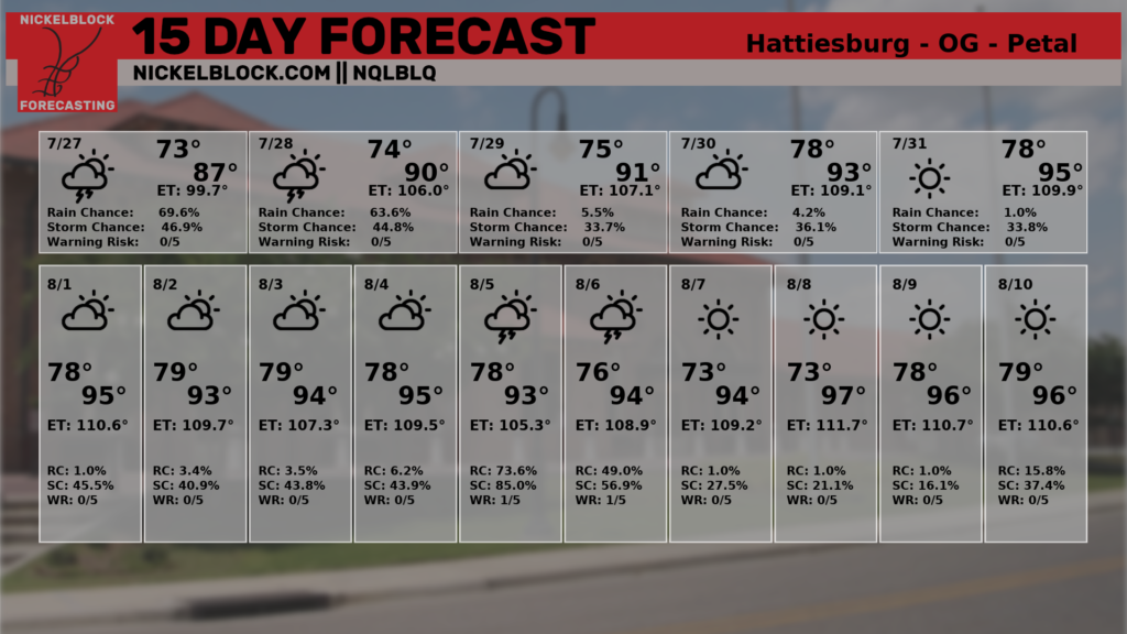
Looking at the 15 day forecast, we see the warmup ahead with decreasing rain chances over the next week. By next week, it looks like the models suggest that the wave may have an effect on some possible rain chances and then dry out afterwards.
Regional Day-to-Day Forecast
Tonight – A chance of showers and thunderstorms into the night. Patchy fog before 4am, then patchy fog after 5am. Otherwise, partly cloudy, with a low in the mid 70s. Calm wind. Chance of precipitation is 30%.
Monday – A chance of showers, with thunderstorms also possible in the afternoon. Patchy fog before 8am. Otherwise, sunny, with a high in the mid 90s. Heat index values as high as 105. Calm wind becoming west around 5 mph in the afternoon. Chance of precipitation is 50%. New rainfall amounts of less than a tenth of an inch, except higher amounts possible in thunderstorms.
Monday Night – A slight chance of thunderstorms before sunset. Mostly clear, with a low around 76. Calm wind. Chance of precipitation is 10%.
Tuesday – A 30 percent chance of showers and thunderstorms in the afternoon. Sunny, with a high in the mid 90s. Calm wind becoming west around 5 mph.
Tuesday Night – Mostly clear, with a low in the mid 70s. Calm wind.
Wednesday – A 30 percent chance of showers and thunderstorms in the afternoon. Sunny and hot, with a high in the upper 90s. Calm wind.
Wednesday Night – Patchy fog after 4am. Otherwise, mostly clear, with a low in the mid 70s. Calm wind.
Thursday – A 30 percent chance of showers and thunderstorms in the afternoon. Sunny and hot, with a high in the upper 90s. Calm wind.
Thursday Night – Mostly clear, with a low in the mid 70s.
Friday – A 30 percent chance of showers and thunderstorms. Sunny and hot, with a high in the upper 90s.
Friday Night – Mostly clear, with a low in the mid 70s.
Saturday – A 50 percent chance of showers and thunderstorms. Sunny and hot, with a high in the upper 90s.


