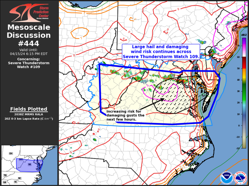
Yes, you are probably waking up to storms – unless you’re reading this later in the morning and you slept through them.

As of this writing (3am) the model guidance is showing a cluster of storms moving through the area this morning with a background severe weather risk.
The concern is mainly for wind and tornadoes. But the potential is pretty isolated to a few specific scenarios, so this isn’t going to be any kind of a widespread severe weather event for the Southern MS/AL/LA region. Instead it will be a few storms that produce severe weather for specific locations.
From the Storm Prediction Center last night:
Concern has increased for the potential, at least on an isolated/conditional basis, for severe storms overnight across portions of southeast Louisiana/southern Mississippi and into southwest Alabama by the predawn hours of Monday. Steady low-level moistening is expected to occur across the region through the late-night/early morning hours in tandem with a northward-shifting warm front.
A convectively augmented mid-level vort max will continue to shift eastward from the ArkLaTex toward the Tennessee Valley Monday morning, with increasing ascent and strengthening deep-layer winds progressively influencing the region overnight.
A somewhat separate mesoscale branch of increasingly strong 850 mb/1-2km AGL winds should overspread the region, resulting in elongating low-level hodographs. Strong/severe storms currently over northern Louisiana may persist east-southeastward overnight. Additional storms may develop/increase, at least on a widely scattered basis, within a near-coastal low-level confluence regime.
With this potential, the expected environmental trends causes concern for the possibility of supercells, which may include tornado potential, a bit farther south/southeast that previously thought. Recent HRRR runs and 00z guidance such as the NSSL-WRF lend credence to this potential.
Then this morning, the SPC noted parts of the region for the potential for a Tornado Watch and some severe weather this morning.


This is definitely not a ‘slam dunk’ for severe weather – or storms, frankly – as it looks like aside form the cluster of storms, things may be pretty isolated. This is a pretty conditional threat. And most of the cluster of storms to the north should remain elevated, and not surface-based meaning the potential for tornadoes is lower the farther north you live.
The reality is that you have to be south of the warm front. I drew its general location (probably a bit too far north on this image) on the radar shot at 3am below, to start to even think about a tornado threat. The only caveat I’ll add is that the warm front is slowly lifting northward this morning and will likely pass under some of these elevated storms, allowing them to build toward being surface-based.

In fact, the reasont here are “Severe Thunderstorm Warnings” instead of “Tornado Warnings” is because the storms are not fully surface-based. And because of that, they can’t produce tornadoes. When / if the warm front passes through those storms, then things change in terms of the potential threats for those storms – and other storms in the area.
But there is still a bit of uncertainty about how fast it moves north and how far it makes it.
And, of course, we still need to watch for other isolated storms south of the warm front for the potential for severe weather, too.
All of this will happen during the next few hours. And will likely be done by 10am. And then we can get ready for a bit of a soggy week.
FIVE DAY AG FORECAST
Here is a look at the Ag Froecast

REGIONAL DAY TO DAY FORECAST
Today: Mostly cloudy in the morning, then becoming mostly sunny. Highs in the upper 80s. South winds 10 to 15 mph with gusts up to 25 mph.
Tonight: Mostly cloudy. Patchy fog after midnight. Lows in the lower 70s. South winds 10 to 15 mph with gusts up to 25 mph.
Wednesday: Mostly cloudy with storms possible. Highs in the upper 80s. South winds 10 to 15 mph with gusts up to 25 mph. Chance of rain 30 percent.
Wednesday Night: Mostly cloudy with storms possible. Patchy fog after midnight. Lows in the upper 60s. South winds 10 to 15 mph. Chance of rain 20 percent.
Thursday: Cloudy with storms possible. Cooler with highs in the upper 70s. Chance of rain 40 percent.
Thursday Night: Mostly cloudy with some storms possible. Lows in the upper 50s. Chance of rain 30 percent.
Friday: Mostly cloudy with storms possible. Highs in the mid 70s. Chance of rain 50 percent.
Friday Night: Mostly cloudy with storms possible. Lows in the lower 60s. Chance of rain 60 percent.
Saturday: Cloudy with a chance for storms. Highs in the lower 70s. Chance of rain 60 percent.
Saturday Night: Mostly cloudy with a few storms possible. Lows around 60. Chance of rain 20 percent.
Sunday: Mostly cloudy with, you guessed it, storms possible. Highs in the mid 70s. Chance of rain 40 percent.
Sunday Night: Mostly cloudy. Lows in the upper 50s.
Monday: Mostly sunny. Highs around 80.

