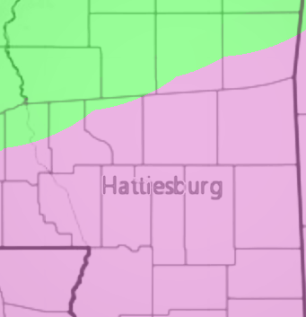
After digesting all of the data from the overnight and early morning models, and sneaking a peek at the unfinished data from the midday models, this is what the forecast looks like as of Wednesday, December 6th, 2017 at 10:30am for south Mississippi:
Wednesday: Morning temperatures around 38 with morning showers and drizzle followed by more afternoon drizzle and light rain. Highs around 45
Thursday: Morning temperatures around 35 with drizzle and light rain easing back to just patchy light showers in the afternoon. Highs around 48
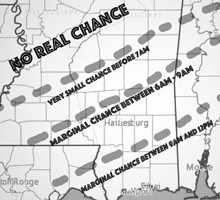
Friday: Morning temperatures around 33 with rain showers with a wintry mix possible, too. Between 6a and 9a, snowflakes may fall, but they would mix with intermittent rain, too. No meaningful accumulation or icy road conditions anticipated at this time. Dry by afternoon. Highs around 45.
Here is a crude and brief look at the wintry precip area and timeline:


To reiterate, the only chance for any frozen precip looks to be Friday morning. It will be mixed with rain and temperatures will be above freezing at the surface so any threat for hazardous driving conditions will be minimal. Very minimal.
I can’t speak for business, schools, hospitals, etc, on their ability/willingness to open. What I can say is that, at this time and based on available data, the weather will have very little to zero impact on road conditions (other than being plain wet).
The next full write up will be later today!

