Through today and through Friday, too, we will see a plume of showers and storms drift this direction from the Gulf. This is loosely associated with the cluster of storms that the NHC has been monitoring. The plume of extra moisture will increase the shot for rain both today and Friday. While I don’t think it will be terribly meaningful for everyone, some folks may end up underneath a “toad strangler” for a half hour.
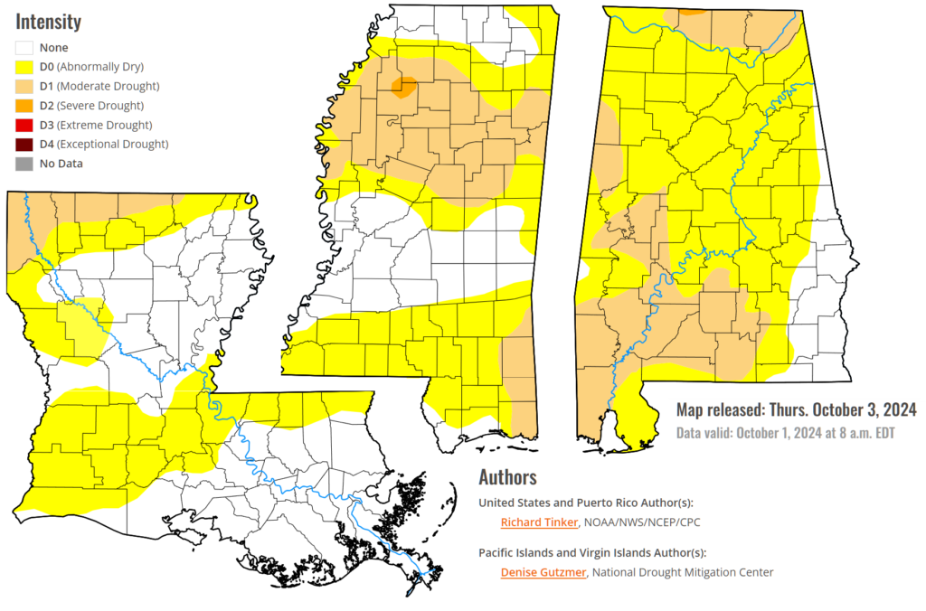
The D0/D1 drought persists across much of the area with a few blotches of D2 sneaking in. This means we are pretty dry and starting to see impacts on longer term soil moisture and plants. This is relatively typical for this time of year. And nowhere near as bad as the D4 drought many folks were dealing with last Autumn.

The chance for showers and storms should come to an end Friday night. I still think we may have a few football games that end up pretty damp across the area. If nothing else, the guys will be a bit muddier than normal, even if it doesn’t rain during the game.
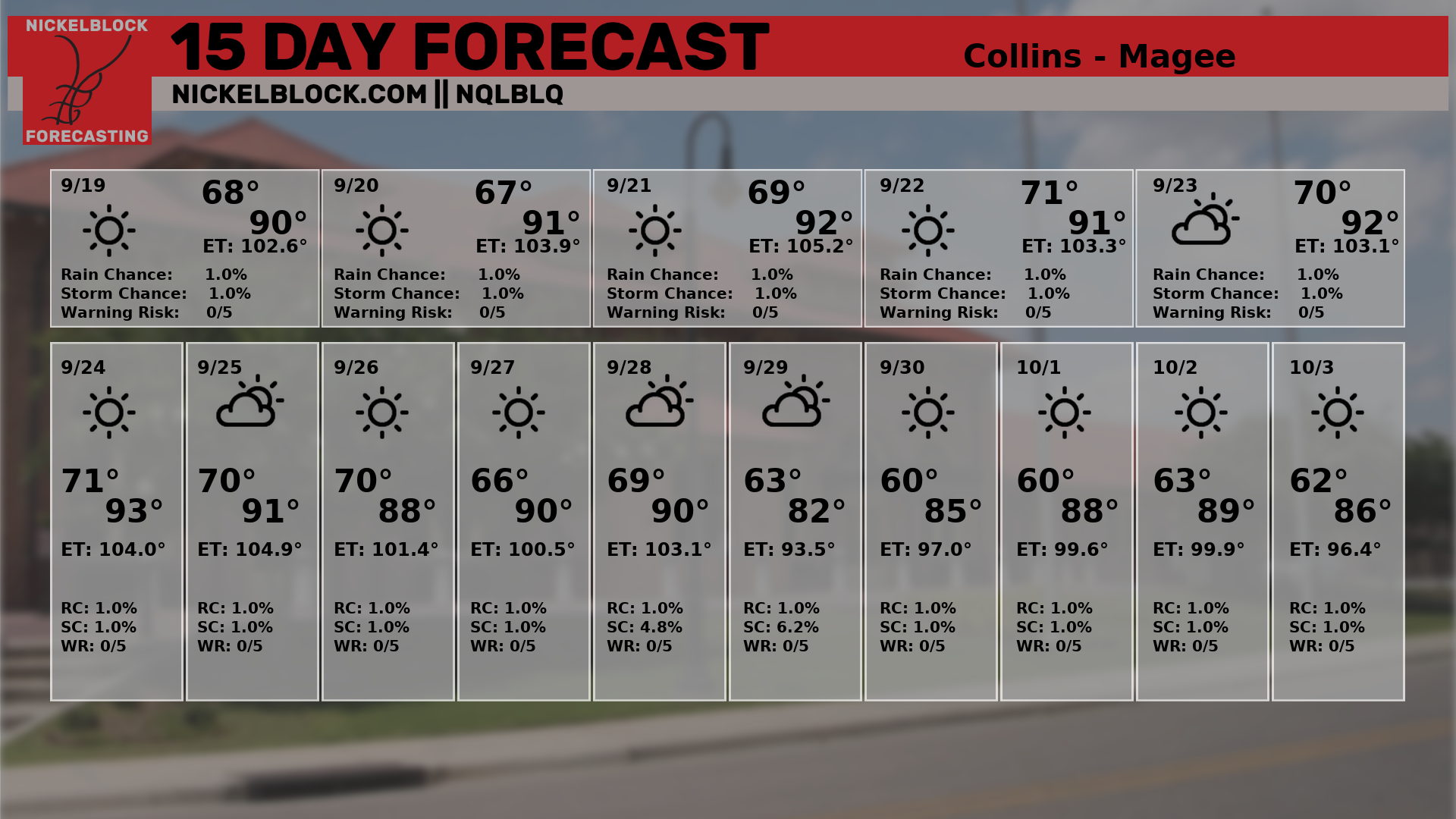
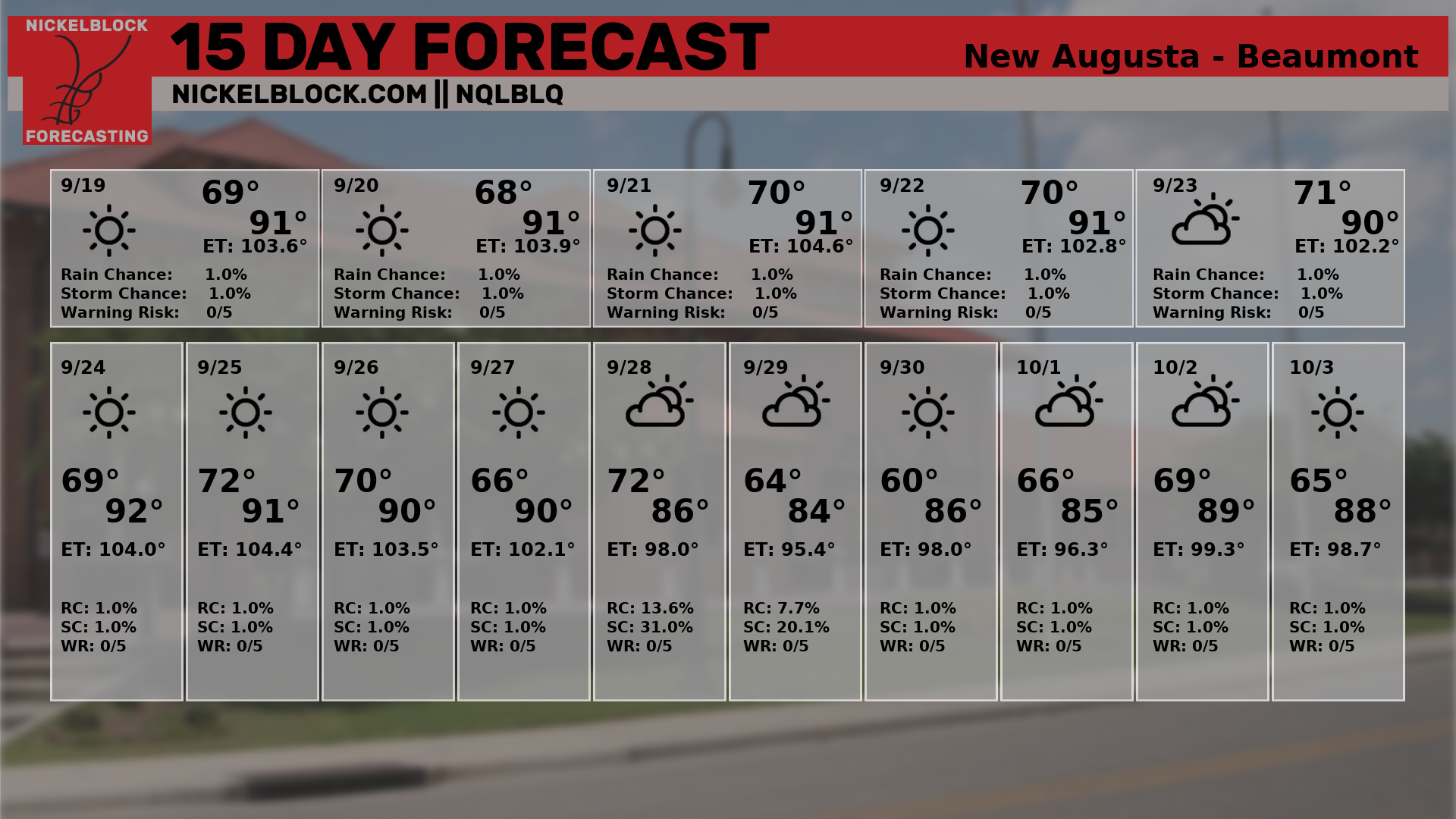
Then things clear out for the weekend and look really nice for next week. Look at thsi 15-day forecast for Hattiesburg/Petal/Oak Grove. While we do warm abck up toward the middle of the month, I actually think we will avoid any more widespread 90s after this cold front.

One may even say, this is THE Fall Cold Front. Sure we will warm back up, and see days back in the upper 80s again and maybe a handful of 90s here and there. But this is the Summer Buster.
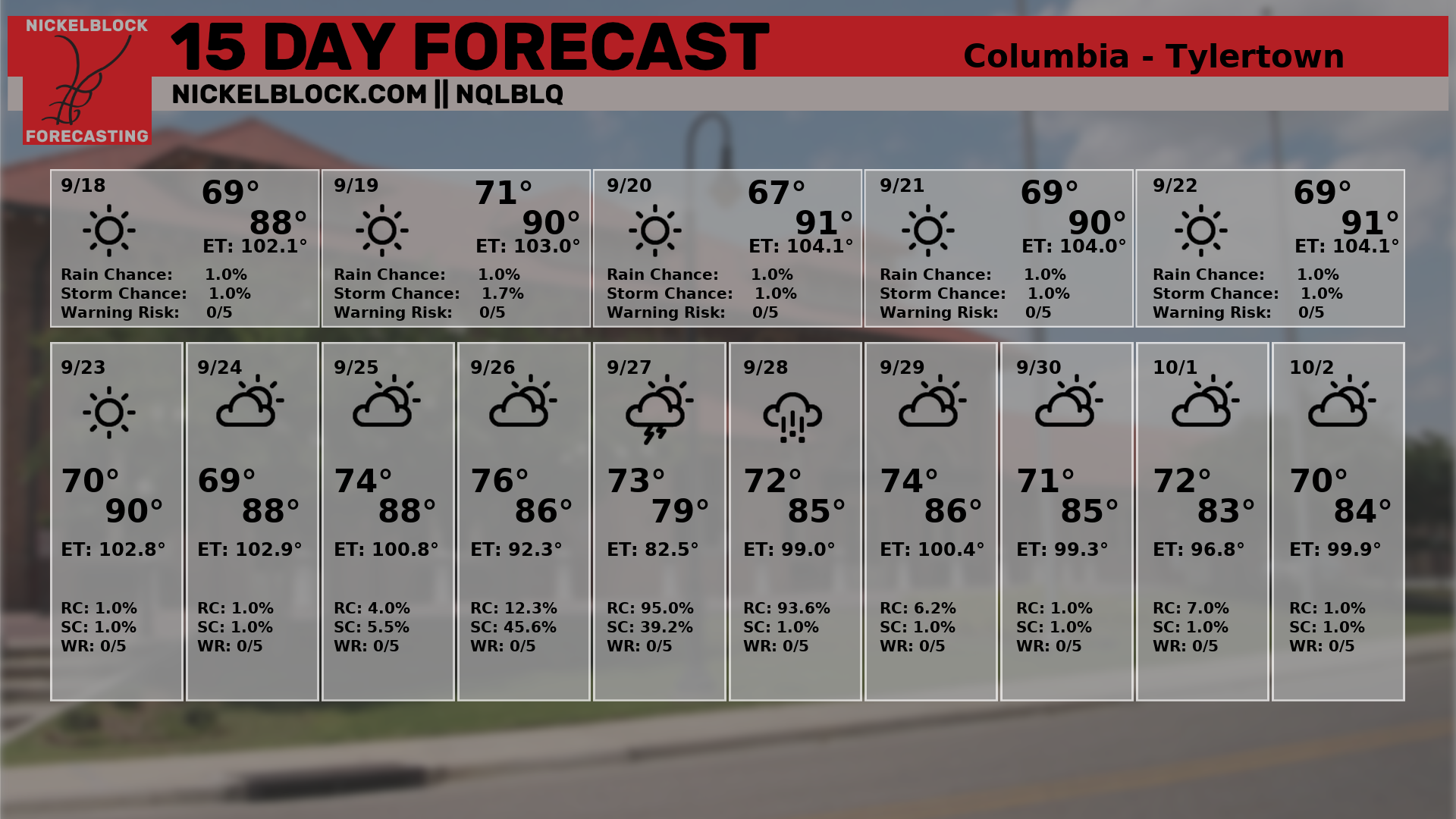
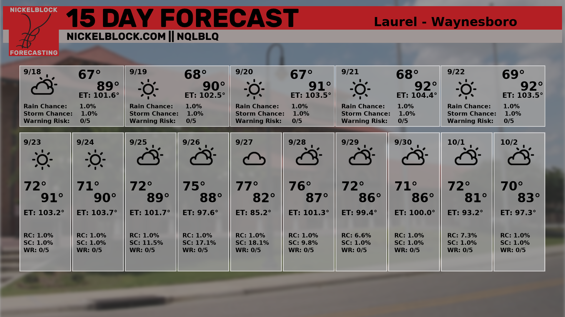
And here is a look at the rest of the 15-day forecasts for South Mississippi. I still need to build more of these out for other areas, too.
All of this while we monitor any potential developments in the Gulf.
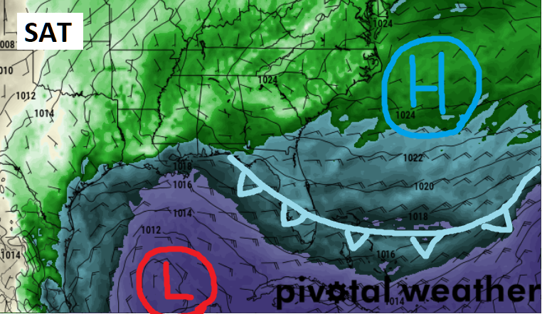
Speaking of, it looks like a tandem of systems will glide by the region helping to keep whatever is out there, out there and not near here. You’ll likely see local TV folks put a big cold front across parts of the northern Gulf indicating that we are “safe” from this thing.
While that is generally true, it is incomplete.
Yes, a cold front is coming. Yes it will help to knock back dewpoints – and also temperatures – into a much more comfortable Fall range. And yes, it will also help to stave off anything in the Gulf from moving due north. And may do a good job at capturing whatever is out there and ushering it to the east.
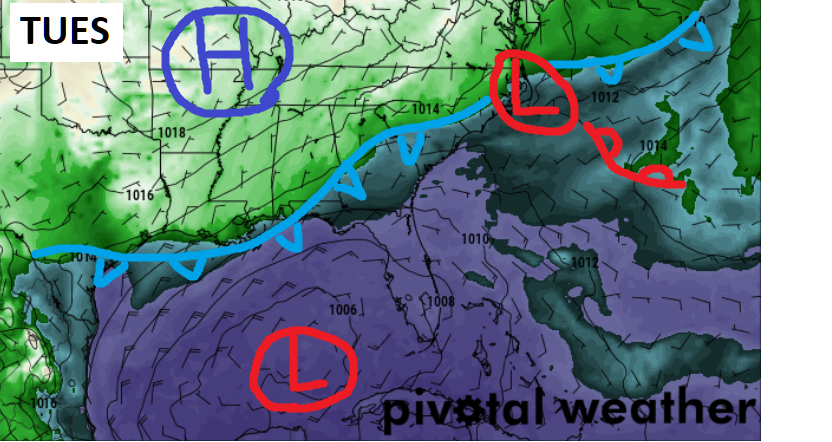
But depending on the trajectory of the front and how well it tries to pick up whatever is out there, there is a chance it doesn’t get all of it. And there is a chance that a bit of mid-level spin may be lingering along the tail end of the front to try and spin up another ‘something’ out in the Gulf like this thing never even left.
That would show up next Saturday. To be extra clear here, I mean next Saturday – not this Saturday, next one. October 12th.
So, sure we may have a front that will help keep this one away, but not completely.
I will note, though, that either way, the NHC isn’t really confident it will ever turn into anything at all, anyway.

The NHC only pegs the area with a 30% chance of development.
REGIONAL DAY TO DAY FORECAST
Today: Mostly sunny and you can’t rule out a shot for a shower. Highs in the upper 80s. East winds 5 to 10 mph. Chance of rain 10 percent.
Tonight: Mostly cloudy with some rain and thunder possible. Lows in the lower 70s. East winds around 5 mph. Chance of rain 40 percent.
Friday: Passing storms possible. Highs around 80. Northeast winds 5 to 10 mph. Chance of rain 60 percent.
Friday Night: Mostly cloudy. Lows in the upper 60s. Northeast winds 5 to 10 mph.
Saturday: Partly sunny in the morning, then becoming mostly cloudy. Highs in the mid 80s. Northeast winds 5 to 10 mph.
Saturday Night: Mostly cloudy. Lows in the upper 60s.
Sunday: Mostly sunny. Highs in the mid 80s.
Sunday Night: Partly cloudy in the evening, then clearing. Lows in the mid 60s.
Monday: Sunny. Highs in the upper 80s.
Monday Night: Mostly clear. Lows in the mid 60s.
Tuesday: Sunny. Highs in the lower 80s.
Tuesday Night: Mostly clear. Lows around 60.
Wednesday: Sunny. Highs in the lower 80s.


Correct me if I’m wrong but I believe it was the tail-end of a front in the Gulf that helped get Francine going. Ah, I believe the term is ‘frog’ strangler.