Not much to report this week. IT is a nice change of pace!
We should have mostly sunny skies most of the week with temperatures hanging in the upper 50s to mid 60s each day. No real chance for rain until we get toward the weekend.

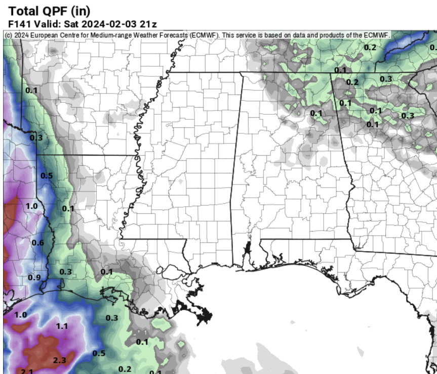
By Saturday and Sunday we should have a little system zip through that will offer a shot for rain.
So far, it looks like a warm front will try to lift northward through the area, on Saturday night, ahead of the next area of low pressure. But the low will pass through so quickly that we may not have enough time to pool enough warm, humid air to worry about severe weather.
Instead, we will see some rain overnight that should clear out as we move through the day on Sunday.
Like I said, pretty uneventful!
REGIONAL DAY T DAY FORECAST
Monday: Sunny. Highs in the upper 50s. North winds 5 to 10 mph.
Monday Night: Mostly clear. Lows in the mid 30s. North winds around 5 mph.
Tuesday: Mostly sunny. Highs in the mid 60s. West winds 5 to 10 mph.
Tuesday Night: Partly cloudy in the evening, then clearing. Lows in the lower 40s. Southwest winds 5 to 10 mph.
Wednesday: Sunny. Highs in the mid 60s.
Wednesday Night: Partly cloudy. Lows in the upper 30s.
Thursday: Mostly sunny. Highs in the lower 60s.
Thursday Night: Mostly cloudy. Lows in the lower 40s.
Friday: Mostly sunny. Highs in the upper 60s.
Friday Night: Mostly clear in the evening, then becoming partly cloudy. Lows in the lower 40s.
Saturday: Mostly sunny. A slight chance of showers in the afternoon. Highs in the upper 60s. Chance of rain 20 percent.
Saturday Night: Mostly cloudy. A chance of showers in the evening, then showers likely after midnight. Lows in the upper 40s. Chance of rain 60 percent.
Sunday: Partly sunny with a 50 percent chance of showers. Highs in the lower 60s.

