First, I want to make sure everyone is doing okay after Francine passed through last night. I know it wasn’t as eventful, locally, as anticipated, but there were still plenty of power outages and trees down across the area.
Secondly, I want to say thank you to everyone who donated to my paypal to buy me pizza or coffee. Super nice of everyone who donated. Thank you, thank you, thank you! And know that one the menu for tonight: Pizza!
Okay, now to the weather!
It should be pretty nice during the next 48 hours as we will be a bit too far south to see much rain from the remnants of Francine and we will have the dry air that ate up that storm lingering around.
Okay, it’ll still be a bit humid — but not as bad as it was for certain.
The only real hurdle will be the wind slowly easing off during the next 24 hours. It’ll still be breezy this afternoon and evening but by tomorrow morning, should be a bit more manageable.
Temperatures will rebound tomorrow back to around 90 for some folks, but many areas will be between 85 and 90.
The pattern through the weekend will leave the remnants of Francine to the north as ridging starts to build in across Texas and then up into the Northeast. This will leave Francine floating around and leave us in a bit of a northwest flow.
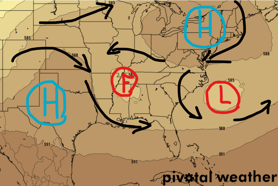
And a northwest flow for us, is generally a dry pattern. So the ground will have some time to dry out a bit after soaking up all of that rain.
The pattern doesn’t really shift much during the next week – aside from Francine finally moving out – with the ridge in place to our west. We may see the return of a few afternoon storms, but we are starting to get a bit too late in the season for those to be a daily occurrence that is widely scattered. Instead any afternoon storms would be more isolated.
That gives us plenty of time to keep tabs on what is happening out in the tropics!
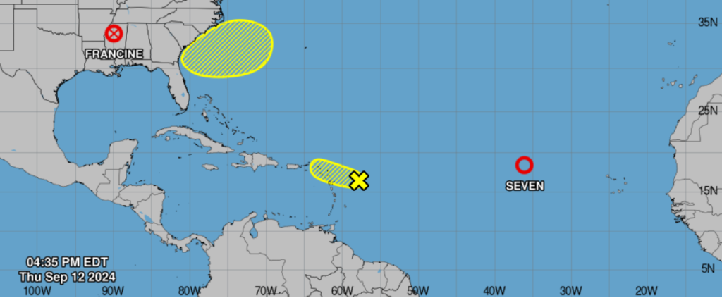
Nothign out there now poses any kind of immediate threat to the Gulf. But there won’t be much happening around here through the weekend, so I’ve got plenty of time to keep tabs on things!
REGIONAL DAY TO DAY FORECAST
This Afternoon: Mostly sunny. Near steady temperature in the lower 80s. Southwest winds 15 to 20 mph with gusts up to 30 mph.
Tonight: Partly cloudy. Lows in the upper 60s. South winds 5 to 10 mph.
Friday: Mostly sunny. Highs in the mid 80s. West winds 5 to 10 mph.
Friday Night: Mostly clear. Lows in the upper 60s. Southwest winds around 5 mph.
Saturday: Sunny. Highs in the upper 80s. West winds around 5 mph.
Saturday Night: Partly cloudy in the evening, then becoming mostly cloudy. Lows in the upper 60s.
Sunday: Mostly sunny. A slight chance of showers and thunderstorms in the afternoon. Highs in the mid 80s. Chance of rain 20 percent.
Sunday Night: Partly cloudy with a slight chance of showers and thunderstorms in the evening, then mostly clear after midnight. Lows in the upper 60s. Chance of rain 20 percent.
Monday: Mostly sunny. A chance of showers and thunderstorms in the afternoon. Highs in the upper 80s. Chance of rain 20 percent.
Monday Night: Mostly clear. A slight chance of showers and thunderstorms in the evening. Lows in the upper 60s. Chance of rain 20 percent.
Tuesday: Sunny. A chance of showers and thunderstorms in the afternoon. Highs in the upper 80s. Chance of rain 20 percent.
Tuesday Night: Mostly clear. Lows in the upper 60s.
Wednesday: Sunny. A slight chance of. Highs around 90.


