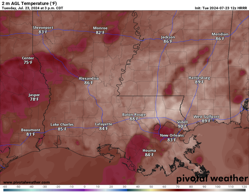
The weather pattern today and tonight remains unchanged from the past few days, As the day warms up, showers and a few thunderstorms will develop where surface-based instability is higher. Showers will move slowly at times and may lead to some localized flash flooding.
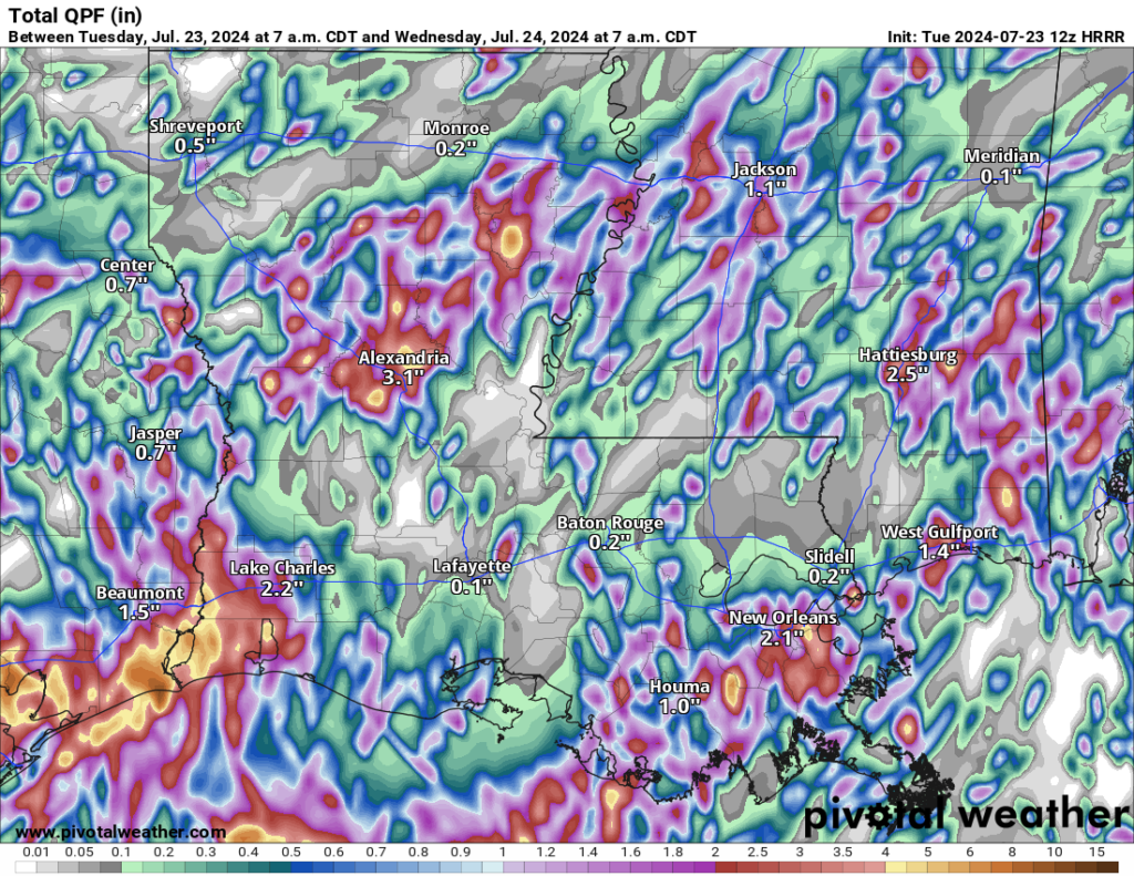
Looking ahead through the week and into the weekend, there doesn’t look to be much of a change. We are locked into this pattern currently. The limited flash flooding threat will persist through at least Friday, especially south of I-20.
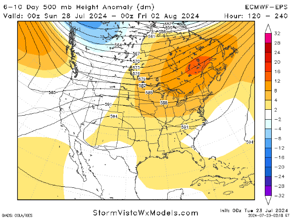
A change may be on the horizon – sort of. As we look at the forecast for next week, we will see some extra ridging across the area, but we may still be stuck in a Northwest Flow to some extent.
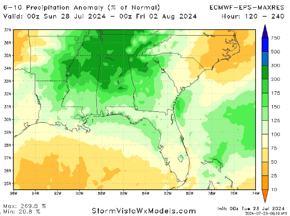
So we will still have the afternoon storms here and there, but it may pivot the highest rainfall totals to the north a bit. That would mean longer breaks between storms for some folks and a chance to dry out a bit – without turning into the Sahara.
REGIONAL DAY TO DAY FORECAST
Today: Partly sunny. A chance of showers and thunderstorms this morning, then showers and thunderstorms likely this afternoon. Highs around 90. Temperature falling into the mid 80s this afternoon. South winds around 5 mph. Chance of rain 70 percent. Heat index values up to 105.
Tonight: Mostly cloudy with a chance of showers. A chance of thunderstorms, mainly in the evening. Humid with lows in the lower 70s. Southeast winds around 5 mph in the evening, becoming light and variable. Chance of rain 40 percent.
Wednesday: Showers and thunderstorms. Humid with highs in the mid 80s. East winds around 5 mph, becoming south around 5 mph in the afternoon. Chance of rain 70 percent.
Wednesday Night: Mostly cloudy. A chance of showers and thunderstorms in the evening. Lows in the lower 70s. East winds around 5 mph in the evening, becoming light and variable. Chance of rain 40 percent.
Thursday: Mostly sunny. A chance of showers and thunderstorms in the morning, then showers and thunderstorms likely in the afternoon. Humid with highs in the upper 80s. Northwest winds around 5 mph. Chance of rain 60 percent.
Thursday Night: Partly cloudy. A slight chance of showers and thunderstorms in the evening. Lows in the lower 70s. Chance of rain 20 percent.
Friday: Mostly sunny. A slight chance of showers and thunderstorms in the morning, then a chance of showers and thunderstorms in the afternoon. Highs around 90. Chance of rain 60 percent.
Friday Night: Mostly cloudy. A slight chance of showers and thunderstorms in the evening. Lows in the lower 70s. Chance of rain 20 percent.
Saturday: Partly sunny. A slight chance of showers and thunderstorms in the morning, then a chance of showers and thunderstorms in the afternoon. Highs around 90. Chance of rain 40 percent.
Saturday Night: Mostly cloudy. A slight chance of showers and thunderstorms in the evening. Lows in the lower 70s. Chance of rain 20 percent.
Sunday: Partly sunny with a chance of showers and thunderstorms. Highs in the lower 90s. Chance of rain 40 percent. Heat index values up to 105.
Sunday Night: Mostly cloudy with a slight chance of showers and thunderstorms in the evening, then partly cloudy after midnight. Lows in the lower 70s. Chance of rain 20 percent.
Monday: Mostly sunny. A chance of showers and thunderstorms in the morning, then showers and thunderstorms likely in the afternoon. Highs in the lower 90s. Chance of rain 40 percent. Heat index values up to 110.


