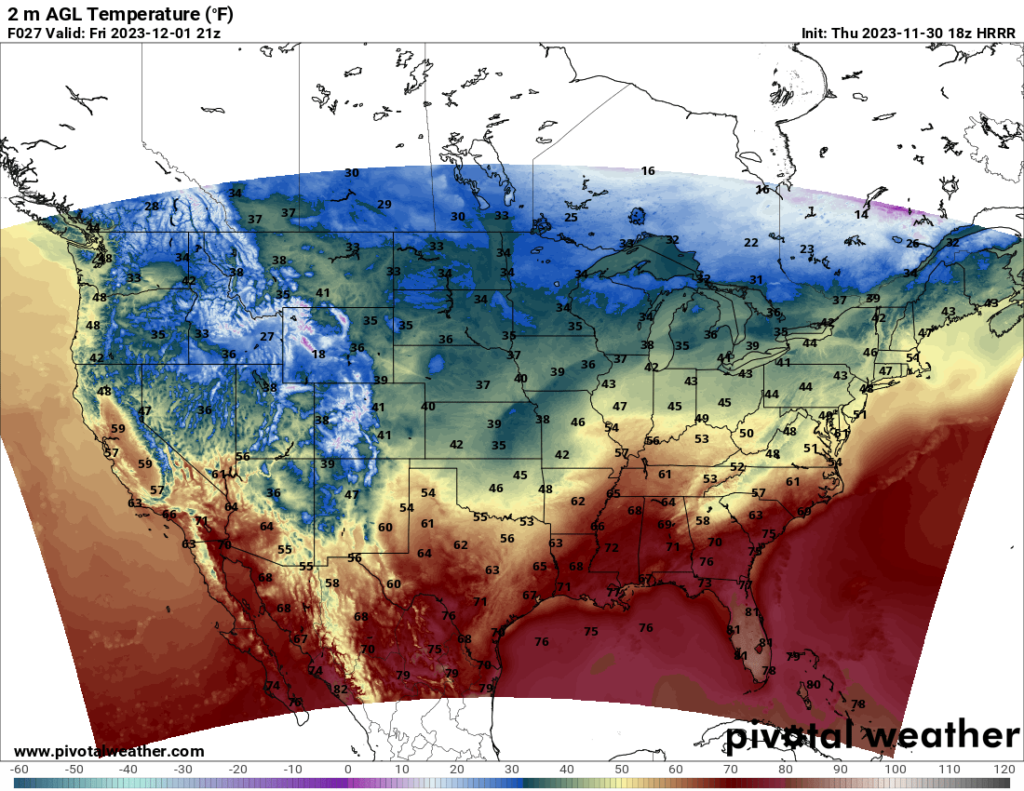
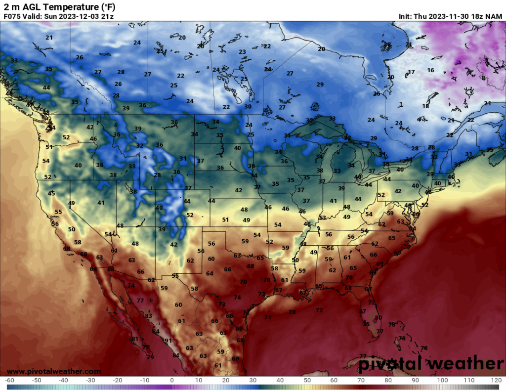
As we enter December and the start of meteorological winter, the temperatures definitely reflect the time of year. Chilly to cold temperatures are expected across most of the CONUS this weekend, and the only areas with fair to pleasant temperatures will be in parts of the South, although as we will soon see, many Southerners will not be able to go outside to enjoy the nicer temperatures.
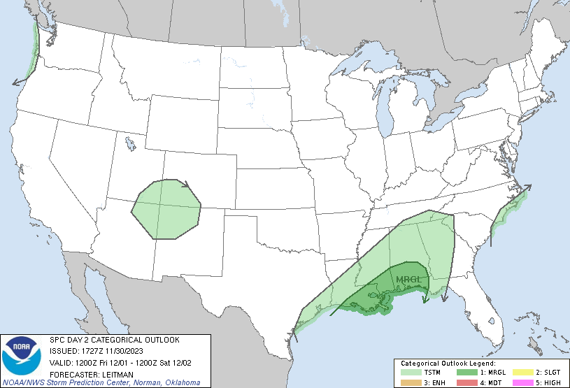
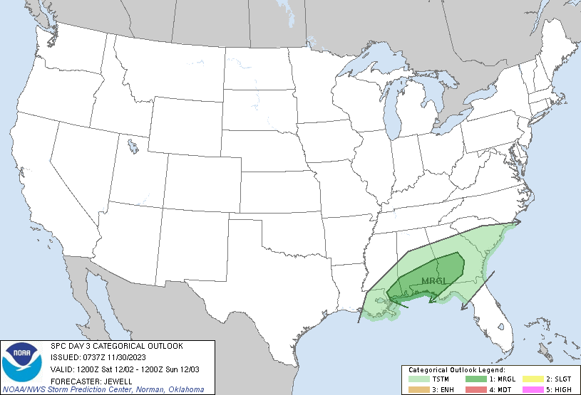
The Southeast can expect a lot of rain this weekend. Friday and Saturday have a Marginal Risk for severe storms, with the main threats being strong winds and isolated tornadoes for both days. The SPC notes that there is uncertainty at this point that limits any greater severe risk areas at this time, but it is possible either of these risk areas could be updated to Slight if favorable conditions for severe weather become apparent. The biggest limiting factor right now is instability. Shear and moisture are sufficient, but instability will be on the lower side, so any areas with greater instability will see higher chances for severe weather. With the current model runs, the greatest instability is forecast to be near the Gulf Coast, owing to warm air being brought in from the Gulf.
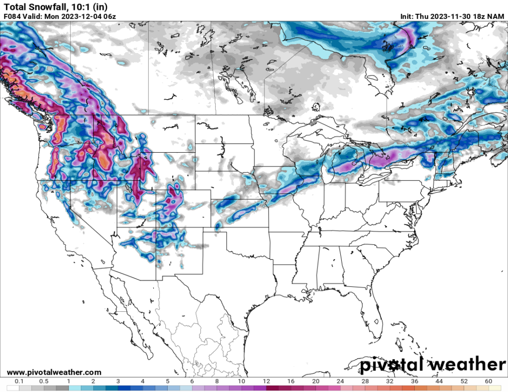
Other parts of the country are expected to see snow this weekend. The Mountain West states, particularly those in the northwest part of the country, are expected to see a fair amount of snow this weekend, with the high elevations potentially seeing feet of snow. Some Midwestern states may see snow this weekend as well.

