We have dipped quite a bit below the anticipated temperatures for today! Many of us have only reached the mid 30s for today’s high while to our north it’s still below freezing and will stay that way overnight! Temperatures will fall well below the freezing mark tonight and the north winds will only add to the dangerously cold weather. We’re going to be in the low 20s tonight which means that pipes need to be wrapped, pets taken inside, and plants covered. The wind chill will fall into the low teens tonight as well.
Tomorrow looks to be another chilly day with the north winds still reigning strong. Wind gusts over 20mph are possible and highs will just reach the low 40s, however the experienced temperature will make it feel more like the 20s. Clouds will clear out during the day which means we’ll at least have some sun, but overall it’ll be a very chilly day. Overnight, the temperatures will plummet again into the low 20s with wind chills in the low to mid teens. By Friday, the winds will shift a bit eastward and die down a bit with some upper level clouds moving in. Temperatures will rise to the upper 40s and fall below the freezing mark once again.
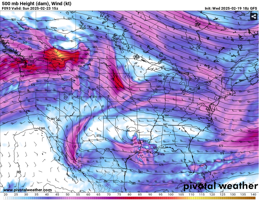
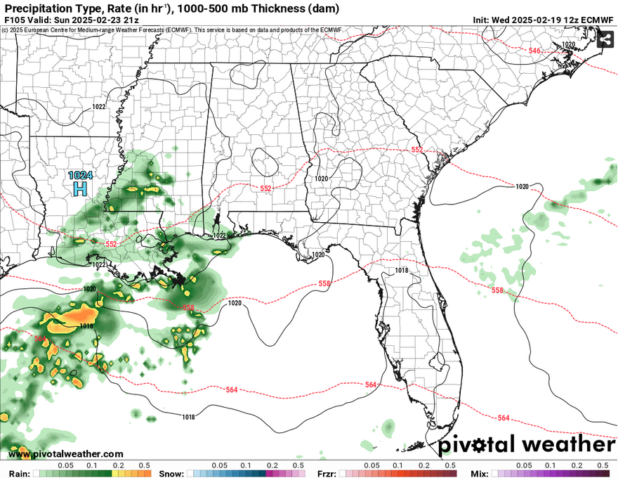
Saturday will be a slightly warmer day with more upper level clouds moving in, anticipating a small system on Sunday. Highs will reach the mid 50s during the day and fall into the low 30s overnight. Overnight, a closed upper level low and a system from the Gulf of Mexico will bring in a brief rain shower for much of Louisiana and southern Mississippi and Alabama. Not much is expected of this except for a little over 1/4 of an inch for much of us, more for southern Louisiana. It will be enough to kill some Sunday afternoon plans, however, so you may have to stay in after church.
Afterwards, we’ll be on a warming trend! It’ll be quite nice afterwards with temperatures slowly climbing from the mid 60s on Monday to the mid 70s by Wednesday. Lows will rise from the low 40s to upper 40s as well. Our only other concern will be overnight on Wednesday with another closed low moving over the mid-South. This looks to be fairly weak so far, but it will bring some overnight and early morning rain. The system itself looks to be hindered by a surface high that remains over us which may kill some of the moisture flow, but for now, it looks like a small chance of an organized system moving in.
Select Data Set:

Regional Day-to-Day Forecast
Tonight – Mostly cloudy, with a low in the low 20s. North wind 10 to 15 mph, with gusts as high as 25 mph.
Thursday – Partly sunny, then gradually becoming sunny, with a high in the low 40s. North wind 10 to 15 mph, with gusts as high as 25 mph.
Thursday Night – Clear, with a low in the low 20s. North northeast wind 5 to 10 mph.
Friday – Sunny, with a high in the mid 40s. Northeast wind around 5 mph.
Friday Night – Mostly cloudy, with a low around 30. Calm wind.
Saturday – Mostly sunny, with a high in the mid 50s. Calm wind.
Saturday Night – Partly cloudy, with a low in the low 30s. Calm wind.
Sunday – A 30 percent chance of showers. Partly sunny, with a high in the mid 50s. North northeast wind around 5 mph becoming calm.
Sunday Night – Partly cloudy, with a low in the mid 30s. Calm wind.
Monday – Sunny, with a high in the mid 60s.
Monday Night – Clear, with a low in the low 40s.
Tuesday – Sunny, with a high in the mid 70s.
Tuesday Night – Mostly clear, with a low in the upper 40s.
Wednesday – Mostly sunny, with a high in the mid 70s.


