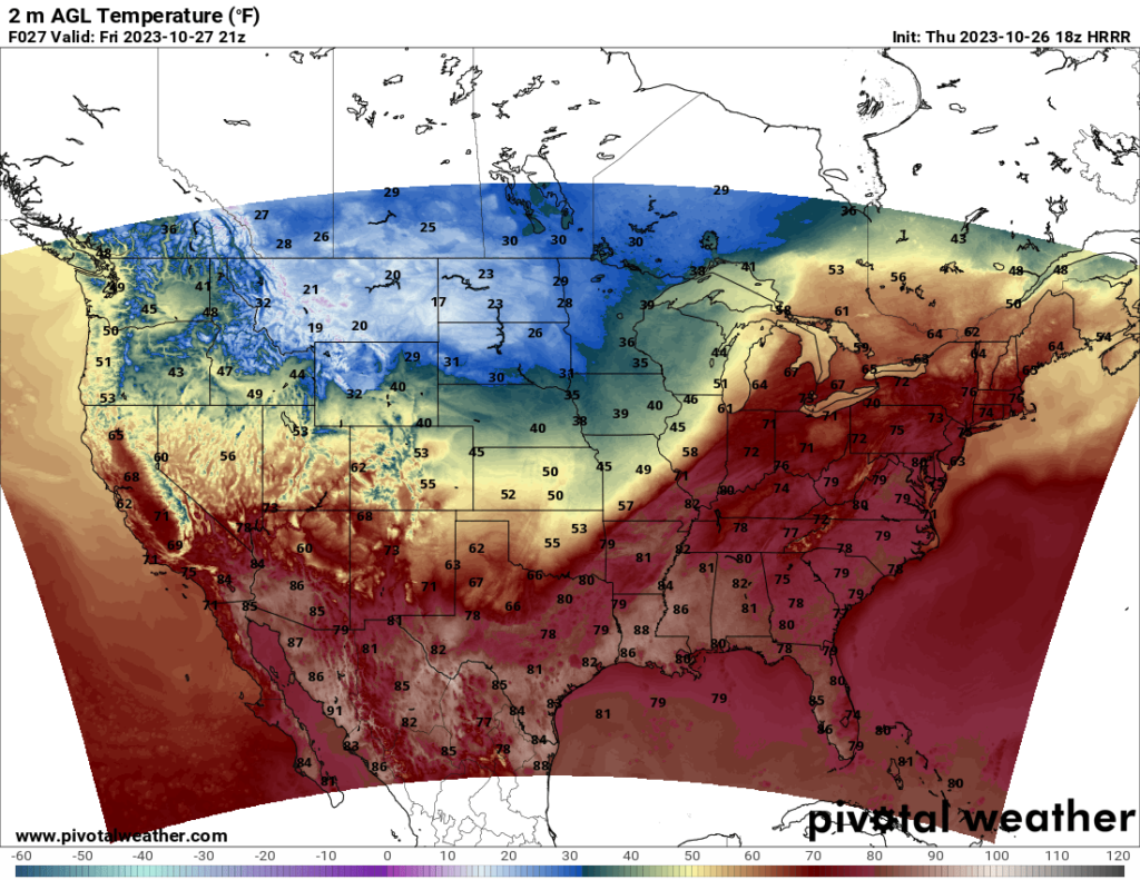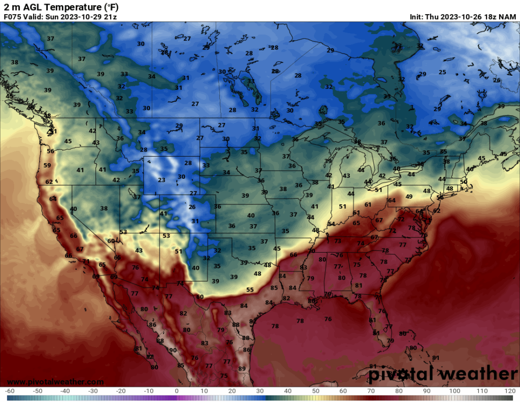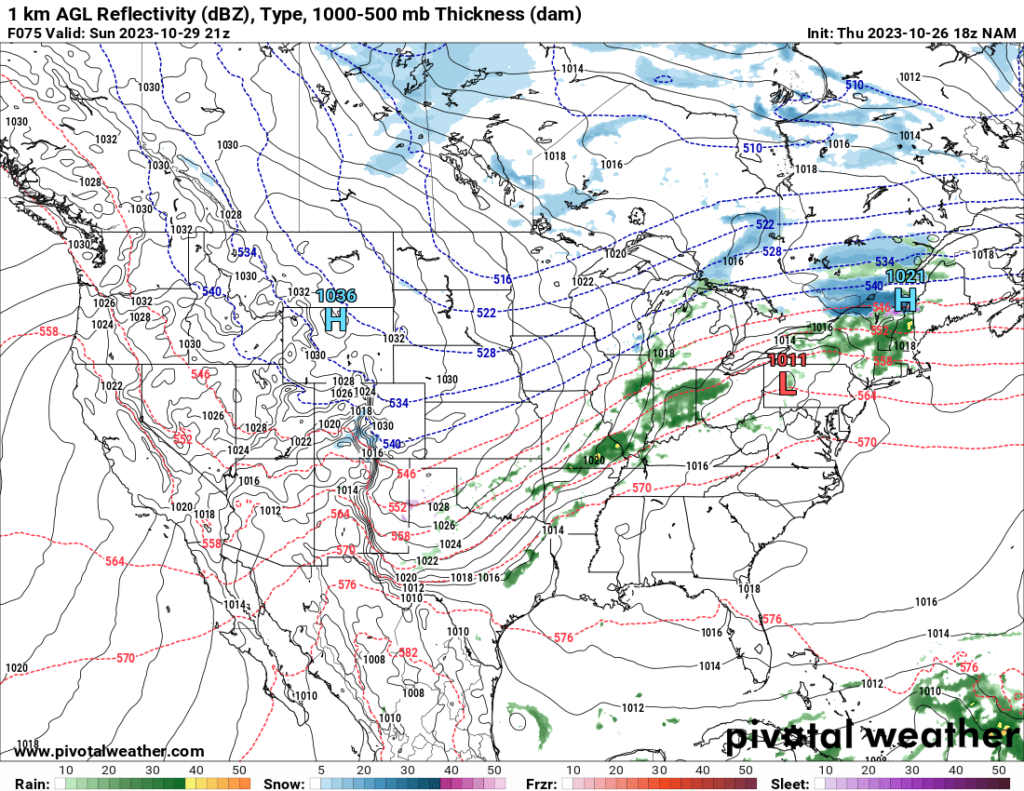
Heading into the weekend, a cold front is making its way across the central US and into the Midwest. The front will progress southeastward during the weekend, bringing unseasonably cold temperatures to some areas, particularly across the Plains. The northern Plains and Mountain West states will see very cold low temperatures, dipping into the teens and even single digits in some areas. Meanwhile, ahead of the cold front, the Southeast will see warm temperatures throughout the weekend, with highs in the upper 70s and 80s.


Showers and thunderstorms will form along the front and bring rain to the South Central US, the Midwest, and eventually the Northeast as the front progresses. Severe potential remains limited owing to relatively weak instability ahead of the front and insufficient shear in the areas where instability is greater. The SPC currently does not have any severe risk areas highlighted over the weekend. If any severe threat materializes, it will likely be isolated.

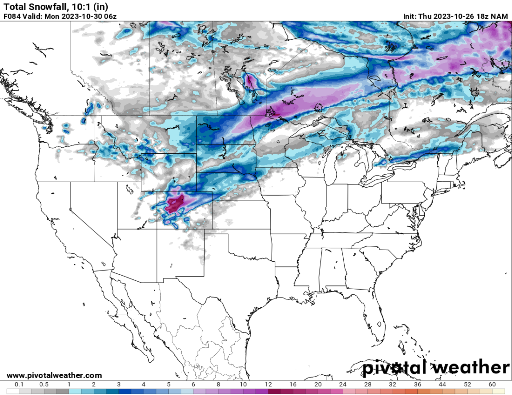
The heavy snowfall that affected Montana and the Dakotas this week will move out into Canada early Friday morning, but lighter snow is likely in the northern Plains (particularly Nebraska and South Dakota) and Midwest on Saturday.
Elsewhere, mainly sunny conditions are forecast in the West Coast states, Southwest, and Southeast.

