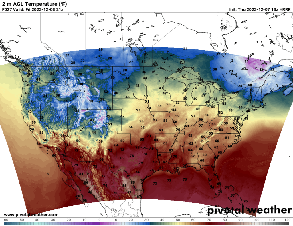
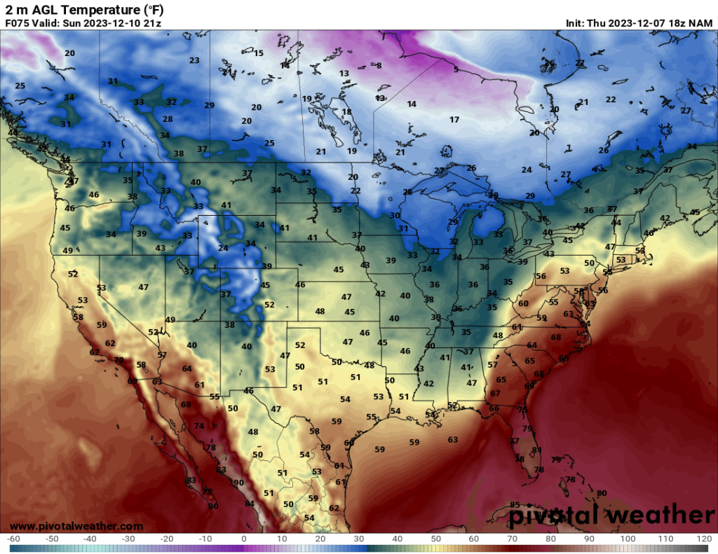
Heading into the weekend, a cold front is expected to move across the Midwest and Southeast. The front will begin in the southern to central Plains and progress eastward throughout the weekend. The mild temperatures in the South will be replaced by chilly air.
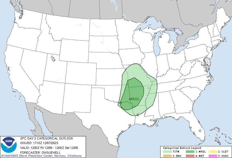
The advancing cold front will bring with it a multi-day severe threat. The threat Friday is mainly for isolated hail across the highlighted region on the map above.
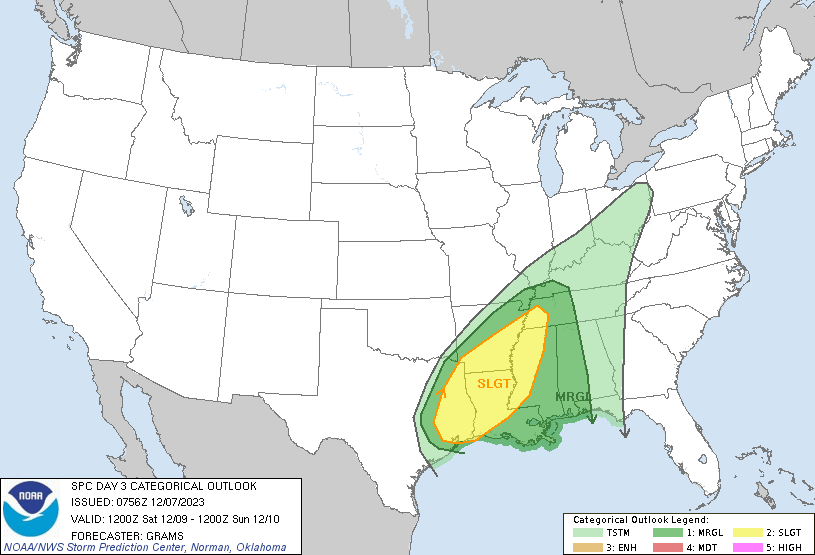
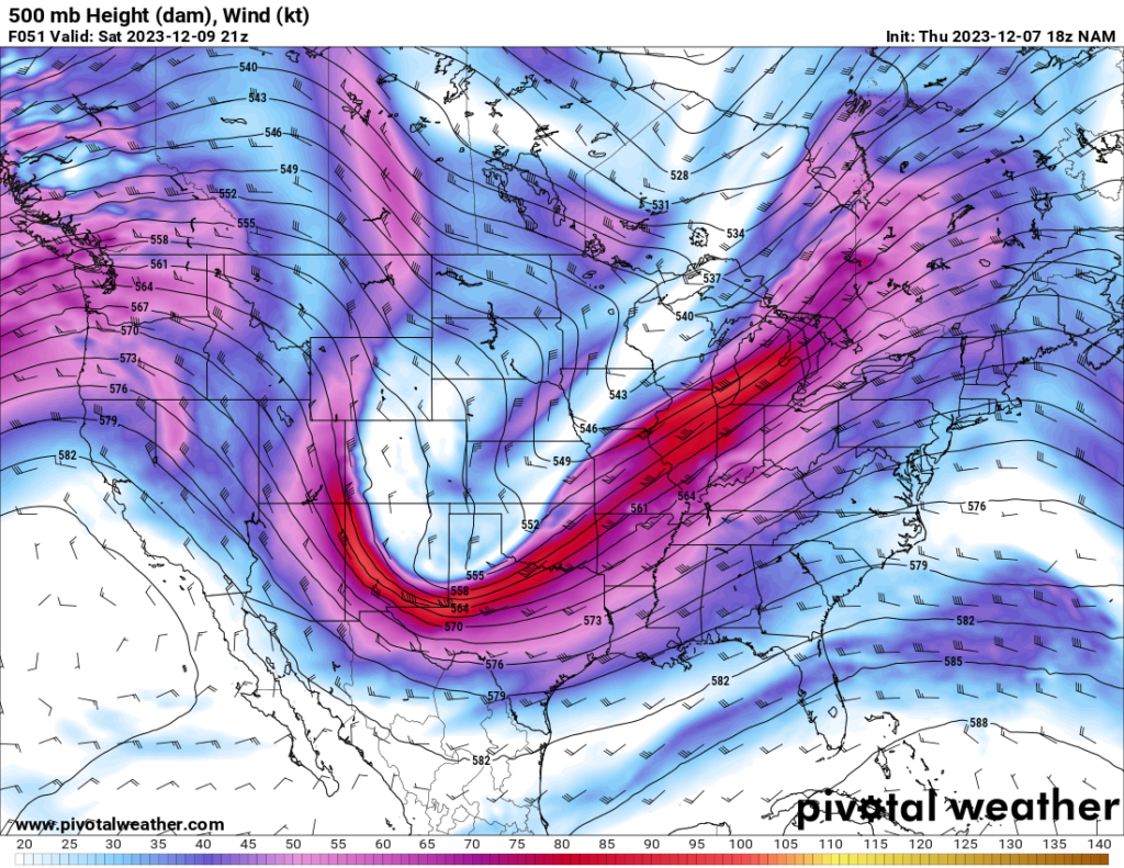
The threat for Saturday appears to be the more significant severe threat of the weekend. Wind, hail, and tornadoes are all potential risks associated with this threat. Strong shear combined with moderate CAPE and a deepening trough to the west (shown above) will provide favorable conditions for severe weather. The biggest threat so far, based on the latest NAMNEST model run, appears to be in northern Louisiana and southern Arkansas. The SPC currently has the maximum risk area at Slight, but it is very possible they upgrade it to Enhanced in a future update. Anyone in the highlighted risk areas should keep monitoring their forecasts as they update.

