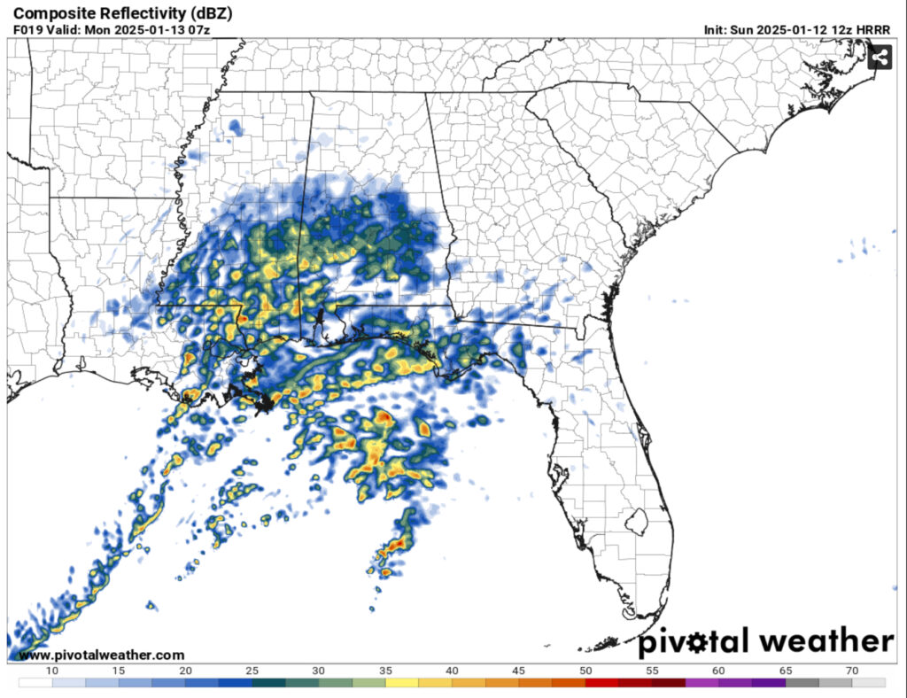
This evening we’ll have another chance for rain with a low pressure system from the Gulf. This won’t arrive until later tonight and remain in the overnight hours. The only people receiving thunderstorms will be those that live towards the mouth of the Mississippi River in South Louisiana. For us, we’ll likely see up to three quarters of an inch in rain by the morning time and this will exit before noon.
Coming in behind this front will be much more seasonal temperatures for much of the week. A surface high will take prevalence over us for a few days and keep the winds down a bit and the temperatures towards the 50s during the day and around the freezing point from Monday to Thursday. Expect some frosty mornings in the mornings, so if you have plants, still cover them and get some cold water cups ready for the defroster on your car.
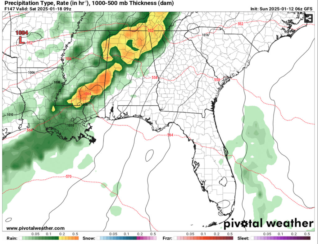
Beginning Friday, we’ll have another chance for rain as a trough from the western Pacific moves in and begins to weaken over the Plains region. This to say, it doesn’t look much like a severe weather event, but it definitely looks like a heavy rain event. So far, the European model shows the low pressure forming as it moves and pulls moisture from a system in the Gulf and bringing in rain on Friday and eventually dumping more rain overnight into most of Saturday. The GFS is only showing rain on Saturday, so the probability for Friday may likely change in the next few model runs and even the next few days.
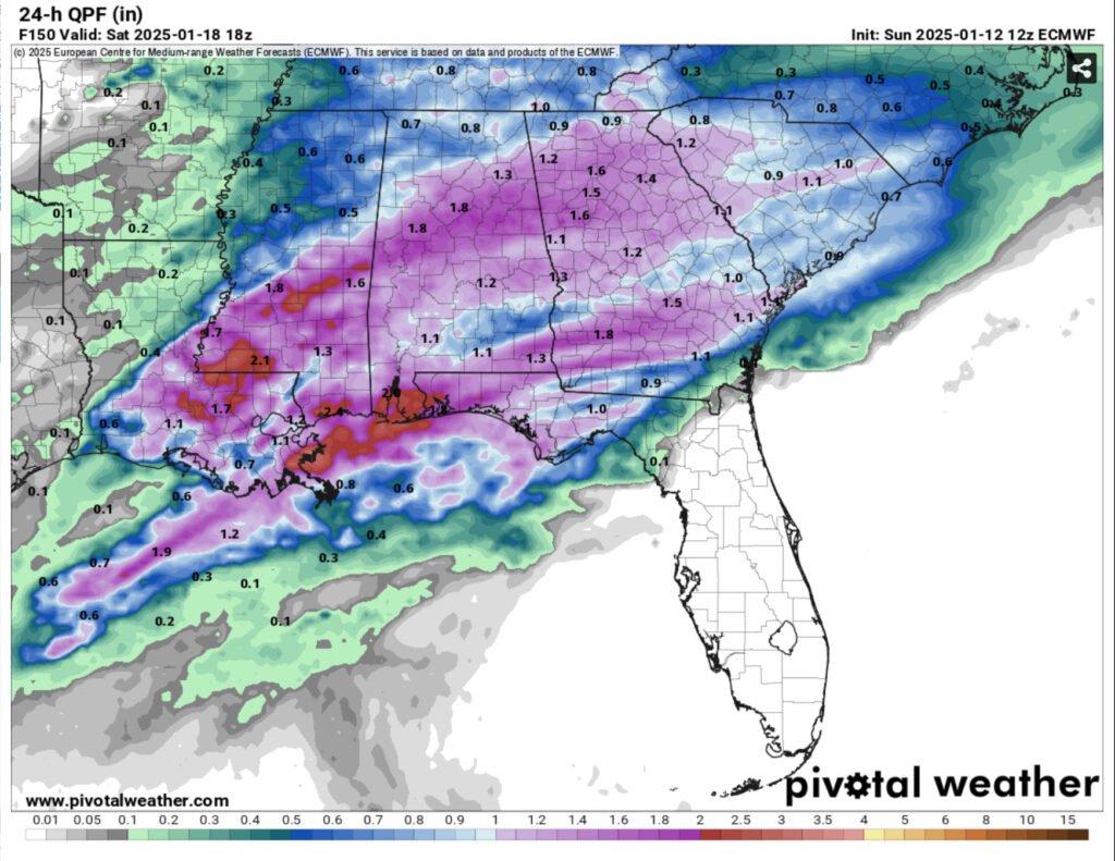
So far, the European model has rainfall totals up to 2.5 inches in some areas while others are averaging around 1.25 inches. There are some areas that may see some thunderstorms develop if conditions are right, but this isn’t a big convection type event so far. Sunday will be a much cooler day much like we’ve had lately with highs in the 40s and the low will drop into the mid 20s.
Winter Weather
I’m sure some people have already hyped up the possible winter weather after MLKJ day and it’s still tough to call. The reason being that the models have flip flopped to all or nothing in the past dozen hours. Needless to say, it’s still very far out, but I’m not going to say it isn’t possible.
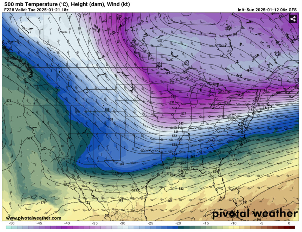
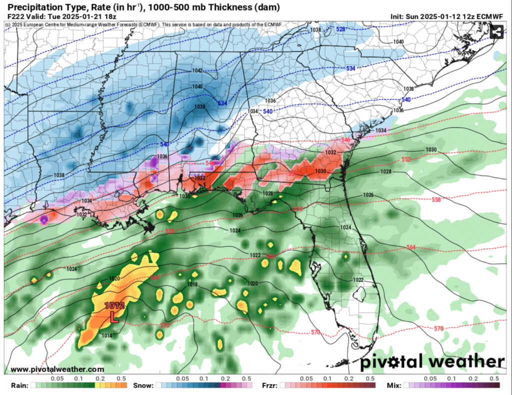
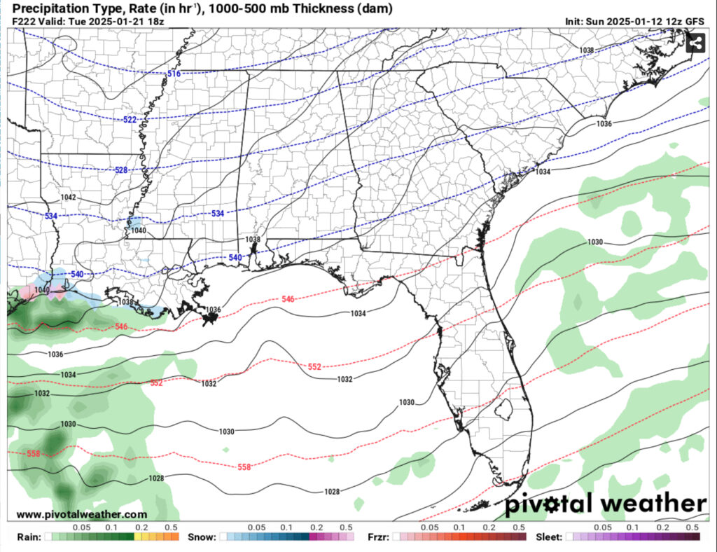
Looking at the maps above, there’s some tell-tale signs that if the winter weather doesn’t happen, it still will be cold. The setup in the atmosphere is indicative of another cold couple of days possible in the middle of next week. But to emphasize my point about long-range output in medium range models, the European (center) and the GFS (right) look entirely different at the same time next Tuesday. Not 6 hours before did the GFS show a similar outlook to the Euro! So keep that in mind for the next few days until the models come into more agreement about what may happen. I’ll keep you all updated on my page and Nick will on the blog as well as his page.
Select Data Set:

Regional Day-to-Day Forecast
This Afternoon – A chance of drizzle around sunset. Partly sunny, with a high in the upper 40s. East southeast wind around 5 mph becoming calm.
Tonight – A chance of rain after dark to the early morning. Low in the low to mid 40s. Calm wind becoming north northeast around 5 mph after midnight. Chance of precipitation is 90%. New precipitation amounts between a half and three quarters of an inch possible.
Monday – A 40 percent chance of rain, mainly before 8am. Cloudy, with a high in the low 50s. North wind 5 to 10 mph.
Monday Night – Widespread frost, mainly after midnight. Otherwise, partly cloudy, with a low in the upper 20s. North wind around 5 mph.
Tuesday – Widespread frost before 7am. Otherwise, partly sunny, with a high in the low 50s. North northeast wind around 5 mph.
Tuesday Night – Mostly cloudy, with a low in the low 30s. Calm wind.
Wednesday – Mostly sunny, with a high in the mid 50s. Calm wind becoming north northwest around 5 mph.
Wednesday Night – Mostly clear, with a low around 30. Calm wind.
Thursday – Sunny, with a high in the upper 50s. Calm wind becoming west around 5 mph.
Thursday Night – Partly cloudy, with a low in the low to mid 30s.
Friday – A 30 percent chance of rain. Mostly sunny, with a high in the low to mid 60s.
Friday Night – Rain likely. Mostly cloudy, with a low around 50. Chance of precipitation is 60%.
Saturday – Rain likely. Mostly cloudy, with a high in the mid 60s. Chance of precipitation is 60%.

