The calmer weather continues today with sunny skies and highs in the 50s. We’ll take it! Sure beats ice storms, tornadoes, or floods.
Looking down the street a bit further, the pattern we’ve been in looks like it is going to flip a bit.


The current pattern (above on the left) leaves the region cooler (but not usually as dry as we are seeing things right now) while the pattern 7 days from now (above on the right) tends to be a bit warmer.
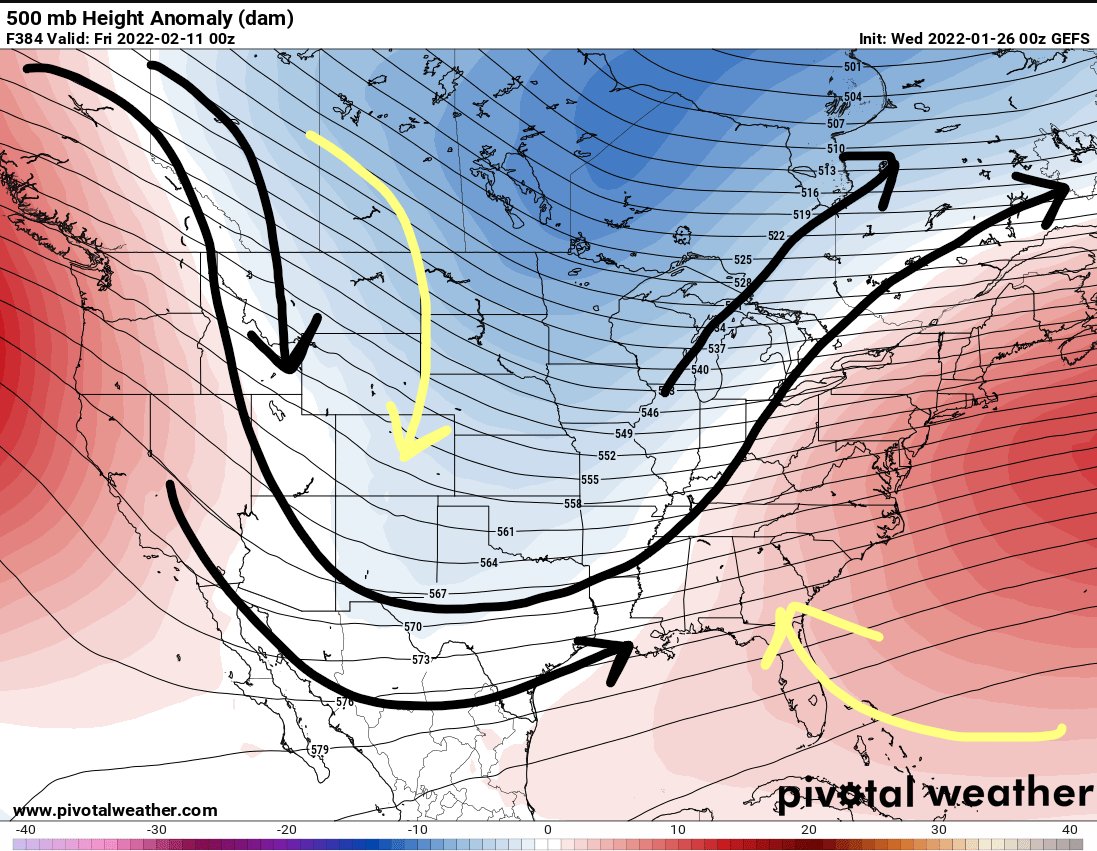
When you look all the way toward about Feb 10th, you can see the overall pattern suggests a big U shape in the middle of the country. This tends to line up with more active weather for the region, too.

So enjoy this calmer weather. Because as we move into February, it looks like things may start to pick back up again.
Day to Day Forecast
Today
Sunny. Highs in the lower 50s.
Tonight
Mostly clear. Lows in the upper 20s.
Thursday
Sunny. Highs around 60.
Thursday Night
Partly cloudy in the evening then becoming mostly cloudy. Warmer. Lows around 40.
Friday
Passing clouds. Cooler and breezy. Highs around 50. Northwest winds 10 to 15 mph. Gusts up to 25 mph in the afternoon.
Friday Night
Clear, colder. Lows in the upper 20s.
Saturday
Sunny. Highs around 50.
Saturday Night
Clear. Lows in the upper 20s.
Sunday
Sunny, warmer. Highs around 60.
Sunday Night
Mostly clear. Lows in the upper 30s.
Monday
Mostly sunny in the morning then becoming partly cloudy. Highs in the lower 60s.
Monday Night
Partly cloudy with a 20 percent chance of light rain. Lows in the mid 40s.
Tuesday
Mostly cloudy with a 40 percent chance of light rain. Highs in the mid 60s.


