We have a relatively dry NW flow in place. That means any risk for afternoon storms should be pretty limited. And the risk for extremely hot temperatures should also be held in check – mostly.
Temperatures today and tomorrow should top out in the low to mid 90s. Much better than “near 100” like we’ve seen recently.


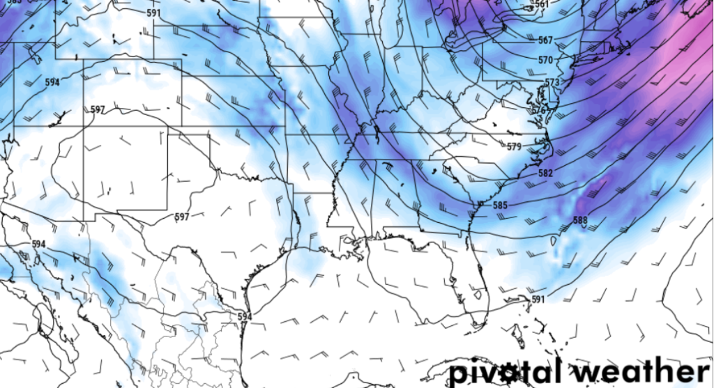
Looking at bit further into the future, by Friday, it looks like the GFS model wants to slide a little system through our area and down into the Gulf. I’m not totally sold on this, but if so, it would give us a boost in the shot for rain on Thursday and Friday and then give us something to monitor in the Gulf in the coming days for potential tropical development.
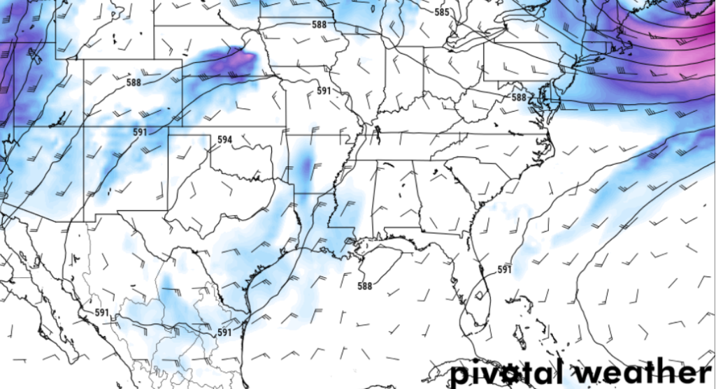
AGain, I want to reiterate here: I’m not sold on this. But it is worth watching as it would give us a slightly better shot for rain heaving into the weekend as well as give us a potential tropical threat to monitor.
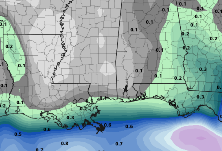
Speaking of rain, the AIFS model keeps us pretty dry through early next week. Rainfall estimats from that model keep the area under 0.25″ of rain – in total – between now and when you go to work next Monday morning. Probably a bit too dry – especially considering the isolated nature of some of the storm potential – but paints a good picture that things are looking drier through the next week or so.
Beyond that, we open up the door to another cold front as we get into the first week of September. We will ahve to see if it makes it all the way down here or if it hangs up around I-40.
REGIONAL DAY TO DAY FORECAST
Today: Sunny. Highs in the mid 90s. North winds 5 to 10 mph.
Tonight: Clear. Lows in the mid 60s. North winds around 5 mph.
Wednesday: Sunny. Highs in the mid 90s. North winds around 5 mph.
Wednesday Night: Clear. Lows in the mid 60s. North winds around 5 mph.
Thursday: Sunny. A slight chance of showers and thunderstorms in the afternoon. Highs in the mid 90s. Northeast winds around 5 mph. Chance of rain 20 percent.
Thursday Night: Mostly clear. A slight chance of showers and thunderstorms in the evening. Lows in the upper 60s. Chance of rain 10 percent.
Friday: Sunny. A chance of showers and thunderstorms in the afternoon. Highs in the lower 90s. Chance of rain 30 percent.
Friday Night: Mostly clear. A slight chance of showers and thunderstorms in the evening. Lows around 70. Chance of rain 20 percent.
Saturday: Sunny. A slight chance of showers and thunderstorms in the morning, then a chance of showers and thunderstorms in the afternoon. Highs in the lower 90s. Chance of rain 30 percent.
Saturday Night: Mostly clear. A slight chance of showers and thunderstorms in the evening. Lows in the lower 70s. Chance of rain 10 percent.
Sunday: Sunny. A slight chance of showers and thunderstorms in the morning, then a chance of showers and thunderstorms in the afternoon. Highs in the mid 90s. Chance of rain 30 percent.
Sunday Night: Partly cloudy with a slight chance of showers and thunderstorms in the evening, then mostly clear after midnight. Lows in the lower 70s. Chance of rain 10 percent.
Monday: Sunny. A slight chance of showers and thunderstorms in the morning, then a chance of showers and thunderstorms in the afternoon. Highs in the mid 90s. Chance of rain 20 percent.


