Statistically speaking, August and September are our driest months of the year, so it’s not a big surprise that we’re not getting any rain. However, due to a strong overarching surface and upper level ridge, rain is almost out of the question for a while. That’s not to say it’s impossible that we’ll get rain in the next few days, but it’s looking very limited. Let’s take a look.
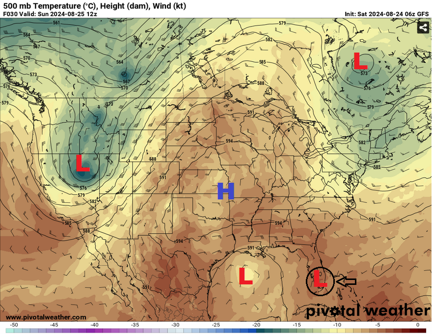
Looking at the 500mb analysis, there is a massive ridge of high pressure stretching from the southwest across the southeast into the northern plains and parts of Appalachia. A surface high is placed in the Appalachians keeping a stalled front across the Gulf of Mexico. This will contribute to the dry air we’ve been feeling, however we’ll slowly get the humidity back in the air as the weekend ends. A Gulf low is tracking to the west and it is fairly weak as it moves into Texas, but may help bring a tinge of moisture to spark a few showers on Sunday. Later in the week, a Bahamian low will roll into the Gulf which could bring some more moisture into the area as the ridge begins to weaken.
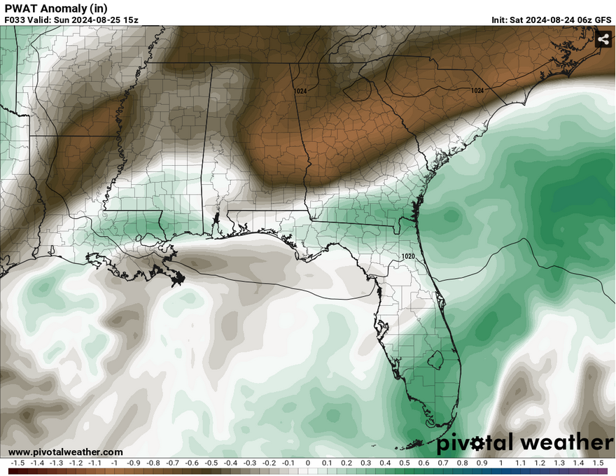
Saturday will remain dry with temperatures in the mid 90s and the heat index reaching under 100 in some areas. The temperature will drop to the low 70s overnight with winds pulling from the east northeast. Sunday is when we’ll have a very slight chance of rain with the Gulf low providing a little bit of moisture. Most of the storms look closer to the coast, however some could spark further inland. This looks to be a pretty slim chance, but I wouldn’t doubt we’ll see a few storms happen in the afternoon. Temperatures will reach the mid 90s during the day with the heat index under 100 and the low 70s at night with some light east northeast winds.
Come Monday, the rain chances will be close to zero with the Gulf low having moved further west. We’ll see temperatures rise into the mid to upper 90s with some areas reaching 100 for the heat index. The NWS isn’t calling for a heat advisory yet, but I wouldn’t doubt there will be one by the middle of the week.
Fire Weather
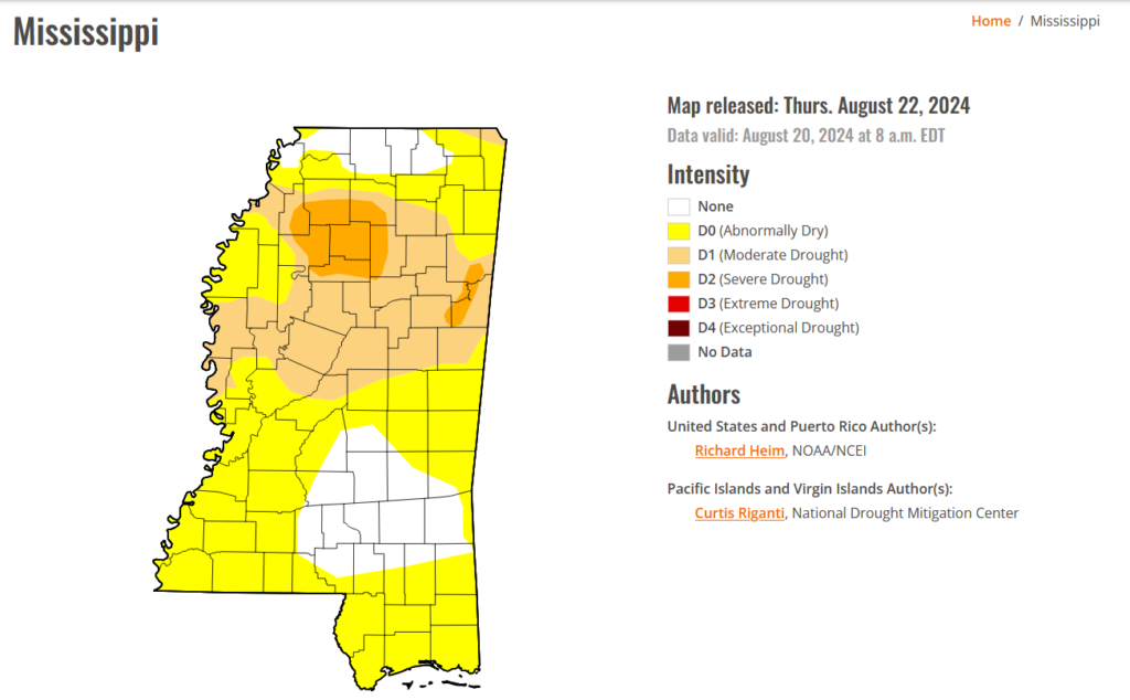
Another concern we have for the next week is the possibility for fires to start. We are still at critically low levels of humidity for this time of year. Combine this with the lack of rain and abnormally dry conditions, there is plenty of fuel on the ground to keep a fire going along with dry winds to spread it around. I would hold off on burning anything for a while to keep any unnecessary fires to happen and burn up acres of land. As a kid growing up in California, I’ve seen and heard about forest fires sparking off and getting out of control quickly, so please be careful these next few weeks.
Select Data Set:

Regional Day-to-Day Forecast
Today – Sunny, with a high in the low to mid 90s.. Heat index values as high as 98. East northeast wind around 5 mph.
Tonight – Mostly clear, with a low in the low 70s. East northeast wind around 5 mph becoming calm in the evening.
Sunday – A 20 percent chance of showers and thunderstorms in the afternoon. Sunny, with a high in the mid 90s. Heat index values as high as 98. Calm wind becoming east around 5 mph in the morning.
Sunday Night – Mostly clear, with a low in the low 70s. Calm wind.
Monday – Sunny, with a high in the mid to upper 90s. Calm wind becoming east northeast around 5 mph in the morning.
Monday Night – Partly cloudy, with a low in the low 70s. Calm wind.
Tuesday – A 20 percent chance of showers and thunderstorms in the afternoon. Mostly sunny and hot, with a high in the upper 90s. Calm wind becoming east around 5 mph in the afternoon.
Tuesday Night – Partly cloudy, with a low in the low 70s. Southeast wind around 5 mph becoming calm.
Wednesday – A 30 percent chance of showers and thunderstorms in the afternoon. Mostly sunny and hot, with a high in the upper 90s. Calm wind becoming east southeast around 5 mph in the afternoon.
Wednesday Night – Partly cloudy, with a low in the mid 70s.
Thursday – A 30 percent chance of showers and thunderstorms. Mostly sunny and hot, with a high in the upper 90s.
Thursday Night – Partly cloudy, with a low in the mid 70s.
Friday – A 40 percent chance of showers and thunderstorms. Mostly sunny and hot with a high in the upper 90s.


