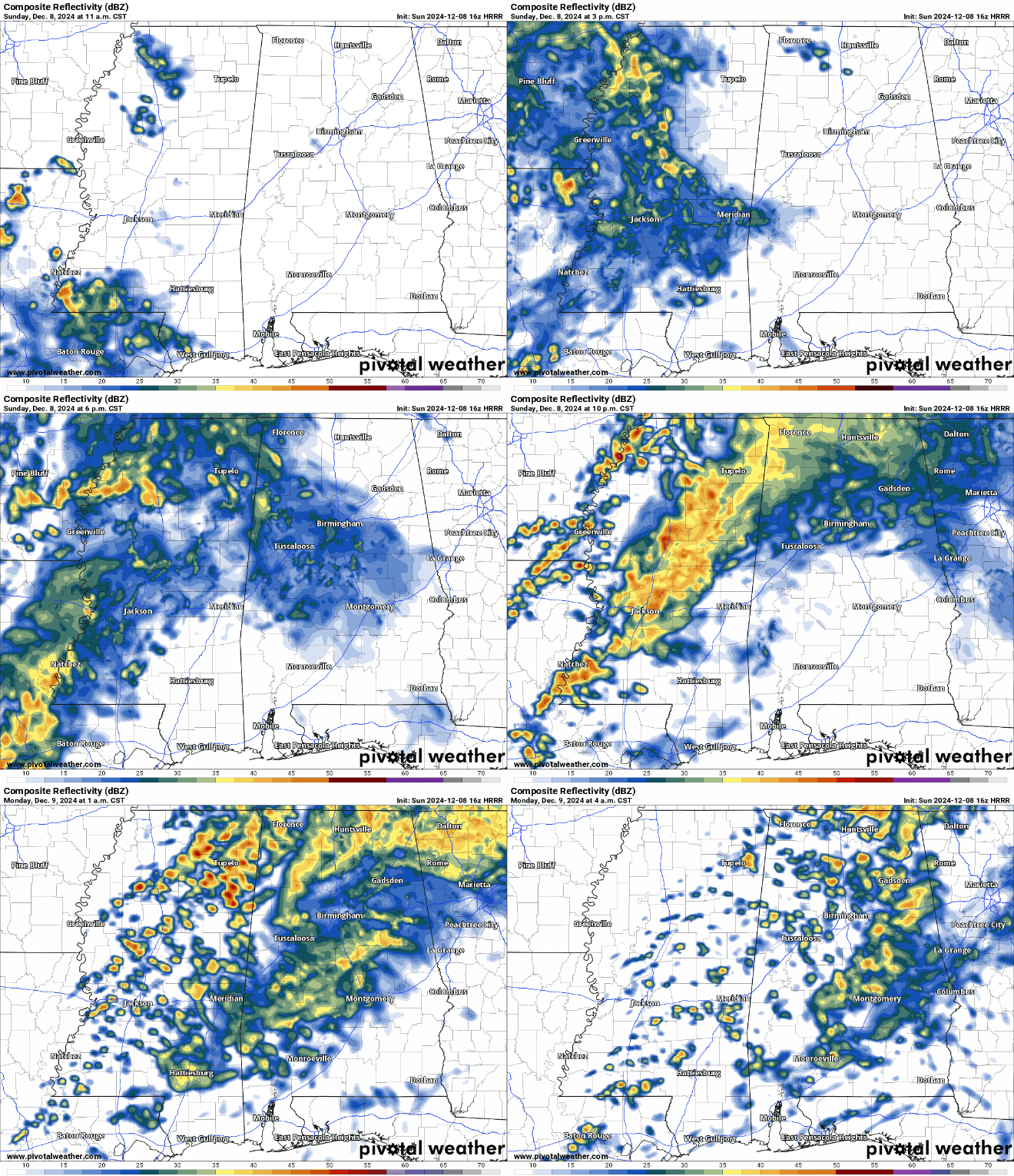
It’s going to be a soggy Sunday for much of us in South/Central MS/LA. The warm front is pulling moisture from the Gulf to rain over us for most of the day before the cold front moves in later tonight. The main deal with this system is that the low pressure system is near stalling which will keep feeding moisture to this system and keep the rain coming. Areas of central and eastern Louisiana along with much of west and central Mississippi will see plenty of rain in the next several hours. Overnight, the cold front will start moving in pushing the system slowly eastward. Much of northern and central Mississippi will see moderate to heavy rain and southern Mississippi and Louisiana will see scattered rain showers as the night continues.
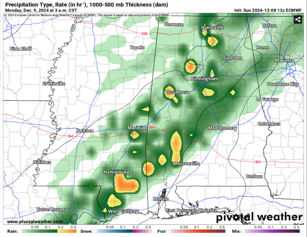
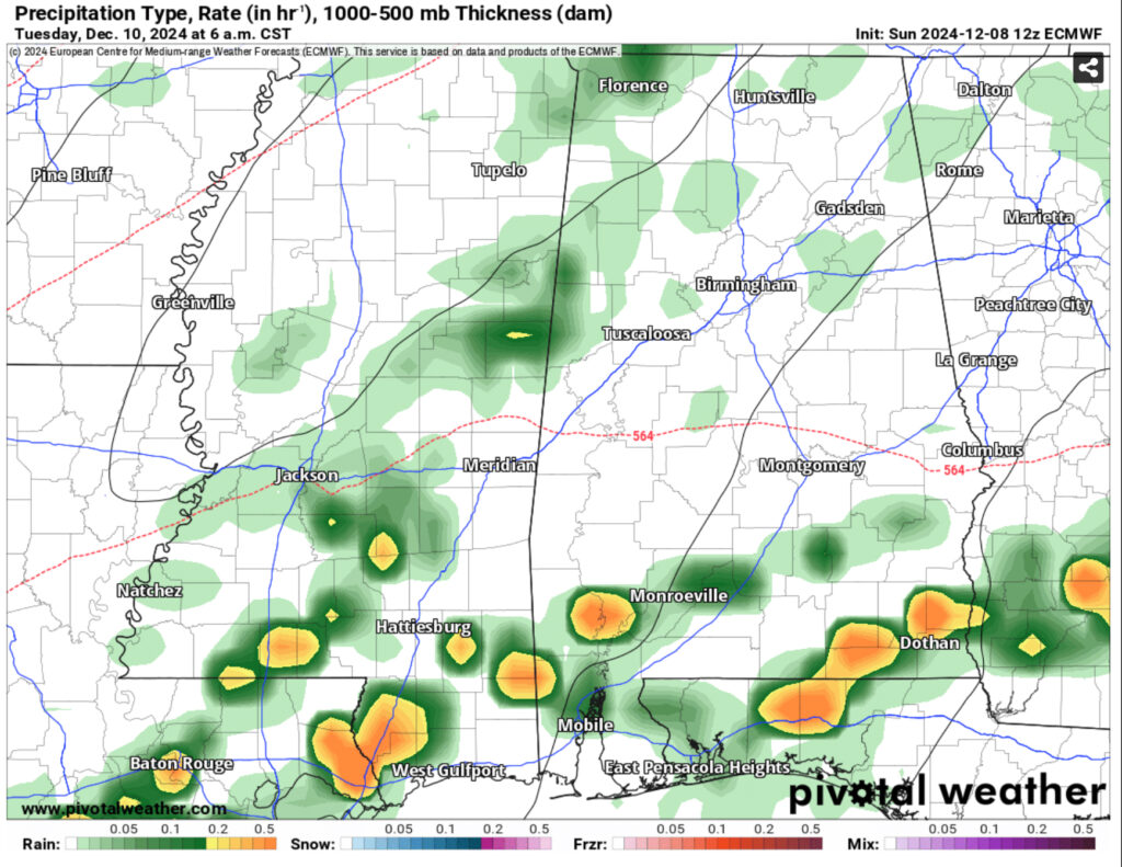
This doesn’t mean we’re out of the woods yet. The cold front will stall over the Pinebelt and keep the rain across much of south Mississippi and Alabama during the day. This will keep conditions warm (highs in the upper 60s to low 70s) and humid. Starting early Tuesday morning, there will be one more round of showers moving across the coastal south. This will remain across Mississippi into the afternoon and Alabama into the evening. The cooler Canadian airmass is soon to follow dropping temperatures on Wednesday. While it won’t be extremely cold, we’ll feel the difference with temperatures in the low 50s and gusty winds from the north northwest. Afterwards, we’ll fall below freezing. Thursday will also be a nice, cool sunny day with temperatures in the mid 50s and lows near the freezing mark.
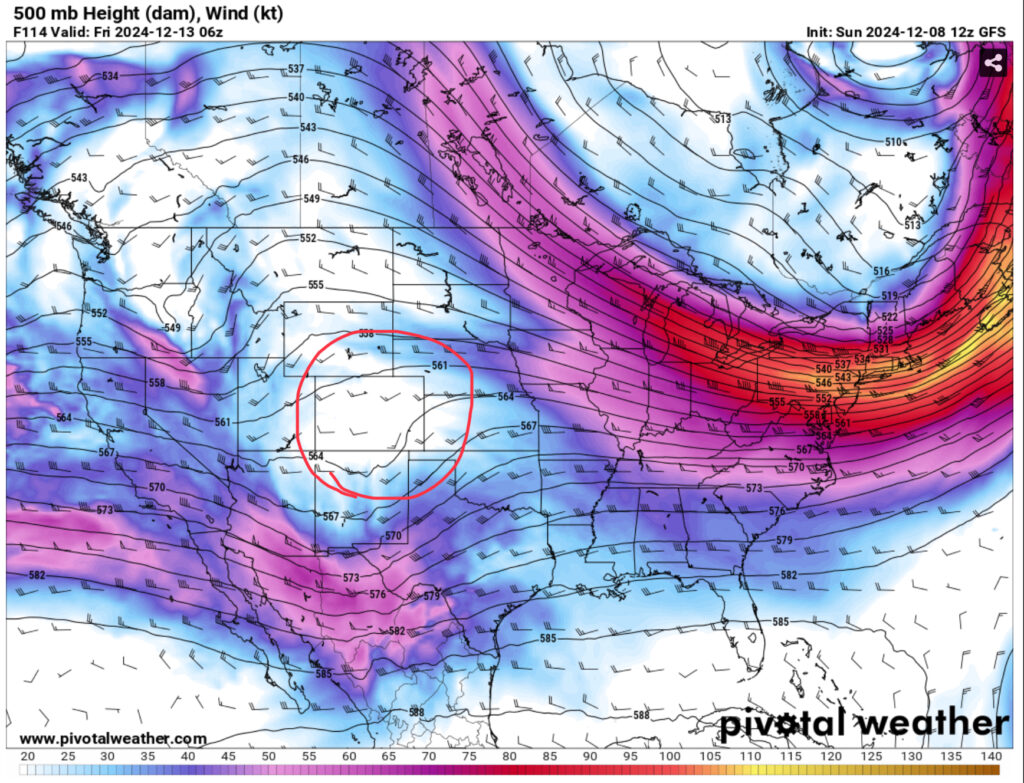
In the upper levels, a trough developing from the Pacific Northwest will form a weaker shortwave trough and begin to move northeast by midweek. Near the surface, a high pressure zone will move towards the North Atlantic. Yet again, we’ll have some return flow providing moisture from the Gulf, however the North Atlantic high will provide some resistance placing that moisture flow right around the Mississippi River line.
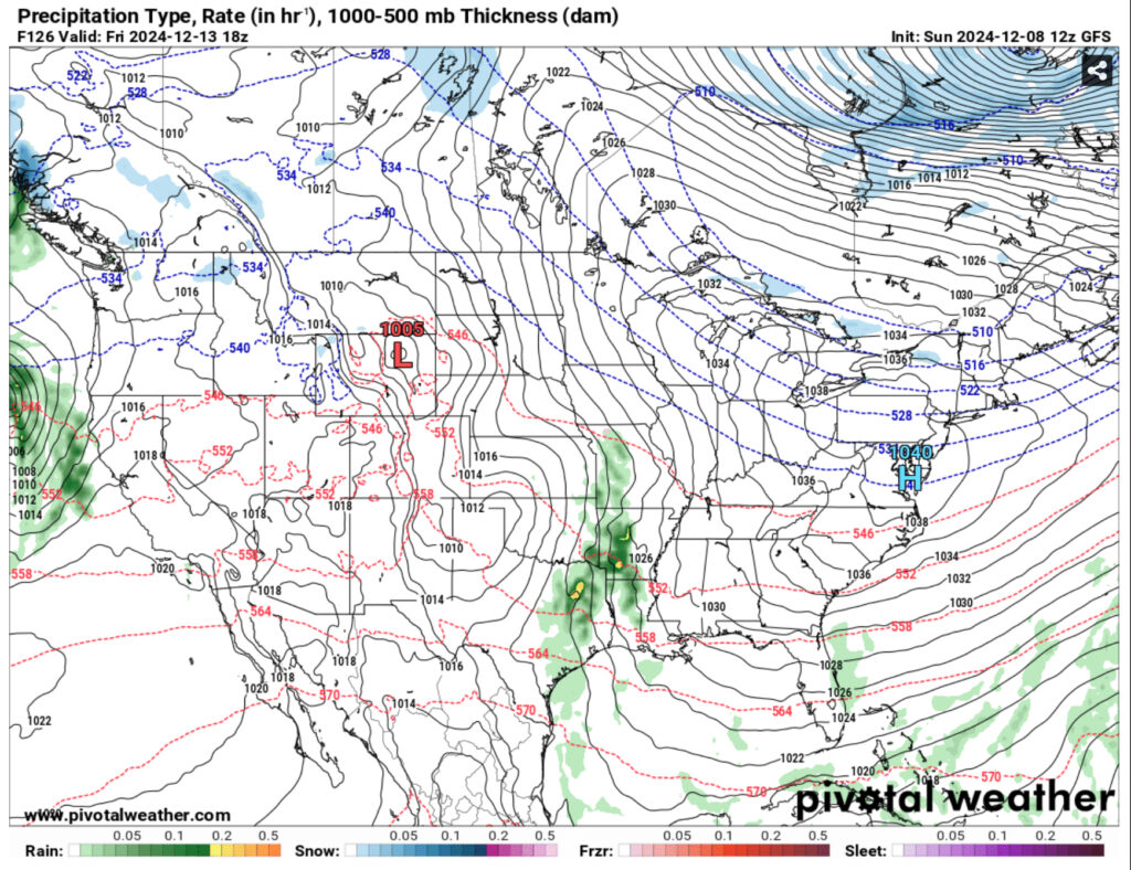
What this means for us is that the rain chances are more limited due to the high’s position. This doesn’t mean we won’t get any rain at all, though. Most of it looks to be around central and northern MS/LA, but we’ll still see some scattered rain showers towards the southern end of the states. This will move along during the day and be out by Sunday. We’ll still see some milder temperatures in the 60s until the main cold front moves in around next Tuesday.
Regional Day-to-Day Forecast
Today – A 50 percent chance of showers, mainly before 5pm. Mostly cloudy, with a high in the mid 60s. South southeast wind 5 to 10 mph. New precipitation amounts of less than a tenth of an inch possible.
Tonight – Showers, mainly after 10pm. Low in the upper 50s. South wind 5 to 10 mph, with gusts as high as 20 mph. Chance of precipitation is 90%. New precipitation amounts between a quarter and half of an inch possible.
Monday – Showers. High in the low 70s. South southwest wind 5 to 10 mph. Chance of precipitation is 90%. New precipitation amounts between a quarter and half of an inch possible.
Monday Night – Showers, mainly after 9pm. Low in the low 60s. South wind around 5 mph. Chance of precipitation is 80%. New precipitation amounts between a quarter and half of an inch possible.
Tuesday – Showers likely, mainly before noon. Mostly cloudy, with a high in the low 70s. South southwest wind 5 to 10 mph becoming northwest in the afternoon. Winds could gust as high as 20 mph. Chance of precipitation is 70%. New precipitation amounts between a half and three quarters of an inch possible.
Tuesday Night – A 20 percent chance of showers before midnight. Mostly cloudy, with a low in the mid to upper 30s. North northwest wind 10 to 15 mph, with gusts as high as 25 mph.
Wednesday – Sunny, with a high in the low to mid 50s. North northwest wind 5 to 15 mph, with gusts as high as 25 mph.
Wednesday Night – Clear, with a low in the low 30s. West northwest wind around 5 mph becoming calm in the evening.
Thursday – Sunny, with a high in the mid 50s. Calm wind becoming east northeast around 5 mph.
Thursday Night – Mostly clear, with a low in the low 30s.
Friday – Mostly sunny, with a high in the low 60s.
Friday Night – A slight chance of sprinkles. Partly cloudy, with a low in the low 40s.
Saturday – A 20 percent chance of showers or sprinkles. Partly sunny, with a high in the mid 60s.

